Yaviza facts for kids
Quick facts for kids
Yaviza
|
|
|---|---|
|
Corregimiento and town
|
|
 |
|
| Country | |
| Province | Darién |
| District | Pinogana |
| Area | |
| • Land | 397.1 km2 (153.3 sq mi) |
| Population
(2010)
|
|
| • Total | 4,441 |
| • Density | 11.2/km2 (29/sq mi) |
| Population density calculated based on land area. | |
| Time zone | UTC−5 (EST) |
| Climate | Tropical monsoon climate (Am) |
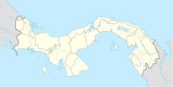
Yaviza is a small town located in the Darién Province of Panama. It is part of the Pinogana District. In 2010, about 4,441 people lived there. Yaviza is also known as a corregimiento, which is like a local administrative area in Panama.
Contents
Where is Yaviza Located?
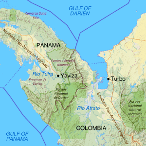
Yaviza is a very important town because it marks the end of the northern part of the famous Pan-American Highway. This highway is a network of roads that connects North and South America. Yaviza is right at the edge of the Darién Gap, a large area of forests and swamps that the highway does not cross.
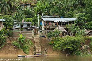
The town sits on the Chucunaque River. This river is a big branch of the Tuira River. People often use these rivers to travel by boat into the Darién Gap. The closest town along the river route is El Real de Santa María. This town is the main city of the Pinogana District.
How Many People Live in Yaviza?
The number of people living in Yaviza has changed over the years.
- In 1990, the population was 8,452.
- By 2000, it had gone down to 3,317.
- But in 2010, the population grew again to 4,441 people.
A Look Back: The History of Yaviza
When Was Yaviza Founded?
Yaviza was first started by Spanish missionaries in September 1638. They named it San Jerónimo de Yaviza.
The Old Fort of San Gerónimo
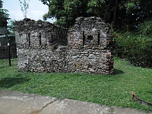
A Spanish fort, called Fuerte de San Geronimo de Yaviza, was built in 1760. This fort was badly damaged in 1780 during an attack by the Indigenous Guna people. Later, in the mid-1900s, a flood destroyed half of what was left of the fort's ruins.
Yaviza and the Pan-American Highway
As the Pan-American Highway was being built, it eventually reached Yaviza. At first, it was just a dirt road. There were plans to finish the highway all the way to Colombia, but these plans were stopped. Because of this, Yaviza became the very end point of the northern part of the highway. Over time, the last sections of the highway leading to Yaviza have been improved and are now paved roads.
See also
 For more information in Spanish, you can visit: Yaviza para niños
 | William M. Jackson |
 | Juan E. Gilbert |
 | Neil deGrasse Tyson |


