York Historic District (York, Maine) facts for kids
Quick facts for kids |
|
|
York Historic District
|
|

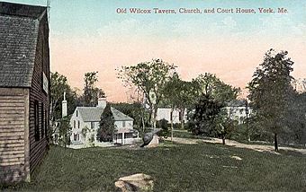
Village view c. 1908
|
|
| Location | Roughly U.S. 1, U.S. 1A, ME 103 and Woodbridge Rd., York, Maine |
|---|---|
| Area | 1,700 acres (690 ha) |
| Built | 1622 |
| Architect | Blaisdell, E.B.; Ross, Donald |
| Architectural style | Bungalow/Craftsman |
| NRHP reference No. | 73000249 |
| Added to NRHP | July 16, 1973 |
The York Historic District is a special area in York, Maine. It's one of the oldest towns in the state! This huge district, about 1,700 acres, includes some very old and important buildings. For example, you'll find Maine's oldest church here, built in 1747. There's also the Old York Gaol, which is one of the oldest public buildings in the entire United States! Because of its history, the district was added to the National Register of Historic Places in 1973.
Contents
Exploring York's History
How York Began
The town of York started a long time ago, around 1630. It was first called "Agamenticus." A man named Sir Ferdinando Gorges wanted to create a big colony in New England. His plans didn't quite work out. So, in the 1650s, Agamenticus became part of the Massachusetts Bay Colony.
Then, Agamenticus was renamed York. It became the main town for York County, Massachusetts. The central part of the village grew on the north side of the York River.
Growing the Village
The village stayed small for a while. But after 1710, the danger from the French and Indian Wars started to lessen. This allowed the town to grow more.
Some of the oldest buildings were built around this time. The first part of the Old York Gaol was built in 1719. The Benjamin Stone Tavern on York Street also dates back to 1719. The First Parish Church, located near the Old Gaol, was built in 1747. This church was for the very first church group established in Maine.
Different Parts of York
The York Historic District includes several important areas. The York Harbor area, located southeast of the main village, became a busy place for shipping and building ships in the 1700s and 1800s. The York Corner area, near United States Route 1, grew as a service stop for travelers and farmers coming from inland areas.
District Boundaries
The district covers a large area. It stretches from U.S. Route 1 to U.S. Route 1A in the northeast. From there, it goes south to the mouth of the York River. The southern edge goes west along the south side of the river to Bartlett Road. Then, the western edge goes north back to the starting point. This area includes the historic centers of York Village, York Harbor, and York Corner. It also includes the York River, which was very important for the community's early growth.
 | Chris Smalls |
 | Fred Hampton |
 | Ralph Abernathy |


