Young River (New Zealand) facts for kids
Quick facts for kids Young River |
|
|---|---|
 |
|
| Country | New Zealand |
| Region | Otago |
| District | Queenstown-Lakes District |
| Physical characteristics | |
| Main source | Mount Doris Southern Alps / Kā Tiritiri o te Moana 44°7′19″S 169°2′42″E / 44.12194°S 169.04500°E |
| River mouth | Makarora River Makarora 305 metres (1,000 ft) 44°12′S 169°14′E / 44.200°S 169.233°E |
| Length | 21 kilometres (13 mi) |
| Basin features | |
| Progression | Young River North Branch → Young River → Makarora River → Clutha River / Mata-Au |
| River system | Clutha River / Mata-Au |
| Tributaries |
|
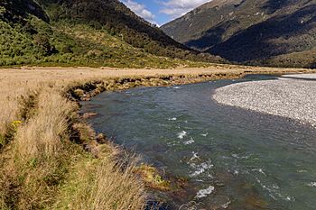
The Young River is a cool river in the Otago region of New Zealand. You can find it on the South Island. This river flows through the beautiful Mount Aspiring National Park. It eventually joins the Makarora River. The Makarora River is about 3 kilometers (1.9 miles) upstream from the village of Makarora.
The Young River in New Zealand
Where the River Flows
The Young River starts high up on Mount Doris. This mountain is part of the Southern Alps / Kā Tiritiri o te Moana. The river begins as the Young River North Branch and flows east.
About 9 kilometers (5.6 miles) downstream, something interesting happened. In 2007, a huge landslide created a natural dam. This dam formed a lake about 2.5 kilometers (1.6 miles) long.
After the lake, the river turns right and flows south for about 6 kilometers (3.7 miles). There's a special bridge called the Young Fork Bridge. A popular hiking trail, the Gillespie Pass Circuit, crosses the river here.
About 14 kilometers (8.7 miles) from where the north branch starts, the Young River South Branch joins in. It comes from the right side. The river then keeps flowing east for another 7 kilometers (4.3 miles). Finally, it meets the Makarora River. This meeting point is about 3.5 kilometers (2.2 miles) north of the village of Makarora.
The Big Landslide of 2007
On August 29, 2007, at 4:40 in the morning, a massive landslide happened. It was a "debris avalanche," which means a lot of rock, soil, and trees slid down. This huge slide blocked the Young River North Branch.
About 11 million cubic meters (388 million cubic feet) of material fell into the river valley. This created a natural dam that was about 70 meters (230 feet) high. A new lake started to form behind this dam.
The lake grew bigger and bigger. On October 5, 2007, the water finally flowed over the top of the dam. When the lake is full, it is about 2,500 meters (8,200 feet) long. It can also be up to 500 meters (1,600 feet) wide. The lake holds a huge amount of water, about 23 million cubic meters (812 million cubic feet).
 | Delilah Pierce |
 | Gordon Parks |
 | Augusta Savage |
 | Charles Ethan Porter |

