Yungay, Peru facts for kids
Quick facts for kids
Yungay
|
|||
|---|---|---|---|
|
Town
|
|||

Cemetery in Yungay
|
|||
|
|||
| Country | |||
| Region | Ancash | ||
| Province | Yungay | ||
| District | Yungay | ||
| Founded | 4 August 1540 | ||
| Elevation | 2,458 m (8,064 ft) | ||
| Population
(2017)
|
|||
| • Total | 20,070 | ||
| Time zone | UTC-5 (PET) | ||
| Climate | BSk | ||
Yungay is a town in the Ancash Region of north-central Peru, a country in South America. It is known for its beautiful mountain views and a very important, though sad, part of its history.
Contents
Geography of Yungay
Yungay is located in a valley called the Callejón de Huaylas. It sits next to the Río Santa (Santa River) at an elevation of about 2,500 meters (around 8,200 feet) above sea level. This town is about 450 kilometers (280 miles) north of Lima, which is the capital city of Peru.
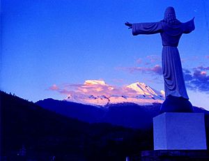
To the east of Yungay, you can see the tall, snow-covered mountains of the Cordillera Blanca. Huascarán, Peru's highest mountain, is only about 15 kilometers (9 miles) east of Yungay.
Yungay is the capital of the Yungay Province. It is also the main town in the Yungay District. The town itself has about 10,000 people (based on 2010 numbers). The whole Yungay Province has a population of around 60,000 people (from a 2000 estimate). This province includes parts of the Callejón de Huaylas valley, the Conchucos Valley, the coast of Ancash, and the Huascarán National Park.
History of Yungay
The Battle of Yungay
An important battle happened near Yungay on January 20, 1839. This was during the War of the Confederation. An army made up of Chilean and Peruvian soldiers, called the "Restoration" army, fought against the army of the Peru-Bolivian Confederation. The "Restoration" army won, and this battle led to the end of the short-lived confederacy.
The 1962 Avalanche
On January 11, 1962, a huge avalanche of ice and rock fell from Mount Huascarán. This avalanche destroyed a village called Ranrahirca and eight other nearby villages. Sadly, about 4,000 people lost their lives. Luckily, the town of Yungay itself was not hit by this avalanche.
The 1970 Ancash Earthquake and Landslide
Before the big disaster, in 1962, two American scientists, David Bernays and Charles Sawyer, saw something worrying. They reported that a huge slab of rock on Mount Huascarán Norte was becoming unstable because of a melting glacier. They warned that if it fell, it could destroy Yungay. When this warning was published in a newspaper, the government reportedly told them to take back their report, and they left the country. People in the area were also told not to talk about the possible danger.
Eight years later, on May 31, 1970, the scientists' prediction came true. A powerful earthquake, known as the Ancash earthquake, struck. This earthquake caused a large part of the north side of Nevado Huascarán to break off. A huge mass of glacial ice, about 800 meters (half a mile) wide, also fell.
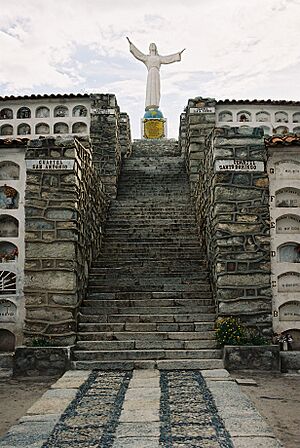
This caused a massive debris avalanche. A debris avalanche is like a very fast-moving landslide made of rock, ice, and mud. This avalanche buried the town of Yungay completely. Tragically, about 20,000 people died. Only about 400 people survived. Most of the survivors were in the cemetery and the stadium at the time of the earthquake. These areas were on higher ground in the town.
More than 50 million cubic meters of debris slid about 15 kilometers (9 miles) downhill. It moved incredibly fast, at speeds between 340 mph (547 km/h) and 620 mph (998 km/h).
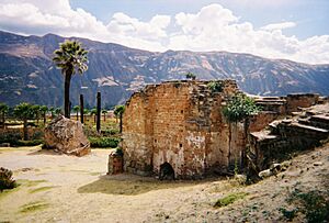
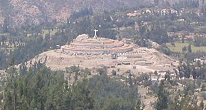
Today, the Peruvian government has made the area where the old town of Yungay is buried a national cemetery. No one is allowed to dig there. The new town of Yungay was rebuilt about 1 kilometer (0.6 miles) north of where the old city once stood.
See also
 In Spanish: Yungay (Perú) para niños
- Ancash Region
- Yungay Province


