Yunguyo facts for kids
Quick facts for kids
Yunguyo
|
|
|---|---|
|
Town
|
|

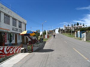
Street in Yunguyo leading to the border crossing to Bolivia
|
|
| Country | Peru |
| Region | Puno |
| Province | Yunguyo |
| Population
(2008)
|
|
| • Total | 12,625 |
| Time zone | UTC-5:00 (EST) |
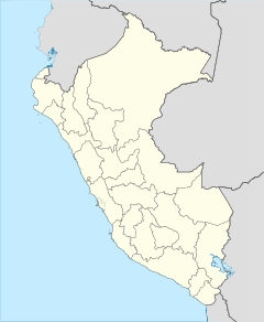
Yunguyo is a town in southeastern Peru. It is located in the Puno Region. This town is the capital of both Yunguyo Province and Yunguyo District. In 2008, about 12,625 people lived there.
Yunguyo sits on a piece of land that sticks out into Lake Titicaca. This type of land is called a peninsula. The border between Peru and Bolivia is very close to the town. A road connects Yunguyo to the town of Copacabana, which is just a few kilometers away in Bolivia.
Weather in Yunguyo
Yunguyo has a unique climate because it is located very high up, near Lake Titicaca. The weather changes throughout the year, with some months being wetter and others much drier.
| Climate data for Tahuaco-Yunguyo, elevation 3,888 m (12,756 ft), (1991–2020) | |||||||||||||
|---|---|---|---|---|---|---|---|---|---|---|---|---|---|
| Month | Jan | Feb | Mar | Apr | May | Jun | Jul | Aug | Sep | Oct | Nov | Dec | Year |
| Mean daily maximum °C (°F) | 14.7 (58.5) |
14.9 (58.8) |
15.0 (59.0) |
15.1 (59.2) |
14.5 (58.1) |
13.4 (56.1) |
13.2 (55.8) |
14.1 (57.4) |
14.9 (58.8) |
15.8 (60.4) |
16.5 (61.7) |
15.8 (60.4) |
14.8 (58.7) |
| Mean daily minimum °C (°F) | 4.0 (39.2) |
3.9 (39.0) |
3.7 (38.7) |
2.2 (36.0) |
−0.4 (31.3) |
−2.0 (28.4) |
−2.0 (28.4) |
−0.8 (30.6) |
1.0 (33.8) |
2.2 (36.0) |
3.2 (37.8) |
3.9 (39.0) |
1.6 (34.9) |
| Average precipitation mm (inches) | 174.3 (6.86) |
145.0 (5.71) |
120.3 (4.74) |
41.0 (1.61) |
11.4 (0.45) |
10.4 (0.41) |
9.7 (0.38) |
18.5 (0.73) |
27.0 (1.06) |
47.3 (1.86) |
54.6 (2.15) |
98.7 (3.89) |
758.2 (29.85) |
| Source: National Meteorology and Hydrology Service of Peru | |||||||||||||
More to Explore
 In Spanish: Yunguyo para niños
Black History Month on Kiddle
African-American female entrepreneurs
 | Madam C. J. Walker |
 | Janet Emerson Bashen |
 | Annie Turnbo Malone |
 | Maggie L. Walker |

All content from Kiddle encyclopedia articles (including the article images and facts) can be freely used under Attribution-ShareAlike license, unless stated otherwise. Cite this article:
Yunguyo Facts for Kids. Kiddle Encyclopedia.

