Ōrongomai / Cass Peak facts for kids
Quick facts for kids Cass Peak |
|
|---|---|
| Ōrongomai | |

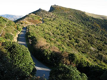
Kennedys Bush Scenic Reserve and the Summit Road in the foreground, with Cass Peak in the background
|
|
| Highest point | |
| Elevation | 545 m (1,788 ft) |
| Geography | |
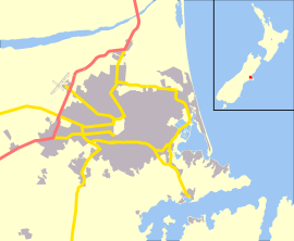
| Location | Christchurch |
| Parent range | Port Hills |
| Geology | |
| Mountain type | Basalt volcanic rock |
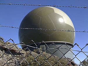
Ōrongomai / Cass Peak is a hill located in the western Port Hills near Christchurch, New Zealand. You can easily spot it because of a large radar dome on its top. This dome was built in the late 1980s. It helps guide airplanes by providing their exact location.
Contents
Exploring Cass Peak's Location
Cass Peak is part of the beautiful Port Hills. It stands tall at 545 metres (1,788 ft) (about 1,788 feet) above sea level. On the Christchurch side, there's a ridge called Otamatua. This ridge separates the Hoon Hay and Kennedy's Bush valleys. At the end of Otamatua, you'll find the Halswell Quarry.
Looking east from Cass Peak, you can see Lyttelton Harbour. The towns of Allandale and Governors Bay are close by on the harbour side. You can reach the peak by car using the Summit Road. You can also hike there along the Crater Rim walkway.
The Names of Cass Peak
Why is it called Cass Peak?
The name Cass Peak comes from Thomas Cass. He was the main surveyor for the Canterbury area from 1851 to 1867. The hill was first known as Cass's Peak.
What does Ōrongomai mean?
The Māori name for the hill is Ō-Rongo-Mai. This name means "where voices are heard." This name comes from a story about 300 years ago. The Ngāi Tahu tribe took control of the area from the Kāti Māmoe tribe.
On top of the peak, the Ngāi Tahu heard the voices of a Kāti Māmoe hunting group. Sadly, the Kāti Māmoe hunters were defeated on the peak.
In July 2020, the New Zealand Geographic Board officially gave the hill a dual name. It is now known as Ōrongomai / Cass Peak.
A Look at Cass Peak's Past
Early Uses and Protection
The original railway station in Christchurch was built in 1876. It used red bricks and stone from Cass Peak for its design. In 1948, an area of 7 acres (2.8 ha) on Cass Peak became a special reserve. It was named the Cass Peak Scenic Reserve. This reserve is fenced to protect its valuable plants. The fence around the reserve is about 1 kilometre (0.62 mi) long.
Building the Summit Road
Harry Ell was famous for protecting the Port Hills. He helped make the area easier to access by building the Summit Road. Much of this road was built during the Great Depression in the 1930s.
Later, there was a risk that houses would be built all over the Port Hills. To stop this, Norman Kirk helped pass a law in 1963. This law was called the Summit Road (Canterbury) Protection Act. It protected the skyline by stopping building from the ridge down to 100 metres (330 ft) below the Summit Road. However, this law did not stop the building of the Sugarloaf communications tower or the radar dome on Cass Peak.
Modern Technology on the Peak
Cass Peak is home to a repeater station. This station boosts radio signals for amateur radio users, ambulance services, and air traffic control. The large, round radar dome on top of Cass Peak is a key part of New Zealand's air traffic management system. Airways New Zealand operates it.
This nationwide system was built in the late 1980s and started working in 1991. Cass Peak has the southernmost of six radar stations in New Zealand. These stations send aircraft position data to air traffic control centers in Auckland and Christchurch.
In the 1980s, the Summit Road Society built many new tracks in the Port Hills. A new track was also built at Cass Peak in 1985.
 | May Edward Chinn |
 | Rebecca Cole |
 | Alexa Canady |
 | Dorothy Lavinia Brown |


