ʻEleʻele facts for kids
Quick facts for kids
Eleele, Hawaii
ʻEleʻele
|
|
|---|---|

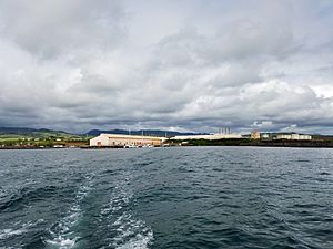
Port Allen with ʻEleʻele in the background
|
|

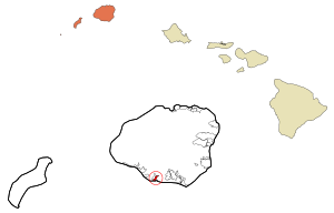
Location in Kauai County and the state of Hawaii
|
|
| Country | United States |
| State | Hawaii |
| County | Kauai |
| Area | |
| • Total | 1.08 sq mi (2.81 km2) |
| • Land | 0.78 sq mi (2.01 km2) |
| • Water | 0.31 sq mi (0.80 km2) |
| Elevation | 23 ft (7 m) |
| Population
(2020)
|
|
| • Total | 2,515 |
| • Density | 3,245.16/sq mi (1,252.71/km2) |
| Time zone | UTC-10 (Hawaii-Aleutian) |
| ZIP code |
96705
|
| Area code(s) | 808 |
| FIPS code | 15-07000 |
| GNIS feature ID | 0358794 |
ʻEleʻele is a small community in Hawaii. Its name means "black" or "black water" in the Hawaiian language. It is located on the beautiful island of Kauaʻi.
Eleele is known as a census-designated place. This means it is a community that the government counts for statistics. It is not a city or town with its own local government. The ZIP code for Eleele is 96705. A cool local spot is Glass Beach. It is famous for its colorful sea glass. In 2020, about 2,515 people lived in Eleele.
Where is Eleele?
Eleele is found on the south side of Kauai. It is right next to Hanapepe. The Hanapēpē River forms the border between these two places.
Hawaii Route 50 goes through Eleele. This road connects Eleele to other towns. For example, Kalaheo is about 4 miles (6.4 km) east. Kaumakani is about 2 miles (3.2 km) west. The larger city of Lihue is about 17 miles (27 km) to the east.
The community covers a total area of about 1.08 square miles (2.8 square kilometers). Most of this area is land. About 0.31 square miles (0.8 square kilometers) is water. This water area includes part of Hanapepe Bay.
Who Lives in Eleele?
| Historical population | |||
|---|---|---|---|
| Census | Pop. | %± | |
| 2020 | 2,515 | — | |
| U.S. Decennial Census | |||
In 2000, there were 2,040 people living in Eleele. By 2020, the population had grown to 2,515 people.
The people in Eleele come from many different backgrounds. In 2000, a large number of residents were of Asian heritage. Many people also identified as Pacific Islander or White. About 22.5% of the people were from two or more racial groups. About 8.2% of the population was Hispanic or Latino.
Many families live in Eleele. In 2000, about 41% of homes had children under 18. The average household had about 3 people. The average family had almost 4 people. The community has people of all ages. About 30% of the population was under 18 years old. About 16% were 65 years or older. The average age was 36 years old.
Weather in Eleele
Eleele has a tropical savanna climate. This means it is warm all year round. The average monthly temperature is always above 64°F (18°C).
The climate also has a clear dry season. This means that some months get much less rain. The driest month usually has less than 2.4 inches (60 mm) of rain. This type of weather is called "As" in the Köppen Climate Classification system.
See also
 In Spanish: Eleele para niños
 | Aaron Henry |
 | T. R. M. Howard |
 | Jesse Jackson |

