
100 Mile House facts for kids
Quick facts for kids
100 Mile House
|
|
|---|---|
|
District municipality
|
|
| District of 100 Mile House | |
.jpg)
View of 100 Mile House
|
|
| Motto(s):
Centum Salutationes
|
|

100 Mile House
Location in British Columbia

100 Mile House
Location in Canada
|
|
| Country | Canada |
| Province | British Columbia |
| Regional district | Cariboo |
| Founded | 1862 |
| Incorporated | 1965 |
| Area
(2021)
|
|
| • Total | 53.01 km2 (20.47 sq mi) |
| Elevation
at the weather station
|
1,059.2 m (3,475.1 ft) |
| Population
(2021)
|
|
| • Total | 1,928 |
| • Density | 36.4/km2 (94/sq mi) |
| Time zone | UTC−08:00 (PST) |
| Area code(s) | 250 / 778 / 236 |
| Highways | |
| Waterways | Bridge Creek |
100 Mile House is a small town in the Cariboo region of central British Columbia, Canada. It's known as a 'district municipality,' which means it's a type of local government area. The town is an important service center for the surrounding communities.
Contents
History of 100 Mile House
Early Days and the Gold Rush
100 Mile House was first called Bridge Creek House. It got this name from the creek that flows through the area. The town started during the gold rush era. Gold seekers and travelers needed places to rest on their long journeys.
Thomas Miller owned some buildings here. These buildings served as a resting spot for people traveling between Kamloops and Fort Alexandria. Fort Alexandria was about 98 miles (158 km) north of 100 Mile House.
The town got its current name during the Cariboo Gold Rush. In 1862, a special building called a roadhouse was built here. It was exactly 100 miles (160 km) up the Old Cariboo Road from Lillooet.
Growth and Changes
In 1930, a man named Lord Martin Cecil came from England. He came to manage a large estate owned by his father. The estate had its own train stop nearby, called Exeter.
At that time, 100 Mile House was very small. It had the roadhouse, a general store, a post office, and a telegraph office. There was also a power plant. Only 12 people lived there. Sadly, the original roadhouse burned down in 1937.
Indigenous Territory
100 Mile House is located on the traditional, unceded land of the Secwepemc people. The closest Secwepemc community is the Tsq'escen. Their reserve is near Canim Lake.
People of 100 Mile House
Population and Homes
In 2021, the Canadian census counted 1,928 people living in 100 Mile House. These people lived in 907 homes. This was a small increase from 1,918 people in 2016. The town covers an area of about 53 square kilometers. This means there are about 36 people living in each square kilometer.
Beliefs and Religions
The 2021 census also asked about people's religious beliefs.
- Many people, about 58%, said they had no religion.
- About 35% of people identified as Christian.
- About 5% of people followed Sikhism.
Economy and Jobs

100 Mile House is the main service center for the South Cariboo area. This means it provides important services like shops, banks, and healthcare. The town itself has about 2,000 people. But the area it serves has about ten times that many people.
This larger area includes nearby communities like Lac la Hache, Forest Grove, and 108 Mile Ranch. 100 Mile House is the biggest town between Kamloops and Williams Lake.
Main Industries
The main jobs and businesses in 100 Mile House are related to forestry and ranching.
- Forestry involves working with trees, like logging and making wood products.
- Ranching means raising cattle and other livestock.
Building log homes is also an important business.
Fun for Tourists

100 Mile House is a great place for outdoor activities. It's becoming famous for its many different kinds of birds. The area has hundreds of lakes perfect for boating and fishing. Some popular lakes include 101 Mile Lake, Lac La Hache, and Green Lake.
The Cariboo ski marathon is a big event here. It brings many cross-country skiers from all over the world. The nearby communities offer fun activities too, like rodeos. There are also many trails for hiking, snowmobiling, and ATV riding. You can find government campgrounds at Green Lake, Bridge Lake, and Lac La Hache. Many private campsites also offer cabins, boat rentals, and RV hook-ups.
Getting Around
100 Mile House was historically located along the Cariboo Road. This was an important route for travel.
Public Transport
Until 2002, a daily train service connected 100 Mile House to Vancouver and Prince George. Until 2013, Greyhound Canada buses also served the town. Today, the town has its own local bus system, the 100 Mile House Regional Transit System. There's also an intercity bus service called Adventure Charters.
Airports
The town has the 100 Mile House Airport, but it doesn't have regular flights. The larger South Cariboo Regional Airport is also nearby.
Nearby Places to Explore
- North of 100 Mile House:
- Lac la Hache (26 km)
- Williams Lake (91 km)
- Prince George (329 km)
- Southeast of 100 Mile House:
- The Interlakes area and Bridge Lake (56 km)
- South of 100 Mile House:
Climate and Weather
100 Mile House has a climate with warm summers and cool nights. The winters are cold, but not extremely cold for this part of the world. Sometimes, winter temperatures can drop very low, with a record low of -48 degrees Celsius.
The town is in a "rain shadow" because of the coastal mountains. This means it gets less rain and snow. Much of the precipitation that does fall comes as snow.
| Climate data for 100 Mile House Climate ID: 1165791; coordinates 51°38′49″N 121°18′09″W / 51.64694°N 121.30250°W; elevation: 1,059.2 m (3,475 ft); 1981-2010 normals |
|||||||||||||
|---|---|---|---|---|---|---|---|---|---|---|---|---|---|
| Month | Jan | Feb | Mar | Apr | May | Jun | Jul | Aug | Sep | Oct | Nov | Dec | Year |
| Record high °C (°F) | 12.0 (53.6) |
13.5 (56.3) |
21.0 (69.8) |
30.0 (86.0) |
34.5 (94.1) |
40.0 (104.0) |
35.5 (95.9) |
36.0 (96.8) |
36.0 (96.8) |
29.0 (84.2) |
18.3 (64.9) |
12.5 (54.5) |
40.0 (104.0) |
| Mean daily maximum °C (°F) | −2.1 (28.2) |
2.1 (35.8) |
7.4 (45.3) |
12.2 (54.0) |
17.0 (62.6) |
20.3 (68.5) |
23.1 (73.6) |
23.3 (73.9) |
18.5 (65.3) |
11.1 (52.0) |
2.4 (36.3) |
−2.9 (26.8) |
11.0 (51.8) |
| Daily mean °C (°F) | −7.2 (19.0) |
−3.7 (25.3) |
0.8 (33.4) |
5.2 (41.4) |
9.5 (49.1) |
13.0 (55.4) |
15.3 (59.5) |
14.9 (58.8) |
10.4 (50.7) |
4.8 (40.6) |
−2.1 (28.2) |
−7.7 (18.1) |
4.4 (39.9) |
| Mean daily minimum °C (°F) | −12.3 (9.9) |
−9.4 (15.1) |
−5.9 (21.4) |
−1.9 (28.6) |
2.0 (35.6) |
5.7 (42.3) |
7.4 (45.3) |
6.3 (43.3) |
2.2 (36.0) |
−1.6 (29.1) |
−6.5 (20.3) |
−12.5 (9.5) |
−2.2 (28.0) |
| Record low °C (°F) | −44.5 (−48.1) |
−40.5 (−40.9) |
−37.8 (−36.0) |
−15.0 (5.0) |
−9.0 (15.8) |
−4.0 (24.8) |
−1.5 (29.3) |
−6.0 (21.2) |
−10.0 (14.0) |
−32.0 (−25.6) |
−40.5 (−40.9) |
−48.0 (−54.4) |
−48.0 (−54.4) |
| Average precipitation mm (inches) | 35.1 (1.38) |
21.3 (0.84) |
16.5 (0.65) |
29.2 (1.15) |
42.9 (1.69) |
56.6 (2.23) |
68.2 (2.69) |
47.5 (1.87) |
37.0 (1.46) |
32.3 (1.27) |
42.4 (1.67) |
48.2 (1.90) |
477.1 (18.78) |
| Average rainfall mm (inches) | 3.0 (0.12) |
2.5 (0.10) |
5.0 (0.20) |
20.4 (0.80) |
41.9 (1.65) |
56.4 (2.22) |
68.2 (2.69) |
47.5 (1.87) |
36.3 (1.43) |
26.8 (1.06) |
14.0 (0.55) |
1.4 (0.06) |
323.4 (12.73) |
| Average snowfall cm (inches) | 32.1 (12.6) |
18.8 (7.4) |
11.5 (4.5) |
8.8 (3.5) |
1.0 (0.4) |
0.1 (0.0) |
0.0 (0.0) |
0.0 (0.0) |
0.7 (0.3) |
5.5 (2.2) |
28.5 (11.2) |
46.8 (18.4) |
153.7 (60.5) |
| Average precipitation days (≥ 0.2 mm) | 9.4 | 7.2 | 6.7 | 8.6 | 11.9 | 13.0 | 13.0 | 10.5 | 8.7 | 9.5 | 11.1 | 10.4 | 120.0 |
| Average rainy days (≥ 0.2 mm) | 1.3 | 1.1 | 2.6 | 6.4 | 11.6 | 13.0 | 13.0 | 10.5 | 8.5 | 8.2 | 4.2 | 0.7 | 81.0 |
| Average snowy days (≥ 0.2 cm) | 8.7 | 6.2 | 4.2 | 3.0 | 0.7 | 0.1 | 0.0 | 0.0 | 0.4 | 2.0 | 8.0 | 10.2 | 43.4 |
| Source: Environment and Climate Change Canada | |||||||||||||
Sports and Recreation
100 Mile House is home to the 100 Mile House Wranglers. This is a junior 'A' hockey team. They play in the Kootenay International Junior Hockey League. Their home games are held at the South Cariboo Rec Centre.
Images for kids
-
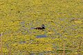
Ruddy duck in a pond near 100 Mile House
-
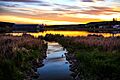
Sunset at a pond in town
-
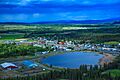
A view of town from the southwest
-
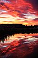
Sunset at a local pond
-
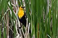
Male yellow-headed blackbird in 100 Mile House
.jpg)
.jpg)
.jpg)
.jpg)

