
Alexandria, British Columbia facts for kids
Quick facts for kids
Alexandria
|
|
|---|---|

Alexandria, British Columbia
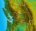
Location in British Columbia
|
|
| Country | Canada |
| Province | British Columbia |
| Region | North Cariboo |
| Regional district | Cariboo |
| Area codes | 250, 778, 236, & 672 |
| Highway | |
Alexandria or Fort Alexandria is a historic area in central British Columbia, Canada. It includes a trading post, a ferry crossing, and a place where steamboats used to land. This area is located on the east side of the Fraser River. You can find it on BC Highway 97, about 74 kilometers (45 miles) northwest of Williams Lake and 45 kilometers (28 miles) south of Quesnel.
Contents
Why is it Called Alexandria?
The name Alexandria honors Alexander Mackenzie. In 1793, he was the first European to visit the Alexandria First Nation village during his journey from the Peace River to the Pacific Ocean. Mackenzie was warned about dangerous rapids downstream. So, he turned back north past the future site of Quesnel. Then, he headed west along the West Road River (Blackwater River) towards the coast.
First Nations People
The First Nations village was on the west side of the Fraser River. It was known as Tautin (Ltau'tenne), meaning "sturgeon people." These people were part of the Takulli (Carrier) group. Hundreds of people originally lived there.
In 1826, the Chilcotin people attacked this village, which was across from the fort. The fur traders at the fort gave weapons to the villagers to help them defend themselves. Because of this, the Chilcotin stopped trading with the fort for a while. Even though the Carrier people took revenge that year, the fighting between the two groups ended by the next year.
The villagers often mixed their traditional beliefs with Christianity. Around 1834, visitors from Oregon introduced a new belief. The villagers were very excited about it. During this time, Father Demers used the fort as a base for his missionary work. By 1902, the village had only about 15 members left.
The Historic Fort
In 1821, George McDougall from the North West Company set up the Alexandria trading post. This happened just before his company merged with the Hudson's Bay Company (HBC) that summer. The fort was important for trade and for feeding the people who lived there, especially with its good fishery.
The fort was first on the east side of the river. In 1836, it moved to the west side. This move might have made trading with First Nations easier. Other reasons suggested for the move include riverbank erosion, the old fort burning down, or finding better land for farming across the river.

The second fort is believed to have been next to the church on the Alexandria reserve. The fort focused on growing crops and raising cattle. They had amazing wheat harvests, which led to building a flour mill. This mill used horses to turn the grindstone and operated from 1842 to 1846. A wooden church was built in 1846. It was one of four Roman Catholic (RC) missionary stations in the area.
By 1860, the fort had only four or five workers. This was much less than its busiest time. The fort closed in 1867 and became just a farm. The HBC gave up the property in 1881, and the buildings were taken down in 1915. The first fort location was recognized as a National Historic Site of Canada in 1925. A special monument was put up in 1936, about 8 kilometers (5 miles) south of today's Alexandria.
Old Trails and Roads
In the 1820s, the Hudson's Bay Brigade Trail started from the fort. It went south to Fort Astoria (also known as Fort George) at the mouth of the Columbia River. Furs from northern forts came by boat to Fort Alexandria. From there, pack trains carried the furs south. A brigade could have 400 to 500 horses, with 200 of them kept at Fort Alexandria. In 1827, the trail's end point changed to Fort Okanogan. The trail took about eight days to reach Fort Kamloops (about 320 km or 200 mi away). It took 10 more days to cover the remaining 480 km (300 mi).
In 1843, a new brigade route to Kamloops made the journey shorter (about 462 km or 287 mi). Before a treaty was signed in 1846, Alexander Caulfield Anderson, who was in charge at Alexandria, looked for other routes. A final route was decided in 1849.

In 1860, the Pony Express Co started a route from Lytton to Fort Alexandria and the Quesnel River. This was a seven-day round trip. In 1863, the Old Cariboo Road from Lillooet was finished. This road replaced the old brigade trail to Kamloops.
That same year, Alfred Waddington's road crew started building a wagon road from Bentinck Arm to the fort. In 1864, the Chilcotin people attacked and killed the road workers. This event became known as the Chilcotin War. A group of 50 people from the fort helped track down those responsible.
In 1863, the steamboat Enterprise was built near Alexandria. It traveled between Soda Creek and Quesnel until 1886. During that time, paddlewheelers also stopped at the fort.
In 1864, the Cariboo Road was completed. This new road was better than the one from Lillooet. That year, Walter Moberly built a wagon road northeast to Richfield (near Barkerville).
In 1960, the highway near Alexandria was moved eastward to its current spot after a landslide.
Ferries Across the River
Early Fort Site Ferry
A ferry operated near the fort from 1821 to 1895. It was probably a rowboat. When packhorses needed to cross, a passing steamboat was used. Livestock would swim across.
Later Alexandria Ferry
A reaction ferry was set up in 1913 about 0.8 kilometers (0.5 miles) north of Diamond Island. This was a government-supported service. In 1940–41, a larger ferry replaced the old one. The ferry service stopped in 1950.
Marguerite Ferry
About 4 kilometers (2.5 miles) south of the old fort sites, another ferry connected the community of Castle Rock on the west side of the river with the road and later the railway on the east side. This ferry was officially called the Macalister ferry, but also known as the Castle Rock ferry. It started as a canoe in 1917. A wooden reaction ferry was installed in 1921, which could carry vehicles and people.
A new ferry was built in 1941–42. During winter, when the ferry stopped running, an ice bridge was sometimes used. By the early 1950s, a cage-like aerial passenger ferry was built for winter use.
In 1964, the ferry's official name changed to Marguerite. This was to avoid confusion with the community of Macalister further south. The ferry stopped running in 2002. Even after protests, the government announced in April 2003 that the service would not restart.
Communities in the Area
By the 1910s, the main areas along the river were Alexandria, Castle Rock, and Macalister. When the railway arrived, Marguerite became more important than Castle Rock.
Early Fort Area Settlement
In 1859, Fort Alexandria was the name for both the fort and the nearby settlement. During the Fraser Canyon Gold Rush, miners lived in tents and simple cabins. However, it was mostly a stopover for miners going to the goldfields, so not many people lived there all year. In 1860, the town was surveyed, and it had a saloon, a restaurant, and several stores.
After the gold rush slowed down, Quesnel became the main distribution center, and Alexandria became less important. Alexander Douglas McInnes was the first postmaster from 1876 to 1904. By the late 1880s, there was also a general store. The roadhouse for travelers closed by 1910.
Later Alexandria Community
In 1912, BC Express (BX) bought land for a shipyard and a winter boat storage area. During railway construction, both BX and railway boats used the Alexandria landing. By 1918, a general store was operating. A school, first called Sisters Creek, existed by 1919. It was later called Alexandria North.
Our Lady of Perpetual Help RC church was built in 1940 but closed in the late 1960s. Sawmills started operating in the area by 1940. A new Alexandria school, a Quonset hut type building, opened in 1949–50. The Alexandria North school closed in 1953. The Alexandria school itself closed in 1963, and students then took buses to Quesnel.
Castle Rock Community
Castle Rock is a community on the west bank of the Fraser River. It's between Williams Lake and Quesnel, British Columbia. It's named after a rocky outcrop on the Fraser River. The Castle Rock post office operated from 1916–1943 and 1950–1951. A school opened in 1917. In 1949, a Quonset type building replaced the old school. The school closed in 1956.
Marguerite Community
In 1885, Harry Moffat started Landsdowne Farm, a dairy ranch, near where Marguerite is today. He lived there until 1927. In the early 1900s, the large ranch house served as a roadhouse for stagecoaches. Mary E. Rowed was the first postmaster at Marguerite from 1924 to 1937. By 1926, there was a general store. A BP gas station operated there until at least the 1960s.
The Railway
In December 1920, the Pacific Great Eastern Railway (PGE) reached Australian Creek, about 10 kilometers (6 miles) north of Alexandria. Alexandria became a train station that year. In May 1956, a large washout near Marguerite closed the train line for 11 days. In 1960, a wooden trestle was built over Cuisson Creek on a new path. In the mid-1980s, dirt fill replaced this bridge.
| Train Timetables (Regular stop or Flag stop) | |||||||||||
|---|---|---|---|---|---|---|---|---|---|---|---|
| Mile | 1923 | 1936 | 1943 | 1950 | 1959 | 1969 | 1978 | 1986 | 1996 | 2001 | |
| Quesnel | 347.0 | Regular | Regular | Regular | Regular | Regular | Regular | Regular | Regular | Regular | Regular |
| Dragon | 339.2 | Flag | Flag | Flag | Flag | Flag | Flag | Flag | |||
| Kersley | 334.4 | Flag | Regular | Regular | Flag | Flag | Flag | ||||
| Australian | 327.8 | Flag | Both | Both | Flag | Flag | |||||
| Alexandria | 320.8 | Flag | Flag | Flag | Flag | Flag | Flag | Flag | Flag | Flag | |
| Tingley | 312.9 | Flag | |||||||||
| Marguerite | 311.4 | Regular | Regular | Regular | Flag | ||||||
| Macalister | 307.4 | Flag | Both | Regular | Regular | Flag | Flag | Flag | |||
| Soda Creek | 298.6 | Flag | Regular | Regular | Regular | Flag | Flag | Flag | Flag | Flag | Flag |
. The station existed by 1925.
Images for kids
-
Route of the Cariboo Road in red. Steamboat travel in blue; dotted lines are alternate routes or routes to other goldfields
