Cariboo Road facts for kids
The Cariboo Road was a very important road in British Columbia, Canada. It was also known as the Cariboo Wagon Road, the Great North Road, or the Queen's Highway. This road was built to help people and supplies get to the rich gold fields in the Cariboo region.
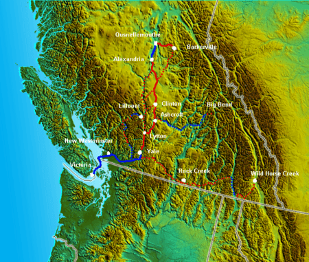
Building the road was a huge challenge. It stretched from Fort Yale to Barkerville, going through dangerous canyon areas. The project started in 1860. It was ordered by James Douglas, who was the Governor of the Colony of British Columbia at the time.
Between the 1860s and the 1880s, the Cariboo Road actually had three different main versions. Each version helped connect the gold fields to the rest of the world.
Contents
Why Was the Cariboo Road Built?
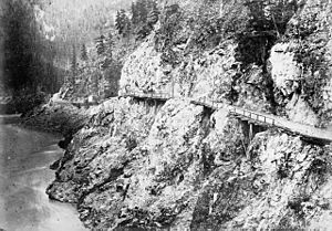
The Cariboo region had a lot of gold. Many people rushed there to find their fortune. Before the Cariboo Road, the only way to get supplies was by a dangerous "mule trail." This trail was very narrow, just wide enough for one mule. It ran along steep cliffs.
Governor Douglas wanted to make it safer and cheaper to bring supplies to the gold miners. So, he ordered the construction of a better road. This new road would allow wagons to travel, which was much safer and could carry more goods.
Who Built the Road?
Local workers were hired to build the road. Also, a special group of soldiers called the Royal Engineers helped a lot. These engineers were very skilled. They built amazing things, like strong bridges. One famous bridge they built was the original Alexandra Suspension Bridge in 1863.
The Cost of the Road
Building the Cariboo Road was very expensive. It cost almost 1.25 million dollars. This was a huge amount of money back then! The cost left the colony with a large debt. This debt was one reason why British Columbia later joined with Vancouver Island in 1866. Then, in 1871, British Columbia joined Canada.
The road was worth it for the gold. Over six and a half million dollars worth of gold was transported on the Cariboo Road.
Different Versions of the Road
The Cariboo Road changed over time. Here are its main versions:
The First Cariboo Road (1861-1862)
This first version of the road followed an older trail used by the Hudson's Bay Company. It started at Port Douglas and went to Lillooet. From Lillooet, it continued through places like Clinton, 100 Mile House, and Lac La Hache. It ended near Soda Creek and Alexandria, which were close to the gold fields.
The Second Cariboo Road (1865-1885)
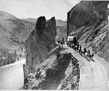
This version was also called the Yale Cariboo Road. It was used by fast stagecoaches and large freight wagons. This road started at Yale. It went north through the amazing Fraser Canyon, passing famous spots like Hell's Gate and Jackass Mountain. It then connected with the earlier Cariboo Road at Clinton.
The Third Cariboo Road (After 1885)
After the Canadian Pacific Railway was finished in 1885, the Cariboo Road changed again. The railway station at Ashcroft became the new starting point for the wagon road. Much of the old Fraser Canyon road was damaged by the railway construction and floods. It wasn't rebuilt until the 1920s for cars.
The "Old" Cariboo Road
Sometimes, the name Cariboo Road also refers to an older toll road. This road was built by Gustavus Blin-Wright in 1861–1862. It went from Lillooet to Williams Lake and then to Williams Creek (Barkerville). This route was known as the "Old Cariboo Road."
The names of places like 100 Mile House come from this old road. They mark distances from "Mile 0" in Lillooet.
Interestingly, people tried to use Bactrian camels to carry goods on this road in 1862! They also tried an early motorized vehicle called a "road train."
Most people walking from Lillooet to the Cariboo used a path called the "River Trail." This trail was much lower than the wagon road. It went along the Fraser Canyon and connected to other routes towards the gold fields.
Television
The Cariboo Road was shown on a TV show about history called Gold Trails and Ghost Towns. It was in season 2, episode 4.
See also
 In Spanish: Ruta Cariboo para niños
 | Janet Taylor Pickett |
 | Synthia Saint James |
 | Howardena Pindell |
 | Faith Ringgold |


