Alexandra Bridge Provincial Park facts for kids
Quick facts for kids Alexandra Bridge Provincial Park |
|
|---|---|
|
IUCN Category III (Natural Monument)
|
|
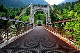
Alexandra Bridge (1926)
|
|
| Location | Fraser Valley RD, British Columbia, Canada |
| Nearest city | Hope |
| Area | 55 ha (140 acres) |
| Established | March 26, 1984 |
| Governing body | BC Parks |
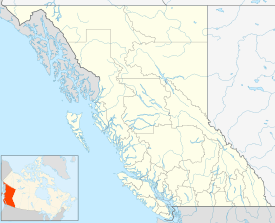
Alexandra Bridge Provincial Park is a special park in the Fraser Canyon area of British Columbia, Canada. It was created on March 26, 1984. The park's main goal is to protect an old and important suspension bridge that crosses the Fraser River.
Contents
History of the Area
The land around Alexandra Bridge has been home to the Nlaka'pamux and other First Nations people for over 9,500 years. They were the first to live here.
In 1808, a European explorer named Simon Fraser and his team visited this spot. It was an important fishing place for First Nations because the river narrows here. This made it easier to catch fish. You can still see old fish-drying racks in the area today.
Long ago, there was a difficult trail here called the Hudson's Bay Brigade Trail. It was used to connect different trading posts. Later, during the Fraser Canyon Gold Rush in 1858, a ferry service helped people cross the river.
The First Alexandra Bridge (1868-1894)
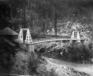
The first road bridge was built in 1861 by Joseph Trutch. He was in charge of public works for the Colony of British Columbia. He used local First Nations and Chinese workers to build it.
Trutch named the bridge after Princess Alexandra of Wales. She was the wife of Queen Victoria's oldest son. The bridge was rebuilt by the Royal Engineers and opened again in 1863. It was part of the famous Cariboo Road.
Near the bridge, there was a place called Alexandra Lodge. This was a popular stop for travelers on the Cariboo Road. There's also the Alexandra Tunnel, which is part of the Canadian National Railway route.
Sadly, the first bridge was washed away by a big flood in 1894. Its remains were taken down in 1912.
The Second Alexandra Bridge (1926-1964)
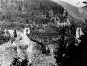
After World War I, cars became popular. So, new roads were built, including the Cariboo Highway through the Fraser Canyon.
In 1926, a new suspension bridge was built on the same spot as the old one. This second Alexandra Bridge is still there today! However, cars stopped using it in 1964. A newer, bigger bridge for the Trans-Canada Highway was built about two kilometers downstream.
Geography
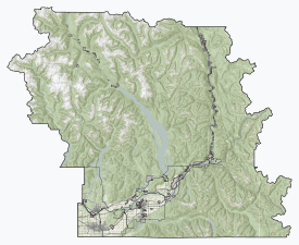
Alexandra Bridge Provincial Park is quite small, covering about 55 hectares (136 acres). It is located right where the original Cariboo Road bridge crossed the Fraser River.
The park also has two steep, raised areas on the east side of the Fraser River. These areas were formed by glaciers and rivers long ago.
Ecology
This spot is a traditional fishing area because the river gets very narrow here. This forces the water to flow faster. It makes it easier for fishermen to catch salmon as they swim upstream.
Millions of salmon pass through the park every year. These include Chinook, Coho, Chum, Pink, and Sockeye salmon. They are all heading to their spawning grounds to lay eggs.
The park is also home to many large trees. You can see big Western hemlock, Western redcedar, and Douglas-fir trees here.
Facilities
The park has a small picnic area where you can relax and eat. There are also simple washrooms (pit toilets). A special trail that is good for wheelchairs leads from the Trans-Canada Highway to the bridge and beyond.
See Also
- List of British Columbia Provincial Parks
 | John T. Biggers |
 | Thomas Blackshear |
 | Mark Bradford |
 | Beverly Buchanan |


