Hope, British Columbia facts for kids
Quick facts for kids
Hope
|
|||
|---|---|---|---|
|
District municipality
|
|||
| District of Hope | |||
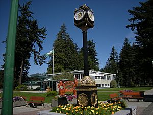
Municipal building and street clock with Memorial Park in background
|
|||
|
|||
| Country | Canada | ||
| Province | British Columbia | ||
| Regional district | Fraser Valley | ||
| Established | 1848 | ||
| Area | |||
| • Total | 40.95 km2 (15.81 sq mi) | ||
| Elevation | 41 m (135 ft) | ||
| Population
(2021)
|
|||
| • Total | 6,686 | ||
| • Density | 151.0/km2 (391/sq mi) | ||
| Time zone | UTC-8 (PST) | ||
| • Summer (DST) | UTC-7 (PDT) | ||
| Area code(s) | 604 / 778 / 236 | ||
| Highways | |||
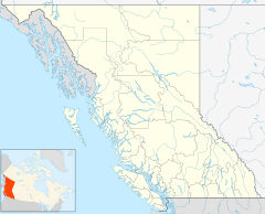
Hope is a district municipality in British Columbia, Canada. It's located where the Fraser River and Coquihalla River meet. Hope is at the eastern edge of the Fraser Valley and the Lower Mainland region. It's also at the southern end of the Fraser Canyon. East of Hope, beyond the Cascade Mountains, is the Interior region of British Columbia.
The town is about 154 kilometers (96 miles) east of Vancouver. Hope is a major meeting point for several highways. These include the Coquihalla Highway, the Crowsnest Highway (also called the Hope-Princeton Highway), and the Trans-Canada Highway (Highway 1). Highway 7 also ends here. Because of its location in the Cascade foothills, Hope gets a lot of rain and cloud, especially in autumn and winter.
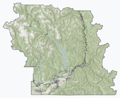
Hope is part of the Fraser Valley Regional District. This district helps provide services to smaller communities and rural areas nearby. The District of Hope includes the main town of Hope and other communities like Kawkawa Lake, Silver Creek, Flood, and Lake of the Woods.
Contents
Hope's History
Early History and First Peoples
The Stó:lō people have lived in the Fraser Valley for a very long time, possibly for 8,000 to 10,000 years. Sadly, a smallpox epidemic in 1782 caused many deaths among the Stó:lō people.
European Arrival and Settlement
In 1808, explorer Simon Fraser arrived in the area that is now Hope. Later, in 1848, the Hudson's Bay Company set up a trading post called Fort Hope.
The area changed a lot when the Fraser Canyon Gold Rush started in 1858. The next year, Governor James Douglas planned out the town of Fort Hope. Hope became part of the new British colony of British Columbia in 1858. In 1871, Hope and the rest of British Columbia joined Canada.
First Library and Church
In 1859, Reverend Alexander St. David Francis Pringle came to Hope. On December 1st of that year, he started the first library on the British Columbia mainland. Within two years, he also founded the Christ Church Anglican church. This church is the oldest one on the British Columbia mainland that still holds services in its original spot. It is now a National Historic Site of Canada.
Hope officially became a village in 1929. It became a town in 1965 and then a District Municipality in 1992.
How Hope Got Its Name
Fort Hope was built in 1848–49 by Henry Newsham Peers. He found a mountain route that stayed within Canadian territory, avoiding the American border. This discovery gave him "hope" that his route would work, leading to the name.
Hope During World War II
During World War II, a camp was set up near Hope at Tashme (now Sunshine Valley). This was a place where Japanese Canadians were moved during the war.
Recent Events in Hope
In 2011, the Kawkawa Bridge was taken down. This bridge was famous for being in the 1982 Rambo movie, First Blood. In 2020, a wooden statue of Sylvester Stallone's character, John Rambo, was put up in Hope.
Hope's Geography

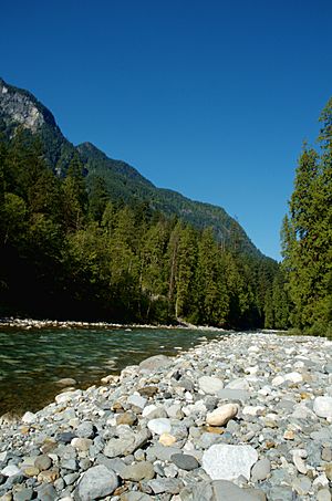
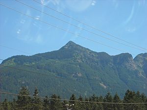
Hope is located at the easternmost point of British Columbia's Lower Mainland area. It's often considered part of the Fraser Canyon or "eastern Fraser Valley." Tall mountains rise to the north, east, and south of the town. To the west, you can see flat land and the wide lower part of the Fraser River. The river flows through the Fraser Canyon before reaching Hope. From Hope, the river enters a wide, flat area that stretches 130 kilometers (81 miles) to the coast and Vancouver.
The Coquihalla River, Sumallo River, and Silverhope Creek all start in the Cascade Mountains. They flow into the Fraser River near Hope. The Skagit River begins south of Hope.
Hope's Climate
Hope has an oceanic climate, which means it has warm summers and fairly cold winters. The town is very cloudy for most of the year. December is the cloudiest month, with very little sunshine. Late summer is the sunniest time of year in Hope.
People of Hope
In 2021, Hope had a population of 6,686 people. This was an increase from 6,181 people in 2016. The area of Hope is about 40.87 square kilometers (15.78 square miles). This means there were about 151 people living in each square kilometer in 2021.
Different Backgrounds in Hope
Hope is home to people from many different backgrounds. Most people in Hope are of European descent. There is also a significant number of Indigenous people living in Hope. Other groups include people of East Asian, South Asian, Southeast Asian, Latin American, and African backgrounds.
Religions in Hope
According to the 2021 census, many people in Hope do not follow a specific religion (about 53.3%). About 41.8% of people in Hope are Christian. Smaller groups follow Hinduism, Sikhism, Buddhism, Judaism, Islam, and Indigenous Spirituality.
Hope's Economy
People in Hope work in many different jobs. Almost half of the workers are in four main areas:
- Hotels and restaurants (17.1%)
- Health care and social help (12.8%)
- Retail stores (10.3%)
- Transportation and storage (8%)
One of the biggest employers in Hope is Nestlé Waters. This company bottles over 300 million liters of water from Hope's underground water sources every year. Nestlé pays the government a small fee for this water. The bottling plant employs about 75 people.
Planning for Hope's Future
Hope is working on plans to help its economy grow. They focus on the town's good location and high-speed internet. Some key areas for growth include:
- Tourism: Making Hope a more attractive place for visitors, especially those coming from the west.
- Virtual Workers: Encouraging professionals like consultants or software developers to live in Hope and work remotely.
- Natural Resources: Developing industries that use natural resources in a responsible way.
- Local Businesses: Supporting unique local businesses like coffee roasters or small breweries.
- New Shops: Encouraging new stores that can offer special products or services to locals and travelers.
Hope also has a program that helps property owners who develop or redevelop their buildings by offering tax breaks.
Arts and Culture in Hope
Chainsaw Wood Carving
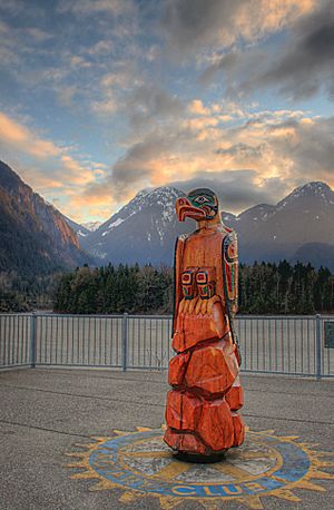
Hope is famous for its chainsaw wood carving events. The town holds competitions and shows where artists create amazing sculptures using chainsaws. Many of these carvings are displayed around downtown Hope, especially in Memorial Park. Pete Ryan is a local carver who has made many of the carvings you can see.
Hope Arts Gallery
The Hope Arts Gallery shows and sells art made by local artists. It's in downtown Hope and has different rooms filled with sculptures, pottery, paintings, jewelry, and more. Volunteers from the Hope Arts Guild run the gallery. They also offer an "ART WALK," which is a self-guided tour to see art and chainsaw carvings around Hope.
Hope Brigade Days
One of the biggest events in Hope each year is Hope Brigade Days. It happens every September, the weekend after Labour Day. This festival includes a parade, fireworks, a carnival, a chainsaw carving competition, a demolition derby, and 4x4 racing.
Fun Things to See and Do in Hope
Hope Museum
The Hope Museum teaches visitors about the history and culture of Hope. It's located in downtown Hope, next to the Hope Visitor Centre, and is open all year. You can see exhibits about the First Nations people, the early Fort Hope, the Fraser Canyon Gold Rush, the Kettle Valley Railway, and pioneer life.
Hope Recreation Complex
The Hope Recreation Complex is a great place for activities. It has a library, a swimming pool, an arena for ice sports, and a fitness center. The Fraser Valley Regional District manages this complex.
Hope Slide Viewing Site
The Hope Slide was one of the biggest landslides ever recorded in Canada. It happened in 1965 and sadly, four people died. You can visit a viewing site to see the Hope Slide area. It's about a 15-minute drive east of Hope on Highway 3.
Memorial Park and Friendship Garden
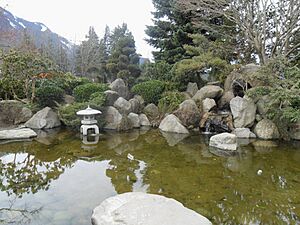
Right next to the District Hall in Hope is a beautiful Japanese garden called the Friendship Garden. This garden was built to honor the Japanese-Canadians who were moved to a camp nearby at Tashme during World War II. Local Japanese-Canadians built it and gave it to Hope in 1991. Men from that camp helped build the Hope-Princeton Highway during the war.
Hope Memorial Park is next to the District Hall and Friendship Garden. In July and August, you can enjoy free concerts there on Sunday afternoons. This park was given to the village of Hope in 1932 and is about 7 acres (2.8 hectares) in the center of town.
Othello Tunnels
The Othello Tunnels are a very popular attraction. They are part of Coquihalla Canyon Provincial Park, east of Hope. These tunnels and bridges were once part of the Kettle Valley Railway. They offer amazing views of the Coquihalla River as it flows through a narrow gorge.
There are two main ways to explore the Othello Tunnels:
- The Othello Tunnels section of the Kettle Valley Trail is 4 km (2.5 miles) long (round trip). It's easy to walk and is even good for strollers and wheelchairs.
- The Hope-Nicola Valley Trail Loop is a 5.5 km (3.4 miles) hiking trail. It's well-kept but not as easy to access, so it's not recommended for people with walking difficulties.
Sports in Hope
Curling
The Hope Curling Club is located near the Hope Recreation Complex. The club hosts fun curling events, like the Men's Bonspiel in January and the Mixed Curling Bonspiel.
Golf
Hope has a golf course and club right on the banks of the Coquihalla River.
Hope Icebreakers Junior Hockey Club
The Hope Icebreakers were a junior ice hockey team. They played in Hope from 2003 to 2008. After that, they moved to Mission, British Columbia, and changed their name to the Mission Icebreakers. Their team logo featured a Sasquatch!
Transportation in Hope
Highways
The Trans-Canada Highway (Highway 1) goes right through Hope. Hope is also the start of the Coquihalla Highway (Highway 5). It's the western end of the Crowsnest Highway (Highway 3) and the eastern end of Highway 7. This makes Hope a very important transportation hub.
Hope Aerodrome (Airport)
Hope Aerodrome (YHE) is a small airport about 2.6 nautical miles (4.8 km) west of Hope. The Fraser Valley Regional District runs it. It has one grass runway that is 3,960 feet (1,207 meters) long. The Vancouver Soaring Association, a gliding club, uses this airfield for their gliders and tow planes. The aerodrome is in the community of Flood, within the District of Hope.
Railways
Both the Canadian Pacific and Canadian National train lines pass through Hope. The Canadian, a passenger train run by Via Rail Canada, stops at the Hope railway station.
Heliports
The Hope Heliport is a private heliport at Fraser Canyon Hospital. You can get charter helicopter services there. These services are used for industries like forestry and mining, as well as for film crews, tourism, and public services.
Education in Hope
The Fraser-Cascade School District #78 manages several schools in the District of Hope. In the main town of Hope, there are two schools:
- Coquihalla Elementary School, for Kindergarten to Grade 6.
- Hope Secondary School, for Grades 7 to 12.
There is also Silver Creek Elementary School in the community of Silver Creek. It teaches students from Kindergarten to Grade 7. After that, these students go to Hope Secondary School for Grades 8 to 12. The school district also has other programs, like the District Alternative Secondary Program.
Famous People from Hope
- Darren Huston, who used to be the CEO of Priceline.
- John Weaver, a talented sculptor.
See also
 In Spanish: Hope (Columbia Británica) para niños
 | James Van Der Zee |
 | Alma Thomas |
 | Ellis Wilson |
 | Margaret Taylor-Burroughs |


