Fraser Canyon facts for kids
Quick facts for kids Fraser Canyon |
|
|---|---|
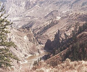
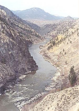
View of Fraser Canyon near Fountain, British Columbia
|
|
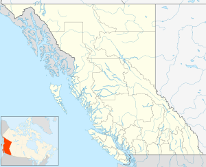
| Coordinates | 49°38′00″N 121°25′00″W / 49.63333°N 121.41667°W |
| Formed by | Fraser River |
The Fraser Canyon is a deep and narrow valley carved by the Fraser River in British Columbia, Canada. It's a place where the river flows quickly through rocky passages in the Coast Mountains. This amazing natural feature connects the high Interior Plateau of British Columbia to the Fraser Valley closer to the coast.
Sometimes, people use "Fraser Canyon" to also mean the Thompson Canyon, which is nearby. This is because they share the same main highway route. However, the Fraser Canyon officially starts further north, near Williams Lake, British Columbia.
Contents
How the Fraser Canyon Was Formed
The Fraser Canyon was created over millions of years, starting about 23 to 5 million years ago. During this time, the Fraser River slowly cut its way through the land as the Interior Plateau was pushed upwards.
The river follows a huge crack in the Earth's crust called the Fraser Fault. This fault runs north to south. You can also see old lava flows in the cliffs along the canyon. These are from volcanic activity that happened a long time ago.
Exploring the Fraser Canyon's Geography
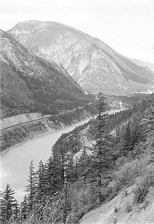
The Fraser Canyon stretches for about 270 kilometers (168 miles) north from Yale, British Columbia. Its southern part is a very important route for travel and transportation. Both the Canadian National Railway and Canadian Pacific Railway lines, along with the Trans-Canada Highway, are built right into the canyon's rocky walls. Many bridges cross the deep side valleys.
In the past, traveling through the canyon was much harder. The trails were very narrow and dangerous, sometimes just small cuts in the rock.
North of Lytton, British Columbia, other highways follow the canyon, like BC Highway 12 and BC Highway 99. The British Columbia Railway also follows this path. Between Pavilion, British Columbia and Lillooet, British Columbia, the canyon is at its deepest, with the river squeezed through very narrow sections.
Hells Gate: A Famous Spot
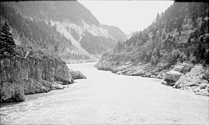
One of the most famous parts of the canyon is Hells Gate, near Boston Bar, British Columbia. Here, the canyon walls rise about 1,000 meters (3,280 feet) above the fast-moving river.
In 1913, a rockslide caused by railway construction made it hard for salmon to swim upstream. So, special "fish ladders" were built along the river to help the migrating salmon get past this difficult spot. Today, you can visit Hells Gate and cross the canyon using an aerial tramway.
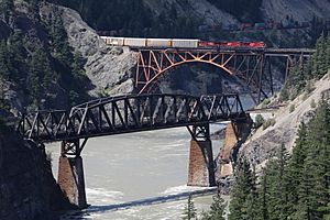
Near Siska, British Columbia, south of Lytton, you'll find the Cisco bridges. These are two railway bridges that cross the river in a narrow gorge. The Canadian Pacific Railway and Canadian National Railway lines switch sides of the canyon here.
Upper Fraser Canyon: Fishing and History
Just north of Lillooet, the river becomes very narrow again. This spot has been an important fishing area for First Nations people for thousands of years. Many different tribes would gather here to fish for salmon.
Smaller Canyons within the Fraser Canyon
The Fraser Canyon is made up of many smaller canyons, each with its own name. For example, the "Little Canyon" is between Yale and Spuzzum. The "Big Canyon" or "Black Canyon" is between Spuzzum and Boston Bar, and it includes Hells Gate Canyon.
Further north, you'll find places like Lillooet Canyon, Fountain Canyon, and Soda Creek Canyon. Even though the river flows through wider areas further north, it enters the "Grand Canyon of the Fraser" in the Robson Valley.
Many rivers and creeks that flow into the Fraser River also have their own canyons. The Thompson Canyon, from Lytton to Ashcroft, British Columbia, is often thought of as part of the Fraser Canyon because it's so close. Other examples include Coquihalla Canyon and Bridge River Canyon.
Tunnels Through the Canyon
The Canadian Pacific Railway has many tunnels in the canyon, some up to half a mile long.
The Fraser Canyon Highway Tunnels were built between 1957 and 1964 as part of the Trans-Canada Highway. There are seven tunnels in total, located between Yale and Boston Bar. The longest tunnel is about 610 meters (2,000 feet) long, making it one of the longest in North America.
Some tunnels, like China Bar and Alexandra, have warning lights for cyclists because they are curved.
History of the Fraser Canyon
People have lived in the Fraser Canyon for a very long time. Archeological sites show that the Stó:lō people were in the area as far back as 8,000 to 10,000 years ago.
The canyon played a big role during the Fraser Canyon Gold Rush from 1858 to 1860. Thousands of miners came to the area, and events like the Fraser Canyon War happened during this time. The building of the Cariboo Road and the Canadian Pacific Railway also shaped the canyon's history.
In the 1880s, when the Canadian Pacific Railway was built, parts of the old Cariboo Road were destroyed because there wasn't enough space for both. This made it harder for towns like Lytton and Boston Bar to be reached by road. Later, a new road, which became part of the Trans-Canada Highway, was built through the canyon in the 1920s.
See also
 In Spanish: Cañón Fraser para niños
 | Kyle Baker |
 | Joseph Yoakum |
 | Laura Wheeler Waring |
 | Henry Ossawa Tanner |


