
Boston Bar, British Columbia facts for kids
Quick facts for kids
Boston Bar
|
|
|---|---|
|
Unincorporated place
|
|

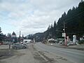
Boston Bar's welcome sign
|
|
| Country | |
| Province | |
| Elevation | 166 m (546 ft) |
| Population
(2016)
|
|
| • Total | 190 |
| Time zone | PST |
| Highways | |
Boston Bar is a small community located in the beautiful Fraser Canyon in British Columbia, Canada. It's a place where two major railways meet. This area has a rich history tied to the gold rush era. Even though it's small, Boston Bar is an important spot along the Fraser River. It is known for its unique climate and stunning natural surroundings.
What's in a Name?
The name "Boston Bar" comes from the exciting time of the Fraser Canyon Gold Rush (1858–1861). A "bar" in this case means a sandy area along the river where gold could be found. The sandbar near today's town was very popular with American gold miners. In the old Chinook Jargon language, Americans were often called "Boston men" or simply "Bostons." That's how the name "Boston Bar" came to be.
The original name for this area in the Nlaka'pamuctsin language was Quayome. This name appeared on old maps and in diaries. The first settlement was on the east side of the river. It later moved to where Boston Bar is now.
In June 2011, Boston Bar briefly changed its name unofficially. It became "Vancouver Bar" to support the Vancouver Canucks hockey team. They were playing against the Boston Bruins in the 2011 Stanley Cup Finals.
Across the River: North Bend
Across the Fraser River from Boston Bar is the small town of North Bend. For a long time, you could only get to North Bend by train or by a special aerial ferry. A two-lane bridge was finally built in January 1986.
The Canadian Pacific Railway (CPR) has a small station in North Bend. This spot is halfway between Vancouver and Kamloops for the railway. Building the railways was very important for this region. First, the CPR line was built (1881–1885). Later, the Canadian Northern Railway (now Canadian National Railway) line was built on the Boston Bar side of the river. Boston Bar is a key point for the Canadian National Railway. It's where two different railway sections connect.
North Bend is also close to the Nahatlatch Valley. This valley has a chain of three lakes and the Nahatlatch River.
Boston Bar's Climate
Boston Bar has a special "pocket climate." This is because it's located deep inside the canyon. Even though it's near the coast, its weather can be very extreme. It's like the weather you find further inland in British Columbia.
Boston Bar enjoys four clear seasons. In summer, temperatures can reach 35-40°C (95-104°F). In winter, they can drop to -5 to -10°C (23-14°F). It's one of the first places inland up the Fraser Canyon where it rains much less. Other areas like Yale and Spuzzum get a lot more rain.
The climate here is a mix of coastal and continental weather. Winters get a lot of rain and are influenced by the ocean. Summers are hot and show more of the continental influence. The plants here are also a mix. You can see trees from rainforests, like bigleaf maple and western red cedar. You'll also find trees common in drier interior areas, like ponderosa pine. The most common tree is the Douglas-fir. Boston Bar is in a specific forest zone called the Interior Douglas-fir zone.
Because of the warm climate, Boston Bar is home to the northern Pacific rattlesnake. These snakes are common in areas further up the Fraser and Thompson Rivers, like Lytton.
Boston Bar has a warm-summer mediterranean climate (Csb).
In 2021, Boston Bar experienced wildfires during a very hot period. Firefighters worked hard to control them. The highway between Boston Bar and Spences Bridge was closed. Many people from nearby Lytton had to come to Boston Bar. Lytton was almost completely destroyed by wildfires due to extreme temperatures.
| Climate data for Boston Bar 1981-2010 (49.863 -121.444) | |||||||||||||
|---|---|---|---|---|---|---|---|---|---|---|---|---|---|
| Month | Jan | Feb | Mar | Apr | May | Jun | Jul | Aug | Sep | Oct | Nov | Dec | Year |
| Mean daily maximum °C (°F) | 2.0 (35.6) |
5.4 (41.7) |
10.7 (51.3) |
16.2 (61.2) |
20.6 (69.1) |
24.1 (75.4) |
28.3 (82.9) |
28.3 (82.9) |
22.8 (73.0) |
13.8 (56.8) |
5.8 (42.4) |
1.2 (34.2) |
14.9 (58.9) |
| Daily mean °C (°F) | −0.4 (31.3) |
1.9 (35.4) |
5.9 (42.6) |
10.1 (50.2) |
14.1 (57.4) |
17.5 (63.5) |
20.9 (69.6) |
20.8 (69.4) |
15.9 (60.6) |
9.5 (49.1) |
3.3 (37.9) |
−1.2 (29.8) |
9.9 (49.7) |
| Mean daily minimum °C (°F) | −2.8 (27.0) |
−1.6 (29.1) |
1.1 (34.0) |
3.9 (39.0) |
7.5 (45.5) |
11.0 (51.8) |
13.4 (56.1) |
13.4 (56.1) |
9.0 (48.2) |
5.2 (41.4) |
0.8 (33.4) |
−3.6 (25.5) |
4.8 (40.6) |
| Average precipitation mm (inches) | 103 (4.1) |
76 (3.0) |
64 (2.5) |
38 (1.5) |
35 (1.4) |
32 (1.3) |
17 (0.7) |
19 (0.7) |
36 (1.4) |
89 (3.5) |
137 (5.4) |
112 (4.4) |
758 (29.9) |
| Source: http://www.climatewna.com/ClimateBC_Map.aspx | |||||||||||||
Images for kids
-
Boston Bar

