Bridge River facts for kids
Quick facts for kids Bridge River |
|
|---|---|
 |
|
| Country | Canada |
| Province | British Columbia |
| Physical characteristics | |
| Main source | Coast Mountains 50°47′N 122°13′W / 50.783°N 122.217°W |
| River mouth | Fraser River 50°45′N 121°56′W / 50.750°N 121.933°W |
| Length | 120 km (75 mi) |
The Bridge River is a river in southern British Columbia, Canada. It is about 120 kilometres (75 mi) long. The river flows southeast from the Coast Mountains.
Before 1961, the Bridge River was a main branch of the Fraser River. It joined the Fraser River about six miles upstream from the town of Lillooet. However, most of its water was later sent into Seton Lake. This happened when the Bridge River Power Project was finished. Now, the water from the Bridge River enters the Fraser River just south of Lillooet.
The Bridge River hydroelectric complex is run by BC Hydro. It uses three dams to create power. These dams provide water for four hydro power plants. Together, these plants can make 492 megawatts of electricity.
Contents
What's in a Name?
The local Lillooet language name for the river is Xwisten. This is pronounced Hwist'n. Sometimes it is spelled Nxwisten or Nxo-isten.
In 1808, Simon Fraser's group explored the area. They called it Riviere du Font. For a while, it was known as Fountain River in English. Some old maps also show it as Shaw's River. This name came from one of Fraser's men.
An ancient ocean, called the Bridge River Ocean, was named after this river.
The River's Path
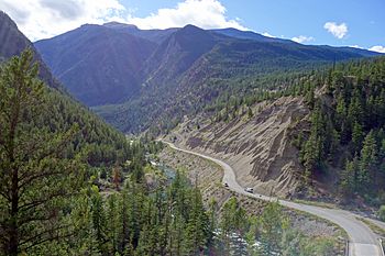
The Bridge River starts in the Coast Mountains. It then flows through a deep valley.
The Big Canyon
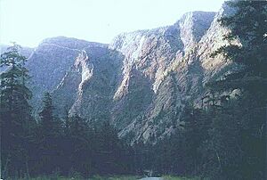
Upstream from a place called Moha, the riverbed goes through the huge Bridge River Canyon. This canyon is just below Terzaghi Dam. This dam is the main one for the Bridge River Power Project.
Terzaghi Dam creates Carpenter Lake. This is the longest and largest lake in the power project. It is about 40 kilometers long. Just upstream from Gold Bridge, which is at the top of Carpenter Lake, is Lajoie Dam. This dam forms Downton Lake.
The Bridge River used to meet the Fraser River in a special double gorge. The two rivers were squeezed through narrow banks here. This made it look like a fountain. Another story says the name came from one of Fraser's men, whose last name was "du Font."
The river became known as the Bridge River because of a bridge across the Fraser at this spot. The local St'at'imc people first built a bridge from poles. Later, during the Fraser Canyon Gold Rush in 1858, a toll bridge was built by settlers.
River Branches (Tributaries)
Because the Bridge River's water is now sent to Seton Lake, not much of its original water reaches the Fraser River. Most of the water that does reach the Fraser comes from one of the Bridge River's branches, the Yalakom River.
The Yalakom River's name means 'the ewe of the mountain sheep' in the Chilcotin language. Long ago, it was called the North Fork of the Bridge. The South Fork of the Bridge River is many miles upstream, near Gold Bridge. Today, it is called the Hurley River.
Other large streams that feed into the Bridge River include Gun Creek, Tyaughton Creek, Marshall Creek, and Cadwallader Creek. Cadwallader Creek joins the Hurley River about 15 kilometers upstream from where the Hurley meets the Bridge.
What the River is Used For
Making Electricity
The Bridge River Power Project uses the power of the Bridge River. It sends the river's water through a mountain to a different area called Seton Lake. This is done using three dams, four powerhouses, and a canal.
The powerhouses can make up to 480 megawatts of electricity. On average, they produce 2670 gigawatt-hours each year. Work on this system began in 1927 and was finished in 1960. First, water goes through the Lajoie Dam and its powerhouse. Then, it is sent through tunnels from Carpenter Reservoir to two powerhouses on Seton Lake Reservoir.
Fishing
For thousands of years, the area where the Bridge River met the Fraser was very important for salmon fishing. This was because of the strong currents of the two rivers.
However, when the Bridge River Power Project was completed in 1961, almost all of the Bridge River's water was sent to Seton Lake. This water now enters the Fraser River south of Lillooet. This change almost completely destroyed the salmon fishing in the Bridge River.
Gold Mining
Many important gold mines of the Bridge River goldfields are found along Cadwallader Creek. These include mines at Bralorne and Pioneer Mine. Other mining towns and camps in the Bridge River goldfields were Minto City, Wayside, Congress, Lajoie, Haylmore, and Brexton.
Other gold mining activities are found throughout the river's area. In the 1800s, large hydraulic mining operations were set up along the river. These were found for about thirty kilometers between the community of Moha and the Bridge River.
Nature and the Environment
Spruce Lake Protected Area
Gun Creek and Tyaughton Creek both drain the southern part of a protected wilderness area. This area is known as the Spruce Lake Protected Area. Many people call it the South Chilcotin. However, it is actually in the Chilcotin Ranges, not the Chilcotin region itself.
The official name for this area has changed over time. This is partly due to efforts from miners and prospectors in the goldfield towns. There has been a long debate about protecting this area versus using its natural resources. In 2007, its name was changed to the Spruce Lake Protected Area. This name shows that some parts of the area can be used for different purposes, not just as a park.
See also
 In Spanish: Río Bridge para niños
 | Claudette Colvin |
 | Myrlie Evers-Williams |
 | Alberta Odell Jones |


