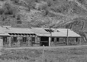
Old Cariboo Road facts for kids
The Old Cariboo Road was an important wagon road built in British Columbia, Canada. It helped people travel to the exciting gold fields where many hoped to find their fortune. This road was built starting in 1859, and it connected Lillooet to Alexandria. It's important not to mix it up with the later Cariboo Road, which took a slightly different path.
To reach the start of the Old Cariboo Road in Lillooet, travelers often used another route called the Douglas Road or "Lakes Route." This route began at Port Douglas, which is located at the top of Harrison Lake.
The famous "mile house" names you see in British Columbia, like 100 Mile House, actually come from the distances measured along this very road, starting from Lillooet. The Old Cariboo Road was a toll road, meaning people had to pay to use it. It was built by a businessman named Gustavus Blin-Wright. He also ran steamboat services that connected the end of the road at Alexandria to Quesnel.
Later, when the main Cariboo Road was built, it joined up with the Old Cariboo Road near Clinton. From there, it followed the same path all the way to Alexandria. The new road was then extended further north along the Fraser River to Quesnel and finally eastward to Barkerville, which was a major gold mining town.
This historic route is also famous for some unusual attempts at transportation. People tried using Bactrian camels (camels with two humps) to carry freight! These camels were bought from the United States Camel Corps, a group that had tried using camels in the American desert. There was also an early motorized vehicle, a tractor-like machine called a Thomson Road Steamer, which was like a "road train."
The Old Cariboo Trail: An Earlier Path
Before the Old Cariboo Road, there was an even older route called the Old Cariboo Trail. This trail followed a path that was once used by the Hudson's Bay Company for their fur trade brigades. It started near the Columbia River in what is now Washington State, close to Fort Okanogan. From there, it went north along the Columbia and Okanagan Rivers into British Columbia.
Fur traders used this trail until 1847. After that, it became a popular route for cattle drives. Ranchers would move their cattle along this trail to supply food to the many gold miners who arrived in British Columbia in the late 1850s.
In Washington Territory, a wagon road from Wallula (near Walla Walla) to the gold mining areas of British Columbia was known as the "Cariboo Trail" or "Wallula-Okanogan Road." This road connected to the famous Oregon Trail at Wallula. It traveled north through places like Moses Lake and Coulee City, then crossed the Waterville Plateau to reach the Columbia River near Fort Okanogan. From there, it followed the Okanagan River valley into Canada, linking up with the Okanagan Trail. The part of this trail known as the Cariboo Trail in Canada branched off near today's Savona. It then headed up the Deadman River towards the first gold discoveries near Likely and Horsefly.
The Road's Path
The Old Cariboo Road began at Lillooet, which was sometimes called "0 Mile House." From Lillooet, the road went directly to Alexandria. Once travelers reached Alexandria, they could take a steamboat service to Quesnellemouthe, which is now known as Quesnel. The road ended there, but a trail continued eastward from Quesnel to Barkerville, where a lot of gold was found.
There was also a trail from Lillooet that went south to Lytton. This was part of the Old Cariboo Road that helped people avoid the difficult Fraser Canyon. By 1864, a new Cariboo Road was built. This new road took a different path for much of its length, but it did use parts of the Old Cariboo Road between Clinton and Alexandria.
 | Ernest Everett Just |
 | Mary Jackson |
 | Emmett Chappelle |
 | Marie Maynard Daly |


