Addicks Reservoir facts for kids
Quick facts for kids Addicks Reservoir |
|
|---|---|
| Location | Houston, Texas, United States |
| Coordinates | 29°47′27″N 95°37′25″W / 29.7908°N 95.6236°W |
| Type | Reservoir |
| Basin countries | United States |
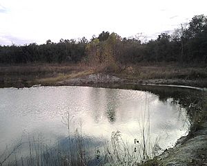
The Addicks Reservoir is a large lake in Houston, Texas. It works with the Barker Reservoir to stop floods from happening in the city. The U.S. Army Corps of Engineers built the Addicks Dam and its water release system in 1948. This was done to protect homes and businesses along Buffalo Bayou from heavy rains.
Contents
Where is Addicks Reservoir?
The Addicks Reservoir is located in west Houston. You can find it north of Interstate 10. It stretches between Barker-Cypress Road and the Sam Houston Tollway. State Highway 6 also runs right through the middle of it.
A Place for Nature and Fun
Even though its main job is flood control, the reservoir area is huge. It covers about 26,000 acres (105 square kilometers) with the Barker Reservoir. This land is often dry and wooded when there isn't a flood. It offers many chances to enjoy nature. You can go hiking, biking, or just watch for wildlife. The West Houston Airport is also located within the reservoir's western side.
How the Reservoir Got Its Name
The Addicks Reservoir and Dam are named after a small town. This town was called Addicks, Texas. It was named after Henry Addicks, who was its first postmaster.
How the Dam Was Built
The Addicks Reservoir is created by a long earthen dam. This dam is about 61,666 feet long. It has a gravel road on top that is 12 feet wide. The highest point of the dam is about 121 feet above sea level. In some spots, it stands almost 50 feet high.
Water Storage Capacity
The reservoir can hold a lot of water. Its maximum storage capacity is 201,000 acre-feet. An acre-foot is the amount of water needed to cover one acre of land with one foot of water. Before Hurricane Harvey, the highest water level recorded was 123,100 acre-feet in April 2016.
During Hurricane Harvey in 2017, the water level reached its highest point ever. It peaked at 109.1 feet on August 30, 2017. At this level, the reservoir held 217,500 acre-feet of water. When combined with the nearby Barker Reservoir, they can hold about 410,000 acre-feet of water together.
Keeping the Dam Safe
From 2008 to 2014, the U.S. Army Corps of Engineers worked to make the dam safer. They spent $4.4 million on temporary fixes. This was done while they planned for long-term repairs. In 2014, they shared their plans with the public. Major construction work to improve the dam began in 2015 and finished in 2019.
Releasing Water Safely
During heavy floods, like Hurricane Harvey, the U.S. Army Corps of Engineers carefully releases water. This is called a "controlled release." They do this at both the Addicks and Barker Reservoirs. The goal is to manage the flood levels in the area.
On August 28, 2017, during Hurricane Harvey, they started these controlled releases. Even with releases, the water levels kept rising. On August 29, water began to flow around the end of the dam. The Army Corps of Engineers then increased the release rates. This helped control the flood, but some areas downstream still experienced more flooding.
Why the Reservoirs Are Important
The Addicks and Barker Reservoirs are very important for Houston. Along with other flood control projects, they prevent a lot of damage. It's estimated they save the city about $16,372,000 in flood damages each year. They protect homes, businesses, and roads from being flooded.
Fun Things to Do at Addicks Reservoir
The reservoir area is home to several parks. One popular spot is Bear Creek Pioneers Park. There are also many trails for hiking, biking, and even horseback riding. A paved bicycle trail runs alongside the reservoir. You can find a trailhead near Sherwood Elementary School.
Legal Discussions About Flooding
During and after Hurricane Harvey, about 7,000 acres of private land upstream of the dams got flooded. This happened because the dams held back water to protect areas downstream. Some landowners felt their property was taken by the government due to this flooding. They filed lawsuits to discuss this issue.
A judge heard some of these cases in 2019. The court decided that the flooding of these upstream lands was a "taking" under the Fifth Amendment. This means the government might need to pay for the use of this private land.
 | DeHart Hubbard |
 | Wilma Rudolph |
 | Jesse Owens |
 | Jackie Joyner-Kersee |
 | Major Taylor |


