Aguacate, Yabucoa, Puerto Rico facts for kids
Quick facts for kids
Aguacate
|
|
|---|---|
|
Barrio
|
|

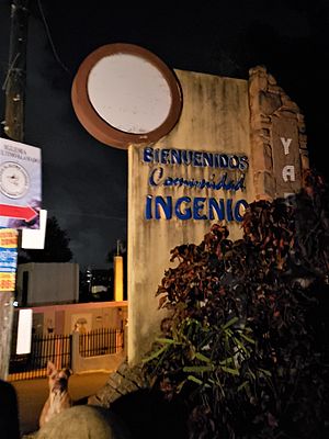
Entrance sign to Comunidad Ingenio in Aguacate, 2020
|
|

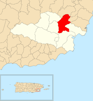
Location of Aguacate within the municipality of Yabucoa shown in red
|
|
| Commonwealth | |
| Municipality | |
| Area | |
| • Total | 5.41 sq mi (14.0 km2) |
| • Land | 5.41 sq mi (14.0 km2) |
| • Water | 0 sq mi (0 km2) |
| Elevation | 66 ft (20 m) |
| Population
(2010)
|
|
| • Total | 2,828 |
| • Density | 522.7/sq mi (201.8/km2) |
| Source: 2010 Census | |
| Time zone | UTC−4 (AST) |
Aguacate is a special kind of neighborhood, called a barrio, located in the town of Yabucoa, Puerto Rico. In 2010, about 2,828 people lived there.
History of Aguacate
Puerto Rico used to be controlled by Spain. After the Spanish–American War in 1898, Spain gave Puerto Rico to the United States. This was part of a deal called the Treaty of Paris of 1898. Puerto Rico then became a territory of the U.S.
In 1899, the United States government counted everyone in Puerto Rico. This count is called a census. The census found that 1,374 people lived in the Aguacate barrio at that time.
| Historical population | |||
|---|---|---|---|
| Census | Pop. | %± | |
| 1900 | 1,374 | — | |
| 1980 | 2,587 | — | |
| 1990 | 2,553 | −1.3% | |
| 2000 | 2,758 | 8.0% | |
| 2010 | 2,828 | 2.5% | |
| U.S. Decennial Census 1899 (shown as 1900) 1910-1930 1930-1950 1980-2000 2010 |
|||
Parts of Aguacate: Sectors
Barrios like Aguacate are often divided into even smaller areas. These smaller parts are called sectores (which means sectors in English).
There are different types of sectores. Some are just called sector, while others might be named urbanización (like a housing development), reparto, barriada, or residencial.
Here are some of the sectores you can find in Aguacate:
- Camino Antonio Rodríguez
- Camino El Cabrito
- Camino Luis Ortiz
- Extensión Villas de Buenaventura
- Parcelas Comunas Nuevas
- Parcelas Comunas Viejas
- Sector Aguacate Adentro
- Sector Aguacate Arriba
- Sector Calle El Sol
- Sector El Cerro
- Sector Ingenio
- Sector Jagueyes
- Sector La Curva
- Sector Los Alicea
- Sector Mariana II
- Sector Parrilla
- Sector Raja Boca
- Urbanización Alturas de Terralinda
- Urbanización Villas de Buenaventura
See also
 In Spanish: Aguacate (Yabucoa) para niños
- List of communities in Puerto Rico
- List of barrios and sectors of Yabucoa, Puerto Rico
 | Audre Lorde |
 | John Berry Meachum |
 | Ferdinand Lee Barnett |


