
Aguadilla barrio-pueblo facts for kids
Quick facts for kids
Aguadilla barrio-pueblo
Barrio Pueblo Aguadilla
|
|
|---|---|
|
Municipality Seat
|
|

Central Plaza of Aguadilla
|
|
 |
|

Aguadilla barrio-pueblo
Location in Caribbean
|
|
| Commonwealth | |
| Municipality | |
| Area | |
| • Total | 0.74 sq mi (1.9 km2) |
| • Land | 0.37 sq mi (1.0 km2) |
| • Water | 0.37 sq mi (1.0 km2) |
| Elevation | 0 ft (0 m) |
| Population
(2010)
|
|
| • Total | 3,627 |
| • Density | 9,802.7/sq mi (3,784.8/km2) |
| Source: 2010 Census | |
| Time zone | UTC−4 (AST) |
Aguadilla barrio-pueblo is a busy part of Aguadilla, a town in Puerto Rico. It's like the main downtown area. In 2010, about 3,627 people lived here.
In Puerto Rico, towns often have a special neighborhood called a pueblo. This pueblo usually has a central plaza, which is a big open square. You'll also find the town hall and a Catholic church there. Every year, fun festivals called Fiestas patronales (patron saint festivals) happen in this central plaza.
| Historical population | |||
|---|---|---|---|
| Census | Pop. | %± | |
| 1950 | 18,276 | — | |
| 1980 | 7,432 | — | |
| 1990 | 5,311 | −28.5% | |
| 2000 | 4,884 | −8.0% | |
| 2010 | 3,627 | −25.7% | |
| U.S. Decennial Census 1899 (shown as 1900) 1910-1930 1930-1950 1980-2000 2010 |
|||
Contents
The Heart of Aguadilla: The Central Plaza
The central plaza, or town square, is a lively spot. People gather here for fun events and to hang out from morning till night. Long ago, Spanish laws called the Laws of the Indies guided how towns were built. These laws said the plaza should be big enough for celebrations. They also said nearby streets should have covered walkways to protect people from the sun and rain.
Across from the central plaza is the Parroquia San Carlos Borromeo, a Catholic church. Building this church started in 1776 and finished in 1783. It was updated in 1855. Sadly, one of its towers fell during an earthquake in 1918. The front of the church was changed when it was rebuilt. Its last update was in 1971. This church is so important that it was added to the National Register of Historic Places (NRHP) in 1984. This means it's a special historic site.
Cool Places to See in Aguadilla
Aguadilla barrio-pueblo has many interesting places to visit. Here are some of them:
- Aguadilla Town Square (Plaza de Recreo de Aguadilla): This is the main square. It's where you'll find the town hall and the historic San Carlos Borromeo Parish Church.
- Amparo Roldán House (Casa Amparo Roldán): Also known as the Casa de Piedra (Stone House). This old house survived the 1918 earthquake. It's the only historic house from that time still standing.
- El Parterre: This is another historic public square. It has a special water spring called Ojo de Agua (Eye of Water). The town of Aguadilla first grew around this spring.
- Fort Concepción (Fuerte de la Concepción): This was once the biggest Spanish fortress in the area. Most of it was taken down in the late 1800s, but one building from the fort still remains.
- López House (Residencia López): This is a beautiful historic building. It's built in a style called Neoclassical, which means it looks like old Greek and Roman buildings.
- Museum of Art of Aguadilla and the Caribbean (Museo de Arte de Aguadilla y del Caribe): This art museum is located in the historic Cardona House. It's a well-kept Neoclassical home.
- Old Museum of Fine Arts of Aguadilla (Museo de Bellas Artes de Aguadilla): This museum is in an old District Courthouse. A famous Puerto Rican architect named Rafael Carmoega designed the building.
- Old Urban Cemetery (Antiguo Cementerio Urbano): This old cemetery was once divided into sections for different religions. Many important Puerto Ricans, like the painter Rafael Arroyo Gely, are buried here.
- Paseo Miguel Garcia Méndez: This is a waterfront walkway, also called a malecón. You can find seafood restaurants, bars, and monuments here, like the Fisherman's Monument (Monumento al Pescador).
- Rompeolas Beach (Playa Rompeolas): This is the main beach right in the downtown area of Aguadilla.
Neighborhoods and Areas
Barrios are like big neighborhoods. They are divided into smaller local areas called sectores (sectors). These sectors can have different names like urbanización, reparto, barriada, or residencial.
Here are some of the sectors in the northern part of Barrio Pueblo:
- Avenida Los Robles
- Calle Barbosa
- Calle Ceiba
- Calle Duda
- Calle Fuerte
- Calle Reguero
- Calle Stahl
- Callejón del Fuerte
- Cerro Juan Vega
- Condominio Cuesta Vieja
- El Chapey
- El Perú
- Joya Las Marinas
- Residencial Cuesta Vieja
- Residencial Puesta del Sol
- Sector Cerro Los Condenados (Cuesta Vieja)
- Sector Cerro Reguero
- Sector Cuesta Nueva
- Sector Cuesta Vieja
- Sector La Vía (Norte)
- Sector Llanos Jiménez
- Sector Luquillo
- Sector Tamarindo
And here are some sectors in the southern and central parts of Barrio Pueblo:
- Avenida San Carlos
- Barriada Visbal
- Barrio Higuey
- Barrio Iglesias
- Calle Mercado
- Calle Mercedes Moreno
- Calle Progreso
- Cerro Cabrera
- Cerro Calero
- Cerro Echevarría
- Cerro Gonzalo
- Condominio Torres del Sol
- Condominio Villa Mar
- Residencial Villamar
- Salsipuedes
- Santa Bárbara
- Sector Campo Alegre
- Sector Cerro Las Ánimas
- Sector Gregorio Vélez Vaz
- Sector Joyas San Carlos
- Sector La Vía (Sur)
Gallery
Here are some pictures of Aguadilla barrio-pueblo:
-
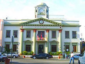
Aguadilla City Hall
-
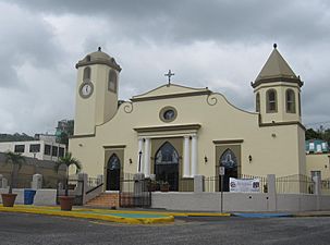
Catholic church in Aguadilla Central plaza
-
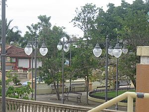
Aguadilla Central plaza
-
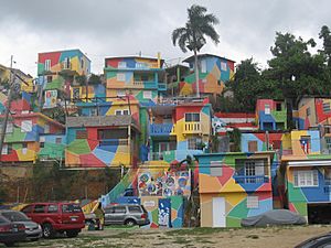
Colorful buildings next to the plaza
-
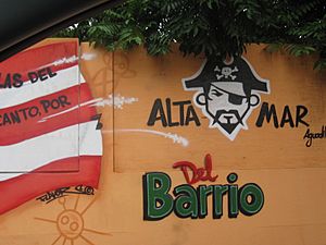
Street art near the plaza
-
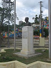
Statue of José de Diego
-
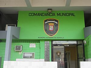
Police headquarters
-
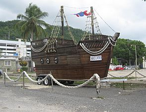
Wooden boat on the waterfront
-
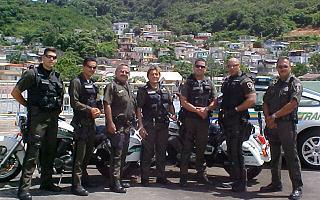
Aguadilla police
-
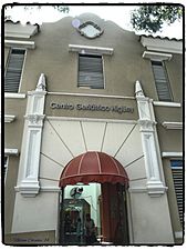
Centro Geriátrico Higüey nursing home


See Also
 In Spanish: Aguadilla (Aguadilla) para niños
- List of communities in Puerto Rico
- List of barrios and sectors of Aguadilla, Puerto Rico
- National Register of Historic Places listings in Aguadilla, Puerto Rico
