Ala de la Piedra facts for kids
Quick facts for kids
Ala de la Piedra
|
|
|---|---|
|
Barrio
|
|

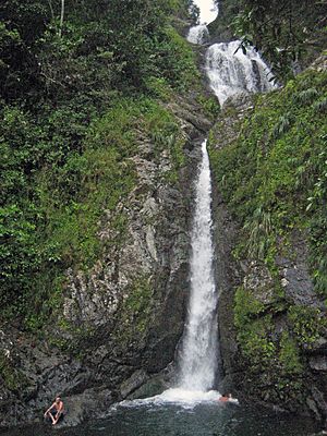
Salto de Doña Juana in Ala de la Piedra
|
|

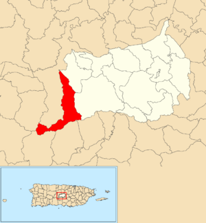
Location of Ala de la Piedra within the municipality of Orocovis shown in red
|
|
| Commonwealth | |
| Municipality | |
| Area | |
| • Total | 5.56 sq mi (14.4 km2) |
| • Land | 5.51 sq mi (14.3 km2) |
| • Water | 0.05 sq mi (0.1 km2) |
| Elevation | 2,123 ft (647 m) |
| Population
(2010)
|
|
| • Total | 419 |
| • Density | 76/sq mi (29/km2) |
| Source: 2010 Census | |
| Time zone | UTC−4 (AST) |
Ala de la Piedra is a small community, or barrio, located in the town of Orocovis, Puerto Rico. It is part of the beautiful island of Puerto Rico. In 2010, about 419 people lived there.
What are the Sections of Ala de la Piedra?
Think of barrios like neighborhoods. These neighborhoods are then divided into even smaller areas called sectores (which means sectors in English).
Some of the sectores you can find in Ala de la Piedra are:
- Sector La Torre
- Sector El Frío
- Sector Doña Juana
- Sector El Guineo
- Sector Divisoria
A Look at the History of Ala de la Piedra
Puerto Rico became a territory of the United States after the Spanish–American War in 1898. This happened under an agreement called the Treaty of Paris of 1898.
In 1899, the U.S. government took a count of all the people in Puerto Rico. At that time, the combined population of Ala de la Piedra and the Orocovis barrio was 1,403 people.
| Historical population | |||
|---|---|---|---|
| Census | Pop. | %± | |
| 1980 | 390 | — | |
| 1990 | 449 | 15.1% | |
| 2000 | 418 | −6.9% | |
| 2010 | 419 | 0.2% | |
| U.S. Decennial Census 1899 (shown as 1900) 1910-1930 1930-1950 1980-2000 2010 |
|||
Today, Ala de la Piedra is also home to a camping site. This site is managed by a local community center. It's a great place for people to enjoy nature.
See also
 In Spanish: Ala de la Piedra para niños
- List of communities in Puerto Rico
 | Stephanie Wilson |
 | Charles Bolden |
 | Ronald McNair |
 | Frederick D. Gregory |


