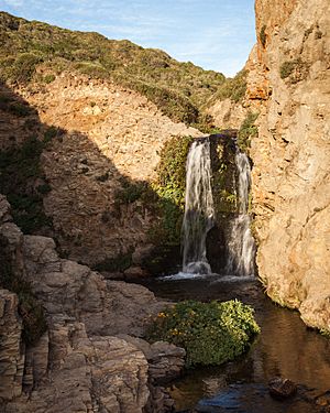
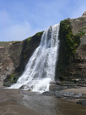
Alamere Falls is a special waterfall located in Point Reyes National Seashore, Marin County, California. What makes Alamere Falls so unique is that it's a "tidefall." This means the water flows directly into the ocean! It's one of only two known tidefalls in California, with the other being McWay Falls.
What Makes Alamere Falls Special?
Alamere Falls drops over cliffs made of fragile shale rock right onto Alamere Creek Beach. Before the main waterfall, there are three smaller waterfalls upstream. These are called the upper Alamere Falls. Together, these smaller falls are about 20–30 feet (6–9 m) tall. All of these waterfalls get their water from Alamere Creek.
How to Visit Alamere Falls
You can reach Alamere Falls by hiking along the Coast Trail. The trail starts at the Palomarin Trailhead, which is at the end of Mesa Road near Bolinas, California.
The Hike to the Falls
- After hiking about 2.5 mi (4.0 km), you will pass two small lakes. These lakes are called Bass Lake and Pelican Lake.
- Bass Lake has a side trail that leads to a rope swing. Many hikers like to stop here for a swim, especially during the summer.
- From the Palomarin Trailhead, it's about 3.8 mi (6.1 km) one-way to reach the top of Alamere Falls.
Reaching the Base of the Falls
- To get to the very bottom of the falls, the National Park Service suggests a longer route.
- You should continue hiking to Wildcat Campground.
- From the campground, you can go down to the beach.
- Then, walk about 1.1 mi (1.8 km) south along the beach.
- The total one-way distance from the Palomarin Trailhead to the base of the falls is about 6.6 mi (10.6 km).

The uppermost falls in the system.


