Algiers Point facts for kids
Quick facts for kids |
|
|
Algiers Point
|
|
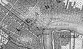
Detail from an 1888 German map of New Orleans
|
|
| Location | New Orleans, Louisiana |
|---|---|
| NRHP reference No. | 78001428 |
| Added to NRHP | August 1, 1978 |
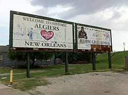
Algiers Point is a special place in New Orleans, Louisiana. It sits right on the Lower Mississippi River. For river pilots, it's a key "point" of land where the river makes a big turn. Since the 1970s, "Algiers Point" also refers to the neighborhood around this important spot. People from Algiers Point are called Algierenes or Algerines.
Contents
Understanding Algiers Point's Location
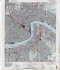
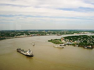
The Mississippi River flows through New Orleans in a shape like a crescent moon. As the river moves downstream, it turns sharply to the east. The French Quarter and other areas are on the outside of this bend. Algiers Point is the land on the other side of the river, on the inside of the bend.
Right near Algiers Point, the Mississippi River is very deep. It's about 60 meters (200 feet) deep! This depth can change a little each year. The United States Coast Guard has a special light, called Algiers Point Light "95," to mark this spot. It helps boats know where they are.
The United States Army Corps of Engineers also measures this location. They call it mile 94.6 AHP. This means it's 94.6 miles above the "Head of Passes," which is where the river splits into different channels before reaching the ocean.
In the 1900s, the Coast Guard started managing boat traffic here. Pilots in a tower across the river talk to boat captains. They use radios and traffic lights to control who goes when. This is important when the water is high, making it safer for everyone.
The Algiers Point Neighborhood
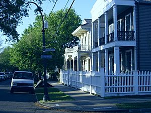
The area around Algiers Point became known as a neighborhood in the 1970s. People started to notice how historic and beautiful the houses were. They wanted to show off this part of Algiers.
The neighborhood's size can change depending on how you define it. A common way to describe it is about 50 city blocks. These blocks are bordered by Opelousas Avenue, Atlantic Avenue, and the river. The Algiers Point National Historic District is a bit larger.
Many houses in Algiers Point are very old. Some were built even before the American Civil War. However, a big fire in 1895 destroyed many buildings. So, most houses you see today were built right after that fire.
Today, Algiers Point is a lively place. It has many small businesses. You can find bars, restaurants, coffee shops, and other services. This mix makes it a great place to live and visit.
Who Lives Here?
In 2000, about 2,381 people lived in the Algiers Point neighborhood. There were 1,145 households.
By 2010, the population had grown slightly to 2,455 people. There were 1,229 households living here.
Learning in Algiers Point
The Orleans Parish School Board runs the public schools in New Orleans. The Adolph Meyer School is an elementary school in Algiers Point. It's also known as the Harriet R. Tubman Elementary School. This school building is listed on the National Register of Historic Places.
The Public Library
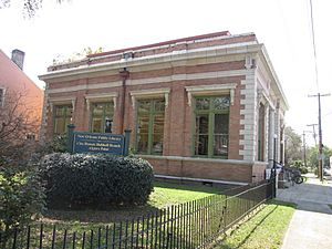
The New Orleans Public Library has a branch in Algiers Point. It's called the Cita Dennis Hubbell Branch. This building is the oldest public library building in New Orleans. It first opened in 1907 as the Algiers Branch. It was one of five Carnegie libraries built in the city.
The library closed for a while when a bigger library opened. But a group of people, led by Cita Dennis Hubbell, worked hard to reopen it. They felt it was too far for people in Algiers Point to get to the new library.
In 2005, Hurricane Katrina hit New Orleans. The library was damaged. After the storm, Cita Dennis Hubbell's daughter helped lead the effort to reopen it again. The building needed repairs for termites and other damage. Finally, the library had a grand reopening in 2013. It's still a beloved part of the community today.
See Also
 | Janet Taylor Pickett |
 | Synthia Saint James |
 | Howardena Pindell |
 | Faith Ringgold |


