Alice Creek Historic District facts for kids
Quick facts for kids |
|
|
Alice Creek Historic District
|
|

Alice Creek Historic District, Highway 200 to Lincoln
|
|
| Lua error in Module:Location_map at line 420: attempt to index field 'wikibase' (a nil value). | |
| Nearest city | Lincoln, Montana |
|---|---|
| Area | 5,425 acres (2,195 ha) |
| Built | 1806 |
| NRHP reference No. | 06000531 |
| Added to NRHP | June 6, 2007 |
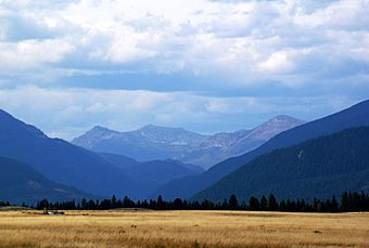
The Alice Creek Historic District is a special place in Montana, found within the Helena National Forest. It's a "historic district," which means it's an important area recognized for its history. This district is located near Lincoln, Montana, in Lewis and Clark County, Montana.
Even though there are no buildings in the district, it's full of history. Scientists studied the age of lichens (small plant-like growths on rocks) to learn about the ancient things found here. They discovered old rock piles (called cairns), stone forts, fire pits, and a stone cross. The area also has marshy parts, open sagebrush fields, and many trees.
Contents
A Long History
People have used the Alice Creek area for about 5,000 years! Native Americans were the first to live and travel through this region.
The Cokahlarishkit Trail
The most important path here is the Cokahlarishkit Trail. In the Nez Perce language, this name means "Road to the Buffalo Trail" or "Buffalo Road River." This trail was used for a very long time by Native Americans. It was the most direct way to travel through this part of North America.
Lewis and Clark Expedition
In July 1806, Meriwether Lewis, a famous explorer, traveled through the Alice Creek region. He was on his way back from the Lewis and Clark Expedition. Lewis and his group used the Cokahlarishkit Trail. Today, this historic path is part of the Lewis and Clark National Historic Trail.
Early Explorers and Settlers
- In 1842, a French Jesuit priest named Father Nicholas Point built a stone cross here.
- Another famous explorer, Father Pierre-Jean De Smet, also explored this region.
- In 1863, Lieutenant John Mullan created maps of the area.
- Gold was found near Lincoln in 1865, and the first homestead (a piece of land claimed for farming) was set up in 1882.
- The United States Forest Service built the Alice Creek Guard Station in 1920.
Scientists have studied the old structures. They believe that some of the rock piles and a stone lookout were made by Native Americans. They also think the stone cross is indeed the one built by Father Point.
Outdoor Adventures
The Alice Creek Trailhead is a starting point for many outdoor activities. From here, you can reach the Lewis and Clark Pass and the Scapegoat Wilderness.
Visitors can enjoy:
- Hiking
- Backpacking
- Camping
- Picnicking
- Studying nature
- Fishing
- Horse riding
- Winter sports
 | William M. Jackson |
 | Juan E. Gilbert |
 | Neil deGrasse Tyson |

