Alkmonton medieval settlement facts for kids
Quick facts for kids Alkmonton medieval settlement |
|
|---|---|

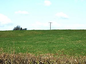
The earthworks, viewed from the south
|
|
| Location | Alkmonton, Derbyshire |
| OS grid reference | SK 194 376 |
| Designated | 25 February 1971 |
| Reference no. | 1018617 |
| Lua error in Module:Location_map at line 420: attempt to index field 'wikibase' (a nil value). | |
The Alkmonton medieval settlement is an old village site. It is now an archaeological area near the village of Alkmonton in Derbyshire, England. This site is about 5 miles (8 km) south of Ashbourne. It is a Scheduled Monument, which means it is a very important historical place protected by law.
Contents
What is Alkmonton Medieval Settlement?
This site shows where a village used to be a very long time ago. Today, you can see bumps and hollows in the ground. These are the remains of old buildings and roads. It's like a ghost village, but instead of ghosts, you see the marks left behind.
History of Alkmonton
The village of Alkmonton is very old. It was first written about in the Domesday Book in 1086. This book was a huge survey of England ordered by William the Conqueror. Back then, Alkmonton was called Alchementune. It had 8 villagers and 7 smallholders, who were like small farmers.
The Hospital and Chapel
Around the year 1100, a hospital was built here. It was for women who had leprosy, a serious skin disease common a long time ago. This hospital was dedicated to Saint Leonard.
Later, in 1406, the hospital was reopened. By then, leprosy was not as common. A lady named Lady Blount, whose husband owned the land, helped with this. Her grandson, Walter Blount, 1st Baron Mountjoy, wanted a chapel built at Alkmonton. This chapel was for Saint Nicholas. He also said that the person in charge of the hospital should hold a special church service there every year.
Both the hospital and the chapel were closed down during the time of King Edward VI. This happened when many religious buildings were shut down in England.
What Can You See Today?
The old village site is south of the modern Alkmonton village. It is on a gentle slope next to Alkmonton Old Hall Farm. The remains of the village are very well preserved.
Village Layout
You can still see the shape of the old village. There is a flat area that was likely the village green. This was a common open space in the middle of old villages. From this green, you can see sunken paths. These were the old roads that led out of the village.
There is a large flat area, about 25 meters by 50 meters (82 feet by 164 feet). Experts think this was where the medieval chapel stood. In 1844, an old stone font was found near here. A font is a basin used for baptism in a church. This font is now in St John's Church in the modern Alkmonton village.
North of the chapel site, there is an even bigger flat area. This platform is about 50 meters by 60 meters (164 feet by 197 feet). There are also other rectangular shapes in the ground. These are the foundations where houses and other buildings once stood.
Old Farm Fields
North and east of the village site, you can see patterns in the ground. These are called ridge and furrow. They are long, wavy lines that are about 0.5 meters (1.6 feet) high. These patterns show where farmers used to plow their fields in the medieval open-field system. This was a way of farming where villagers shared large fields.

