
Almirante Norte facts for kids
Quick facts for kids
Almirante Norte
|
|
|---|---|
|
Barrio
|
|

Vega State Forest in Almirante Norte
|
|

Location of Almirante Norte within the municipality of Vega Baja shown in red
|
|
| Lua error in Module:Location_map at line 416: Malformed coordinates value. | |
| Commonwealth | |
| Municipality | |
| Area | |
| • Total | 3.70 sq mi (9.6 km2) |
| • Land | 3.69 sq mi (9.6 km2) |
| • Water | 0.01 sq mi (0.03 km2) |
| Elevation | 226 ft (69 m) |
| Population
(2010)
|
|
| • Total | 4,397 |
| • Density | 1,191.6/sq mi (460.1/km2) |
| Source: 2010 Census | |
| Time zone | UTC−4 (AST) |
Almirante Norte is a special place called a barrio (which is like a neighborhood or district) in the town of Vega Baja, Puerto Rico. In 2010, about 4,397 people lived there. It's known for its beautiful Vega State Forest, which you can see in some pictures!
A Look Back in Time
Puerto Rico used to be a territory of Spain. After a big event called the Spanish–American War in 1898, Puerto Rico became part of the United States. This happened because of an agreement called the Treaty of Paris of 1898. It meant Puerto Rico was now a territory of the U.S.
In 1899, the United States government did a census (which is like a big count of all the people) in Puerto Rico. They found that 902 people lived in the Almirante Norte barrio back then. Over the years, the number of people living in Almirante Norte has grown quite a bit!
| Historical population | |||
|---|---|---|---|
| Census | Pop. | %± | |
| 1900 | 902 | — | |
| 1960 | 1,981 | — | |
| 1980 | 2,936 | — | |
| 1990 | 3,872 | 31.9% | |
| 2000 | 3,911 | 1.0% | |
| 2010 | 4,397 | 12.4% | |
| U.S. Decennial Census 1899 (shown as 1900) 1910-1930 1930-1950 1960 1980-2000 2010 |
|||
Gallery
-
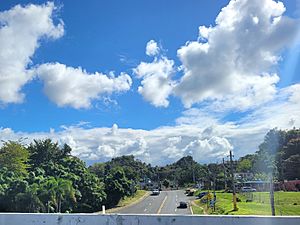
Puerto Rico Highway 160 in Almirante Norte

See also
 In Spanish: Almirante Norte para niños
- List of communities in Puerto Rico
