Alnus Peak facts for kids
Quick facts for kids Alnus Peak |
|
|---|---|
| Highest point | |
| Elevation | 2,968 m (9,738 ft) |
| Prominence | 508 m (1,667 ft) |
| Geography | |
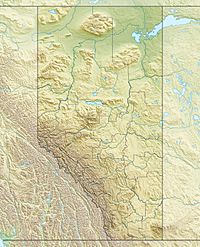
| Location | Alberta / British Columbia, Canada |
| Parent range | Park Ranges |
| Topo map | NTS 83D/08 |
| Climbing | |
| First ascent | 1920 Boundary Commission |
Alnus Peak is a cool mountain located right on the border between two Canadian provinces: Alberta and British Columbia. It's part of the amazing Canadian Rockies mountain range. This peak was officially named in 1921 by a person named Arthur O. Wheeler. The name "Alnus" comes from the Latin word for the Alder tree. It's thought that the mountain got its name because there are many Red Alder trees growing in the area around it.
Contents
Exploring Alnus Peak
Alnus Peak stands tall at 2,968 meters (about 9,738 feet) above sea level. This makes it a significant peak in the Park Ranges, which are a part of the larger Canadian Rockies. Mountains over 2,000 meters are often called "two-thousanders."
Where is Alnus Peak?
This mountain sits right on the invisible line that separates Alberta and British Columbia. This means if you stood on its summit, one foot could be in Alberta and the other in British Columbia! It's located in a wild and beautiful part of Canada. The peak is found in the Kootenay Land District on the British Columbia side.
How Alnus Peak Got Its Name
The name "Alnus Peak" was given in 1921 by Arthur O. Wheeler. He was a famous Canadian mountaineer and surveyor. He helped map many parts of the Canadian Rockies. The word "alnus" is the scientific name for the alder tree. These trees are common in many parts of Canada. They often grow in wet areas or along riverbanks. The name suggests that the area around the peak is home to many alder trees.
First Climbers of Alnus Peak
The first recorded climb of Alnus Peak happened in 1920. This ascent was made by the Boundary Commission. This group was responsible for surveying and marking the exact border between Alberta and British Columbia. Climbing the peak would have been an important part of their work. It helped them accurately map the provincial boundary.
See Also
- List of mountains in Alberta
- List of mountains in British Columbia
 | Bayard Rustin |
 | Jeannette Carter |
 | Jeremiah A. Brown |


