
Alpine, Arizona facts for kids
Quick facts for kids
Alpine, Arizona
|
|
|---|---|
 |
|

Alpine, Arizona
Location in Arizona
|
|
| Country | United States |
| State | Arizona |
| County | Apache |
| Area | |
| • Total | 0.56 sq mi (1.46 km2) |
| • Land | 0.56 sq mi (1.46 km2) |
| • Water | 0.00 sq mi (0.00 km2) |
| Elevation | 8,006 ft (2,440 m) |
| Population
(2020)
|
|
| • Total | 146 |
| • Density | 258.41/sq mi (99.72/km2) |
| Time zone | UTC-7 (MST) |
| ZIP Code |
85920
|
| Area code(s) | 928 |
| FIPS code | 04-01920 |
| GNIS Feature ID | 2582726 |
Alpine is a small community in Apache County, Arizona, United States. It's known as a census-designated place, which means it's an area identified by the U.S. Census Bureau for statistical purposes. In 2010, about 145 people lived there. Alpine is located in the east-central part of Arizona, very close to the state's eastern border.
Contents
History of Alpine
Alpine was settled in 1876 by a person named Anderson Bush. He built a log house that became a trading post called "Fort Bush." In 1879, William Maxwell and Fred Hamblin, who were Mormons, bought the land. They made it a Mormon community and named it Alpine because of its high elevation.
In 2011, Alpine was affected by the Wallow Fire. This was the largest wildfire in Arizona's history, burning over 538,000 acres and even spreading into New Mexico. The Alpine post office uses the ZIP code 85920.
Geography and Nature

Alpine is located high up, about 8,050 feet (2,454 meters) above sea level. It's at the eastern end of the White Mountains. The area is surrounded by the beautiful Apache-Sitgreaves National Forest.
Alpine is also near where the San Francisco River begins. It's only about six miles from the New Mexico border. This area is a popular spot for outdoor activities like hunting, fishing, and camping. Back in 1960, Alpine was known as the highest place in the United States where farming was successfully done.
Population Facts
Alpine first appeared in the U.S. Census in 1900. At that time, 95 people lived there in 17 households. In 1930, it was recorded again, and most of its residents were white. By 1940, Alpine's population grew to 165 people. In 1960, it was estimated that about 300 people lived there. In 2010, Alpine was officially recognized as a census-designated place (CDP). The 2020 census showed a population of 146 people.
Climate in Alpine
Alpine has a climate that feels comfortable, especially during the day. It's influenced by its high altitude and the North American Monsoon. The monsoon brings frequent thunderstorms in the summer. Even though days are warm, nights can get chilly, and frost can happen almost daily from October to May.
Winters in Alpine are cold. Storms bring a lot of snow. Alpine is on the eastern side of the Mogollon Rim. This means it gets less snowfall than other places at similar heights to its west. This is because of something called a "rain shadow" from the White Mountains.
On February 25, 1987, Alpine set a record for the most snowfall in Arizona in 24 hours. It received 38 inches (97 cm) of snow!
| Climate data for Alpine, Arizona (1991–2020 normals, extremes 1912–present) | |||||||||||||
|---|---|---|---|---|---|---|---|---|---|---|---|---|---|
| Month | Jan | Feb | Mar | Apr | May | Jun | Jul | Aug | Sep | Oct | Nov | Dec | Year |
| Record high °F (°C) | 72 (22) |
72 (22) |
74 (23) |
79 (26) |
92 (33) |
94 (34) |
94 (34) |
89 (32) |
87 (31) |
86 (30) |
77 (25) |
72 (22) |
94 (34) |
| Mean maximum °F (°C) | 57.6 (14.2) |
59.4 (15.2) |
64.6 (18.1) |
70.5 (21.4) |
78.2 (25.7) |
86.2 (30.1) |
86.4 (30.2) |
82.4 (28.0) |
78.6 (25.9) |
73.7 (23.2) |
65.6 (18.7) |
60.2 (15.7) |
87.7 (30.9) |
| Mean daily maximum °F (°C) | 45.6 (7.6) |
48.0 (8.9) |
53.9 (12.2) |
60.6 (15.9) |
68.8 (20.4) |
78.3 (25.7) |
78.5 (25.8) |
75.9 (24.4) |
71.9 (22.2) |
63.8 (17.7) |
53.8 (12.1) |
46.2 (7.9) |
62.1 (16.7) |
| Daily mean °F (°C) | 30.5 (−0.8) |
33.2 (0.7) |
38.2 (3.4) |
43.4 (6.3) |
50.1 (10.1) |
58.4 (14.7) |
62.6 (17.0) |
61.2 (16.2) |
55.5 (13.1) |
46.7 (8.2) |
37.8 (3.2) |
30.9 (−0.6) |
45.7 (7.6) |
| Mean daily minimum °F (°C) | 15.3 (−9.3) |
18.4 (−7.6) |
22.5 (−5.3) |
26.2 (−3.2) |
31.5 (−0.3) |
38.5 (3.6) |
46.7 (8.2) |
46.4 (8.0) |
39.2 (4.0) |
29.6 (−1.3) |
21.7 (−5.7) |
15.7 (−9.1) |
29.3 (−1.5) |
| Mean minimum °F (°C) | −3.4 (−19.7) |
1.6 (−16.9) |
8.4 (−13.1) |
14.6 (−9.7) |
19.3 (−7.1) |
27.2 (−2.7) |
38.3 (3.5) |
39.6 (4.2) |
28.2 (−2.1) |
16.3 (−8.7) |
6.2 (−14.3) |
−2.9 (−19.4) |
−8.1 (−22.3) |
| Record low °F (°C) | −32 (−36) |
−28 (−33) |
−25 (−32) |
−6 (−21) |
8 (−13) |
13 (−11) |
27 (−3) |
29 (−2) |
17 (−8) |
−1 (−18) |
−18 (−28) |
−28 (−33) |
−32 (−36) |
| Average precipitation inches (mm) | 1.26 (32) |
1.13 (29) |
0.92 (23) |
0.53 (13) |
0.71 (18) |
0.83 (21) |
3.91 (99) |
4.31 (109) |
2.34 (59) |
1.61 (41) |
1.16 (29) |
1.44 (37) |
20.15 (512) |
| Average snowfall inches (cm) | 10.7 (27) |
9.9 (25) |
8.2 (21) |
1.7 (4.3) |
0.5 (1.3) |
0.0 (0.0) |
0.0 (0.0) |
0.0 (0.0) |
0.0 (0.0) |
1.3 (3.3) |
4.6 (12) |
7.9 (20) |
44.8 (113.9) |
| Average precipitation days (≥ 0.01 inch) | 5.3 | 4.7 | 4.4 | 2.4 | 3.8 | 4.2 | 14.3 | 14.9 | 7.8 | 5.3 | 2.8 | 4.6 | 74.5 |
| Average snowy days (≥ 0.1 inch) | 3.7 | 2.8 | 2.3 | 1.1 | 0.1 | 0.0 | 0.0 | 0.0 | 0.0 | 0.6 | 1.4 | 3.1 | 15.1 |
| Source 1: NOAA | |||||||||||||
| Source 2: National Weather Service | |||||||||||||
Fun Places to Visit

Alpine and its surroundings offer several cool attractions:
- Apache-Sitgreaves National Forest: A huge forest perfect for exploring nature.
- The Coronado Trail Scenic Byway: A 120-mile (193 km) long road along U.S. Route 191. It offers amazing views between Springerville and Clifton, Arizona.
- Escudilla Mountain: This mountain is 10,877 feet (3,315 meters) tall. It's covered in pine and aspen trees. It's great for hiking, horseback riding, and seeing the beautiful fall colors.
- Luna Lake: Located about 3 miles (4.8 km) southeast of Alpine. It's a popular spot for fishing and camping.
Education in Alpine
The Alpine Elementary School District runs Alpine Elementary School, which serves the children in the area. The Apache County Library District also operates the Alpine Public Library, where you can find books and resources.
Picture gallery
-
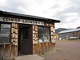
Alpine Country Store
-
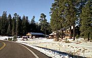
Alpine in November 1990
-
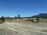
The Wallow Fire's impact in 2011
.jpg)
.jpg)

See also
 In Spanish: Alpine (Arizona) para niños
