Amesbury (CDP), Massachusetts facts for kids
Quick facts for kids
Amesbury, Massachusetts
|
|
|---|---|
|
Former Census-designated place
|
|

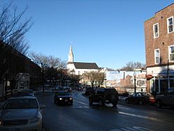
Main Street
|
|
| Country | United States |
| State | Massachusetts |
| County | Essex |
| Area | |
| • Total | 5.7 sq mi (14.7 km2) |
| • Land | 5.3 sq mi (13.8 km2) |
| • Water | 0.4 sq mi (0.9 km2) |
| Elevation | 56 ft (17 m) |
| Population
(2000)
|
|
| • Total | 12,327 |
| • Density | 2,321.5/sq mi (896.3/km2) |
| Time zone | UTC-5 (Eastern (EST)) |
| • Summer (DST) | UTC-4 (EDT) |
| ZIP code |
01913
|
| Area code(s) | 978 |
| FIPS code | 25-01220 |
| GNIS feature ID | 0614180 |
Amesbury CDP was a special area within the town of Amesbury, Massachusetts, located in Essex County. It was called a "census-designated place" (CDP). This meant it was a part of the town where many people lived close together, and the government counted them separately for official records.
When Amesbury changed from being a town to a city in 1996, this special way of counting a specific area was no longer needed. So, by the time of the 2010 census, Amesbury CDP was no longer used for collecting data.
The numbers reported for Amesbury CDP were also included in the total numbers for the entire city of Amesbury. In the year 2000, Amesbury CDP had a total population of 12,327 people.
Contents
About Amesbury CDP's Geography
This section describes the physical area of Amesbury CDP.
Land and Water Area
According to the United States Census Bureau, Amesbury CDP covered a total area of about 14.7 square kilometers (5.7 square miles).
- Most of this area, about 13.8 square kilometers (5.3 square miles), was land.
- The rest, about 1.0 square kilometer (0.4 square miles), was water.
- This means that about 6.51% of the total area was covered by water.
People and Families in Amesbury CDP
This section shares details about the people who lived in Amesbury CDP, based on the census from the year 2000.
Population and Households
In 2000, there were:
- 12,327 people living in Amesbury CDP.
- 4,910 households (groups of people living in one home).
- 3,093 families (households with related people).
The area had about 896 people per square kilometer (2,321 people per square mile). There were also 5,099 housing units, with about 370 units per square kilometer (960 units per square mile).
Diversity of Residents
The people living in Amesbury CDP in 2000 included:
- 96.87% White
- 0.65% African American
- 0.21% Native American
- 0.60% Asian
- 0.02% Pacific Islander
- 0.28% from other races
- 1.37% from two or more races
About 1.05% of the population were Hispanic or Latino (of any race).
Household Makeup
Out of all the households in Amesbury CDP:
- 33.2% had children under 18 years old living with them.
- 46.6% were married couples living together.
- 12.4% were homes where a woman lived without her husband.
- 37.0% were not families (like single people living alone or roommates).
About 29.7% of all households were made up of just one person. Also, 9.8% of households had someone living alone who was 65 years old or older. The average household had 2.45 people, and the average family had 3.07 people.
Age Groups
The population in Amesbury CDP was spread out across different age groups:
- 25.4% were under 18 years old.
- 6.6% were between 18 and 24 years old.
- 34.5% were between 25 and 44 years old.
- 21.0% were between 45 and 64 years old.
- 12.5% were 65 years old or older.
The average age of people in Amesbury CDP was 36 years. For every 100 females, there were about 92.8 males. For every 100 females aged 18 and over, there were about 88.6 males.
Income Information
- The average income for a household in Amesbury CDP was $50,037 per year.
- For families, the average income was $59,853 per year.
- Males had an average income of $41,566, while females had an average income of $31,209.
- The average income per person in Amesbury CDP was $22,657.
About 7.0% of all people and 4.6% of families lived below the poverty line. Of those living in poverty, 8.7% were under 18 years old, and 10.3% were 65 years old or older.

