Amhuinnsuidhe facts for kids
Quick facts for kids Amhuinnsuidhe
|
|
|---|---|
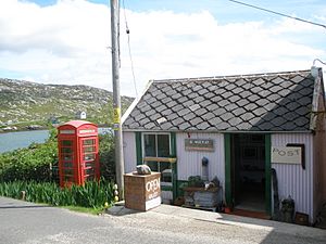
 Post Office and shop at Amhuinnsuidhe |
|
| Language | Scottish Gaelic English |
| OS grid reference | NB043083 |
| Civil parish | |
| Council area | |
| Lieutenancy area | |
| Country | Scotland |
| Sovereign state | United Kingdom |
| Post town | ISLE OF HARRIS |
| Postcode district | HS3 |
| Dialling code | 01859 |
| Police | Northern |
| Fire | Highlands and Islands |
| Ambulance | Scottish |
| EU Parliament | Scotland |
| UK Parliament |
|
| Scottish Parliament |
|
Amhuinnsuidhe (which is Abhainn Suidhe in Scottish Gaelic) is a small place in Scotland. It's located on the Isle of Harris, which is part of the Outer Hebrides. This area is known for its beautiful landscapes.
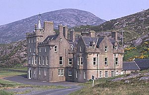
Amhuinnsuidhe is famous for its large country house, Amhuinnsuidhe Castle. The castle is right next to the B887 road.
Exploring Amhuinnsuidhe's Location
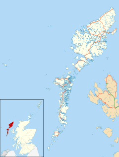
Amhuinnsuidhe is found on the northern coast of West Loch Tarbert. This is a sea loch on the island of Harris. It is about 8 miles (13 km) northwest of a town called Tarbert.
Close to Amhuinnsuidhe, you can find Sron Uladail. This is one of the tallest sheer cliffs in the British Isles. It's a truly impressive natural sight.
A Look at Amhuinnsuidhe Castle's Past
Amhuinnsuidhe Castle was built a long time ago, in 1865. It was made for a person named Charles Murray, 7th Earl of Dunmore. The castle and the land around it, known as the North Harris Estate, were owned by private families for many years.
In 2003, something special happened. The North Harris Estate, which is about 55,000 acres (220 km²), was bought by the local community. This was a big step for the people living there. A group called the North Harris Trust took over the land.
However, the castle itself and the rights to fish in the nearby waters were bought by someone else, Ian Scarr-Hall. Today, the castle is run as the Amhuinnsuidhe Castle Estate. It works as a hotel for visitors who enjoy sports like fishing, and it also hosts meetings and events.


