
Ampara District facts for kids
Quick facts for kids
Ampara District
அம்பாறை மாவட்டம்
අමිපාර දිස්ත්රික්කය |
|
|---|---|

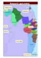
Administrative units of Ampara District in 2006
|
|
| Country | Sri Lanka |
| Province | Eastern |
| Created | April 1961 |
| Capital | Ampara |
| DS Division |
List
Addalaichchenai
Akkaraipattu Alayadivembu Ampara Damana Dehiattakandiya Irakkamam Kalmunai (Muslim) Kalmunai (Tamil) Karaitivu Lahugala Maha Oya Navithanveli Nintavur Padiyathalawa Pottuvil Sainthamarathu Samanthurai Thirukkovil Uhana |
| Area | |
| • Total | 4,415 km2 (1,705 sq mi) |
| • Land | 4,222 km2 (1,630 sq mi) |
| • Water | 193 km2 (75 sq mi) 4.37% |
| Area rank | 4th (6.73% of total area) |
| Population
(2012 census)
|
|
| • Total | 648,057 |
| • Rank | 14th (3.20% of total pop.) |
| • Density | 146.785/km2 (380.17/sq mi) |
| Time zone | UTC+05:30 (Sri Lanka) |
| Post Codes |
32000-32999
|
| Telephone Codes | 063, 067 |
| ISO 3166 code | LK-52 |
| Vehicle registration | EP |
| Official Languages | Tamil, Sinhala |
Ampara District is one of the 25 districts in Sri Lanka. Think of districts as important areas that help manage the country. Ampara District is located in the Eastern Province of Sri Lanka. The main town, or capital, of this district is Ampara.
This district was created in April 1961. It was formed by taking the southern part of the Batticaloa District.
Contents
Exploring Ampara District's Location
Ampara District is found in the southeast part of Sri Lanka. It is part of the Eastern Province.
How Big is Ampara District?
The total area of Ampara District is about 4,415 square kilometers (1,705 square miles). This makes it one of the larger districts in Sri Lanka. Most of this area is land, with a small part being water.
How Ampara District is Governed
Ampara District is managed by a District Secretary. This person is like the main leader for the district. There are also elected representatives from Ampara who serve in the national Parliament and the Eastern Provincial Council. These people help make decisions for the district and its residents.
Divisions within Ampara District
The district is divided into smaller areas called Divisional Secretary's Divisions, or DS Divisions for short. These smaller divisions help manage local services and administration more easily. There are 20 such divisions within Ampara District.
See also
 In Spanish: Distrito de Ampara para niños
Images for kids
-
Administrative units of Ampara District in 2006
