Batticaloa District facts for kids
Quick facts for kids
Batticaloa District
மட்டக்களப்பு மாவட்டம்
මඩකලපුව දිස්ත්රික්කය |
|
|---|---|

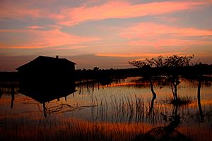
Sunset at Kumburumoolai
|
|

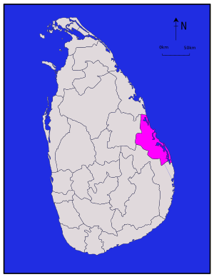
Location within Sri Lanka
|
|

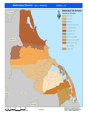
Administrative units of Batticaloa District in 2007
|
|
| Country | Sri Lanka |
| Province | Eastern |
| Capital | Batticaloa |
| DS Division |
List
Eravurpattu
Eravur Town Kattankudy Koralaipattu Koralaipattu Central Koralaipattu North Koralaipattu South Koralaipattu West Manmunai North Manmunaipattu Manmunai S & Eruvilpattu Manmunai South West Manmunai West Porativupattu |
| Area | |
| • Total | 2,854 km2 (1,102 sq mi) |
| • Land | 2,610 km2 (1,010 sq mi) |
| • Water | 244 km2 (94 sq mi) 8.55% |
| Area rank | 9th (4.35% of total area) |
| Population
(2012 census)
|
|
| • Total | 525,142 |
| • Rank | 17th (2.59% of total pop.) |
| • Density | 184.00/km2 (476.56/sq mi) |
| Time zone | UTC+05:30 (Sri Lanka) |
| Post Codes |
30000-30999
|
| Telephone Codes | 065 |
| ISO 3166 code | LK-51 |
| Vehicle registration | EP |
| Official Languages | Tamil, Sinhala |
Batticaloa District (Tamil: மட்டக்களப்பு மாவட்டம்; Sinhala: මඩකලපුව දිස්ත්රික්කය) is one of the 25 districts in the country of Sri Lanka. It is located in the Eastern Province, which is on the eastern side of the island. The main city and capital of this district is Batticaloa.
In April 1961, the Ampara District was created. It was formed from the southern part of what was once Batticaloa District.
Contents
Geography of Batticaloa District
Batticaloa District is found on the eastern coast of Sri Lanka. It is part of the Eastern Province. The district covers a total area of about 2,854 square kilometers (1,102 square miles). This makes it the 9th largest district in Sri Lanka.
A small part of this area, about 244 square kilometers, is made up of water bodies like lagoons and rivers.
How Batticaloa District is Governed
Batticaloa District is an important administrative area in Sri Lanka. It has its own local government to manage daily life for its people.
Local Administration
The main leader of the district is called the District Secretary. This person is in charge of making sure the district runs smoothly. The district is divided into smaller areas called Divisional Secretary's Divisions. These are like local neighborhoods or towns, and each has its own office to help residents. There are 14 such divisions in Batticaloa District.
Representatives in Government
People from Batticaloa District are also represented in the national and provincial governments:
- Members of Parliament (MPs): These are people chosen to represent the district in the Parliament of Sri Lanka. They help make laws for the whole country.
- Members of Provincial Council (MPCs): These representatives work for the Eastern Provincial Council. They focus on issues specific to the Eastern Province, like education and health.
Population of Batticaloa District
According to a census taken in 2012, about 525,142 people live in Batticaloa District. This makes it the 17th most populated district in Sri Lanka. The district is home to people who speak different languages, including Tamil and Sinhala. These are the official languages used in the district.
See also

- In Spanish: Distrito de Batticaloa para niños
 | Bayard Rustin |
 | Jeannette Carter |
 | Jeremiah A. Brown |

