Andover, Tasmania facts for kids
Quick facts for kids AndoverTasmania |
|||||||||||||||
|---|---|---|---|---|---|---|---|---|---|---|---|---|---|---|---|
| Population | 39 (2021 census) | ||||||||||||||
| Postcode(s) | 7120 | ||||||||||||||
| Location | 16 km (10 mi) E of Oatlands | ||||||||||||||
| LGA(s) | Southern Midlands | ||||||||||||||
| Region | Central | ||||||||||||||
| State electorate(s) | Lyons | ||||||||||||||
| Federal Division(s) | Lyons | ||||||||||||||
|
|||||||||||||||
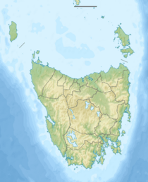
Andover is a small, quiet place in the countryside of Tasmania, Australia. It's located in the Southern Midlands area. This rural spot is about 16 kilometers (10 miles) east of a town called Oatlands. In 2021, only 39 people lived in Andover. It's mostly made up of farms and old country estates. Andover covers an area of about 73 square kilometers.
Contents
Andover's Past
Andover became an official locality in 1974. But its history goes back much further.
Early Days
The area was first named by Lieutenant Francis Tabart in 1831. It was once a small village on the Little Swan River. This was about 62 kilometers (38 miles) from Hobart, Tasmania's capital city.
Post Office History
A post office opened here in 1888. It was first called "Eastern Marshes Siding Post Office." In 1893, its name was changed to Andover. This post office served the community for many years before closing in 1966.
Andover's Location
Andover is a rural area with natural features.
Rivers and Waterways
The Little Swanport River starts its journey in Andover. It then flows through the area towards the south-eastern border. This river is an important part of the local environment.
Roads and Travel
Several roads help people get around Andover and connect it to other places.
- Route C310, also known as Inglewood Road, runs through Andover from west to south-east.
- Route C307, or Lemont Road, begins at an intersection with C310 and heads east.
- Route C309, called Nala Road, also starts from C310 and goes north and then east.
These roads are important for local farmers and residents.
 | Precious Adams |
 | Lauren Anderson |
 | Janet Collins |


