Angle Peninsula Coast facts for kids
| Site of Special Scientific Interest | |
| Area of Search | Pembrokeshire |
|---|---|
| Coordinates | 51°40′49″N 5°05′52″W / 51.68022°N 5.09766°W |
| Area | 133.5 hectares (1.335 km2) |
| Notification | 1 January 1953/16 October 2003 |
The Angle Peninsula Coast is a special piece of land that sticks out into the sea in Pembrokeshire, Wales. It forms the southern edge of the entrance to the Milford Haven Waterway. This area is so important for nature that it's called a Site of Special Scientific Interest (SSSI). You can find lots of different animals and plants here, and it was once home to an important airfield during World War II.
World War II History
The Angle Peninsula has many reminders of World War II. These include old defences and the site of a former airfield called RAF Angle.
Wartime Defences
Many hollows in the banks around the peninsula were used to hide machine guns during the war. There was also a searchlight battery here, which helped spot enemy planes at night.
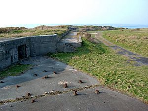
Near East Picket Bay, you can still see parts of the "E-Pens." These were special shelters for fighter aircraft. Close to the World War I memorial, there are also remains of an anti-aircraft post. This was a place where guns were set up to shoot down enemy aircraft.
Another anti-aircraft post can be found on the coastal path, just past the RNLI lifeboat house. This spot was later changed to hold a powerful 40 mm Rolls Royce cannon. At North Hill, you can find the remains of a "Laing hut." This small building was used to house a searchlight.
On a rocky area at West Pill, there is a brick hut called a "mine watcher hut." Its job was to watch for enemies trying to lay mines in Milford Haven.
RAF Angle Airfield
RAF Angle was an important airfield during World War II. It opened in 1941 after the Luftwaffe (German air force) attacked Pembroke Dock.
The airfield first belonged to No. 10 Group, Fighter Command. Many different squadrons used it during the war. These included the No. 312 (Czechoslovak) Squadron RAF and the Canadian 412 Transport Squadron. Famous planes like Spitfires, Westland Whirlwinds, and Hawker Hurricanes flew from here.
In 1943, the Fleet Air Arm of the Royal Navy took over the airfield. During this time, a Sunderland flying boat even landed at Angle after it was damaged during a rescue mission. Later, the airfield returned to the RAF. It became home to a Coastal Command unit that tested weapons. These weapons were designed to be used against German U-Boats (submarines).
After the war ended, the airfield buildings were no longer needed. Many were removed in the 1980s, but some can still be found in remote areas.
Sea Empress Oil Spill
On February 15, 1996, a large oil tanker called the Sea Empress ran aground at the entrance to the Milford Haven Waterway. This caused a huge spill of 72,000 tonnes of crude oil.
The coastline around Angle was badly damaged by the oil. The effects of this oil spill lasted for several years. Cleaning up the area and dealing with the damage cost about £60 million.
 | Georgia Louise Harris Brown |
 | Julian Abele |
 | Norma Merrick Sklarek |
 | William Sidney Pittman |


