Antoine, Arkansas facts for kids
Quick facts for kids
Antoine, Arkansas
|
|
|---|---|

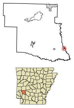
Location of Antoine in Pike County, Arkansas.
|
|
| Country | United States |
| State | Arkansas |
| County | Pike |
| Area | |
| • Total | 0.51 sq mi (1.33 km2) |
| • Land | 0.51 sq mi (1.31 km2) |
| • Water | 0.01 sq mi (0.02 km2) |
| Elevation | 292 ft (89 m) |
| Population
(2020)
|
|
| • Total | 113 |
| • Density | 223.32/sq mi (86.20/km2) |
| Time zone | UTC-6 (Central (CST)) |
| • Summer (DST) | UTC-5 (CDT) |
| ZIP code |
71922
|
| Area code(s) | 870 |
| FIPS code | 05-01540 |
| GNIS feature ID | 2405156 |
Antoine is a small town in Pike County, Arkansas, in the United States. It's located right next to the Antoine River. In 2020, about 113 people lived here.
Contents
Where is Antoine?
Antoine is found on hills just west of the Antoine River. It covers a total area of about 1.3 square kilometers (0.5 square miles). That's all land! The town sits about 89 meters (292 feet) above sea level.
A Look at Antoine's History
How Antoine Got Its Name
The town of Antoine started as a resting spot. This was on the old Southwest Trail to Texas in the early 1800s. It got its name from a French trapper. He was found dead at his camp, which is now the town cemetery. The only thing that identified him was his first name, "Antoine."
He was buried on a hill by the river. This grave became a famous landmark for travelers. Eventually, the name "Antoine" was given to the river and the town that grew up beside it. Antoine's grave is still in the town cemetery today. However, his marker has disappeared over time.
You can also find two special "Bois-D'Arc" marker-trees in town. These trees were used to mark the Southwest Trail. They are still alive on what is now Main Street/Arkansas Highway 29.
Antoine During the Civil War
Even though there was a small fight nearby, called the Skirmish at Terre Noire Creek, Antoine didn't suffer much damage during the Civil War. It stayed under the control of the Confederate side until 1865.
The Railroad's Impact
In the late 1860s and early 1870s, a major railroad line was built. It went across Southwest Arkansas. This was a very important event for Antoine. But the new railroad route was about 20 miles (32 km) southeast of the old Southwest Trail. This meant the railroad completely bypassed Antoine.
Because of this, businesses and people started to leave towns along the old trail. Antoine began a slow decline. It never fully recovered from being bypassed by the railroad.
Logging and Railroad Boom
In the 1890s and early 1900s, there was a big boom in logging and railroads in the area. This lasted until the Great Depression. During this time, railroad lines connected Antoine to other towns. These included Gurdon to the south, Amity to the north, and Delight to the west. The historic railroad bridge over the Antoine River was built in 1908. It is still used today!
Antoine Today
After the Great Depression, Antoine's population slowly but steadily decreased. Today, the main activities in Antoine include:
- logging (cutting down trees)
- ranching (raising animals)
- trucking (transporting goods)
- farming (growing crops)
- tourism (people visiting for fun)
Most people who live in Antoine work in nearby cities. These cities are Arkadelphia, Hope, or Nashville.
Population Changes Over Time
| Historical population | |||
|---|---|---|---|
| Census | Pop. | %± | |
| 1930 | 210 | — | |
| 1940 | 233 | 11.0% | |
| 1950 | 209 | −10.3% | |
| 1960 | 163 | −22.0% | |
| 1970 | 182 | 11.7% | |
| 1980 | 194 | 6.6% | |
| 1990 | 160 | −17.5% | |
| 2000 | 156 | −2.5% | |
| 2010 | 117 | −25.0% | |
| 2020 | 113 | −3.4% | |
| U.S. Decennial Census | |||
In 2000, there were 156 people living in Antoine. There were 64 households and 44 families. About 93.59% of the people were White. About 5.77% were Black or African American. A small number (0.64%) were of two or more races.
About 26.3% of the people were under 18 years old. The average age in Antoine was 42 years.
See also
 In Spanish: Antoine (Arkansas) para niños
 | Jewel Prestage |
 | Ella Baker |
 | Fannie Lou Hamer |

