Apache Peak (Whetstone Mountains) facts for kids
Quick facts for kids Apache Peak |
|
|---|---|

Apache Peak
|
|
| Highest point | |
| Elevation | 7,714 ft (2,351 m) NAVD 88 |
| Prominence | 2,886 ft (880 m) |
| Geography | |
| Location | Cochise County, Arizona, U.S. |
| Parent range | Whetstone Mountains |
| Topo map | USGS Apache Peak |
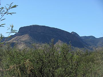
Apache Peak is a tall mountain in Arizona, USA. It stands at 7,714 feet (2,351 meters) high. This makes it the highest point in the Whetstone Mountains.
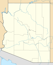
You can find Apache Peak in Cochise County. It's part of the Coronado National Forest. Many people enjoy hiking to its top. The mountain is close to cool places like Kartchner Caverns State Park. It's also near the city of Benson and major roads like Interstate 10.
Hiking to the Top of Apache Peak
Reaching the top of Apache Peak is an exciting adventure. There are a few trails you can take. Both trails are a bit challenging. They have loose rocks and different kinds of plants. You might see shrubs, grass, cacti, and small trees.
What to Expect on the Trails
The hike usually involves climbing about 4,160 feet (1,268 meters). The round-trip distance is around 12.6 miles (20.3 kilometers). It's a good idea to be prepared for this journey.
Important Hiking Tips
- Bring plenty of water: You should carry at least 3 liters of water. This is super important, especially during summer. Even in winter, the air can be very dry.
- Watch the weather: Snow storms can happen in winter. In summer, strong lightning storms and sudden floods are common. It's best not to hike if thunderstorms are expected.
 | May Edward Chinn |
 | Rebecca Cole |
 | Alexa Canady |
 | Dorothy Lavinia Brown |


