Apple River, Illinois facts for kids
Quick facts for kids
Apple River
|
|
|---|---|

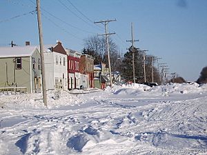
Apple River - Railroad Street in winter 2008
|
|
| Etymology: the nearby Apple River | |

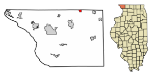
Location of Apple River in Jo Daviess County, Illinois
|
|

Location of Illinois in the United States
|
|
| Country | United States |
| State | Illinois |
| County | Jo Daviess |
| Township | Apple River |
| Area | |
| • Total | 0.7 sq mi (1.82 km2) |
| • Land | 0.7 sq mi (1.82 km2) |
| • Water | 0 sq mi (0 km2) |
| Elevation | 1,010 ft (310 m) |
| Population
(2020)
|
|
| • Total | 347 |
| • Density | 492.2/sq mi (190.16/km2) |
| Time zone | UTC-6 (CST) |
| • Summer (DST) | UTC-5 (CDT) |
| ZIP Code(s) |
61001
|
| Area codes | 815, 779 |
| FIPS code | 17-01673 |

Apple River is a small village located in Jo Daviess County, Illinois, in the United States. It gets its name from the nearby Apple River. In 2020, about 347 people lived there. This was a slight decrease from the 366 people counted in 2010.
Contents
History of Apple River Village
The first home in Apple River was built in 1832 by a man named Daniel Robbins. Years later, in 1854, the Illinois Central Railroad was built through the area. This was also the year that J. M. Irvine opened the town's first general store. Even though people voted on it in 1868, Apple River officially became a village in 1870.
Where is Apple River Located?
Apple River is found at these coordinates: 42°30′11″N 90°5′50″W / 42.50306°N 90.09722°W. This helps us pinpoint its exact spot on a map.
According to the 2010 census, the village covers a total area of about 0.79 square miles (1.82 square kilometers). All of this area is land, with no water within the village limits.
Who Lives in Apple River?
| Historical population | |||
|---|---|---|---|
| Census | Pop. | %± | |
| 1880 | 626 | — | |
| 1890 | 572 | −8.6% | |
| 1900 | 576 | 0.7% | |
| 1910 | 581 | 0.9% | |
| 1920 | 484 | −16.7% | |
| 1930 | 421 | −13.0% | |
| 1940 | 461 | 9.5% | |
| 1950 | 431 | −6.5% | |
| 1960 | 477 | 10.7% | |
| 1970 | 482 | 1.0% | |
| 1980 | 472 | −2.1% | |
| 1990 | 414 | −12.3% | |
| 2000 | 379 | −8.5% | |
| 2010 | 366 | −3.4% | |
| 2020 | 347 | −5.2% | |
| U.S. Decennial Census | |||
In 2000, there were 379 people living in Apple River. These people lived in 159 households, and 102 of these were families. Most of the people living in the village were White (98.94%).
About 30.8% of the households had children under 18 years old living with them. Many households (50.9%) were married couples living together. About 32.1% of all households were made up of people living alone. Some of these were people aged 65 or older.
The population was spread out by age. About 27.7% were under 18. Around 30.3% were between 25 and 44 years old. The average age in the village was 38 years.
Famous People from Apple River
- Terrence Ingram
See Also
 In Spanish: Apple River (Illinois) para niños
 | Janet Taylor Pickett |
 | Synthia Saint James |
 | Howardena Pindell |
 | Faith Ringgold |

