Arapahoe, Colorado facts for kids
Quick facts for kids
Arapahoe, Colorado
|
|
|---|---|

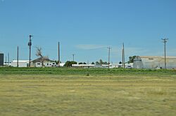
Overview from U.S. Route 40
|
|
| Country | |
| State | |
| County | Cheyenne County |
| Established | 1870 |
| Government | |
| • Type | unincorporated town |
| Area | |
| • Total | 0.277 sq mi (0.718 km2) |
| • Land | 0.277 sq mi (0.718 km2) |
| • Water | 0 sq mi (0.000 km2) |
| Elevation | 4,026 ft (1,227 m) |
| Population
(2020)
|
|
| • Total | 102 |
| • Density | 367.9/sq mi (142.1/km2) |
| Time zone | UTC-7 (MST) |
| • Summer (DST) | UTC-6 (MDT) |
| ZIP Code |
80802
|
| Area code(s) | 719 |
| GNIS feature | Arapahoe CDP |
Arapahoe is a small community in Cheyenne County, Colorado, in the United States. It's called a "census-designated place" (CDP). This means it's an area the government counts for population. However, it's not officially a city or town with its own local government. In 2020, about 102 people lived there. Arapahoe has its own ZIP code, 80802.
Contents
The Story of Arapahoe
Arapahoe has an interesting past! The very first place named Arapahoe was started in 1859. This was in an area that later became Jefferson County, Colorado. But that first town didn't last very long. It became what people call a "ghost town" after just a few years.
A New Beginning
The Arapahoe we know today was established in a different spot in 1870. This new community grew. On May 5, 1910, it even got its own post office.
Where the Name Comes From
The name "Arapahoe" was chosen to honor the Arapaho Native American people. They were a group of Native Americans who lived in this area.
Where is Arapahoe?
Arapahoe is located in Cheyenne County, Colorado. The area of the community is about 0.718 square kilometers. That's about 0.277 square miles. All of this area is land.
Who Lives in Arapahoe?
The United States Census Bureau keeps track of how many people live in different places. They counted the population of Arapahoe for the United States Census 2020.
| Arapahoe, Colorado | ||
|---|---|---|
| Year | Pop. | ±% |
| 2020 | 102 | — |
| Source: United States Census Bureau | ||
 | Janet Taylor Pickett |
 | Synthia Saint James |
 | Howardena Pindell |
 | Faith Ringgold |


