Artashat, Armenia facts for kids
Quick facts for kids
Artashat
Արտաշատ
|
|||
|---|---|---|---|
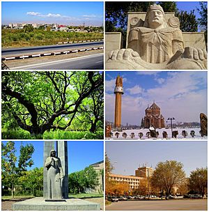
From top left:
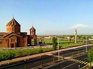
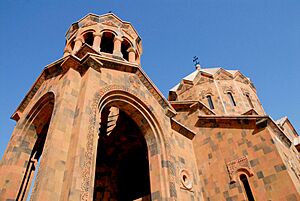
View of Artashat • Statue of King Artaxias I Apricot farms • Surp Hovhannes Church World War II memorial • Downtown Artashat |
|||
|
|||
| Country | Armenia | ||
| Province | Ararat | ||
| Municipality | Artashat | ||
| First settled | 1828–29 | ||
| Received urban-type settlement status | 1946 | ||
| Received city status | 1962 | ||
| Area | |||
| • Total | 18.3 km2 (7.1 sq mi) | ||
| Elevation | 830 m (2,720 ft) | ||
| Population
(2022 census)
|
|||
| • Total | 19,020 | ||
| • Density | 1,039.3/km2 (2,692/sq mi) | ||
| Time zone | UTC+4 (AMT) | ||
| ZIP |
0701-0706
|
||
| Area code(s) | +374 (235) | ||
| Vehicle registration | 25 | ||
| Website | Municipality official website: http://www.artashat.am/Pages/Home/Default.aspx | ||
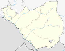
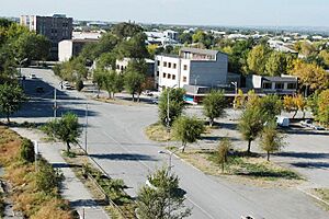
Artashat (Armenian: Արտաշատ) is a town in Armenia. It is the main administrative center of the Artashat Municipality and the Ararat Province. The town is located on the Azat River in the Ararat Plain. It is about 30 kilometers (19 miles) southeast of Yerevan, the capital city of Armenia.
Artashat started as a village called Ghamarlu. It was founded in 1828–29 by Armenians who moved there from Iran. By the late 1800s and early 1900s, it had grown into a large village. In 1945, it was renamed Artashat. This name came from the ancient city of Artashat, whose ruins are nearby. The town became an urban-type settlement in 1946 and a full city in 1962. It then grew into an important industrial area.
Artashat is on a main highway that connects Yerevan to southern Armenia. It also has a railway station, though the railway is not currently in use. In 2022, the town had a population of 19,020 people.
Contents
- What's in a Name? The Story of Artashat
- A Look Back: Artashat's History
- Where is Artashat? Geography
- People of Artashat: Demographics
- Fun and Arts: Culture in Artashat
- Getting Around: Transportation
- Making a Living: Economy in Artashat
- Learning and Growing: Education
- Playing Sports: Sport
- Friends Around the World: Twin Towns
- Famous People from Artashat
- See also
What's in a Name? The Story of Artashat
Modern Artashat gets its name from the ancient city of Artashat. The ruins of this old city are about 8 kilometers (5 miles) southeast of the current town. Ancient Artashat was the capital of the Kingdom of Armenia for almost 350 years. It was founded in 176 BC by King Artashes I.
The name "Artashat" comes from old Iranian languages. It can mean "the joy of Arta (truth)." It is also a shorter way of saying "the joy of Artashes." The old city was sometimes called Ostan Hayots’, which means 'court/seat of the Armenians'. This was also the name of the area where it was located. The modern town was known as Ghamarlu until it was renamed Artashat in 1945.
A Look Back: Artashat's History
Before 1828, the area where Artashat is now was empty. In 1828–29, Armenian families from Iran settled there. They founded a new village called Ghamarlu. By the late 1800s, Ghamarlu was a big village. People grew gardens, cotton, and grapes. They also made Armenian brandy and had a winery.
In 1930, the Ghamarlu District was created, with Ghamarlu as its center. In 1945, the village and district were both renamed Artashat. The town became an urban-type settlement in 1946. A plan for the city was made in 1948. In 1962, Artashat became a "city." Some nearby villages, like Nerkin Ghamarlu, became part of the city.
During the Soviet period, especially after World War II, Artashat grew as an industrial center. It focused on making food products and building materials. In 1995, Artashat became the capital of the new Ararat Province.
Where is Artashat? Geography
Artashat is in the middle of modern-day Armenia. It is in the southeastern part of the Ararat plain. The town is only about 3.5 kilometers (2.2 miles) east of the Araks River. This river forms part of the border between Armenia and Turkey. Artashat is on the left side of the Azat River.
The town is about 830 meters (2,723 feet) above sea level. Mountains surround it: the Yeranos mountains to the north, Gegham mountains to the east, and Urts mountains to the southeast.
Artashat is divided into four main areas: Novruzlu, Kentron, Ghamarlu, and Southwestern district. Almost half of the people live in the Southwestern district. The town is surrounded by villages like Mrgavan, Vostan, and Shahumyan.
People of Artashat: Demographics
Most people in Artashat are ethnic Armenians. Their ancestors moved from areas in Iran after the Russo-Persian War of 1826–28. They belong to the Armenian Apostolic Church. The main church in the town is Surp Hovhannes (Saint John the Evangelist). It was opened on May 31, 2015.
Artashat also has small communities of Assyrian and Russian people.
Here's how Artashat's population has changed since 1945:
| Year | Population |
|---|---|
| 1945 | 4,200 |
| 1959 | 7,277 |
| 1974 | 14,905 |
| 1976 | 16,774 |
| 1989 | 32,000 |
| 2001 | 22,600 |
| 2011 | 22,269 |
| 2016 | 18,700 |
| 2022 | 19,020 |
Fun and Arts: Culture in Artashat
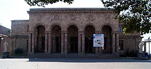
Artashat has many places for culture and entertainment. There is a palace of culture and an art center named after Charles Aznavour. The town also has a drama theatre named after Amo Kharazyan. A public library, named after Ohan Chubaryan, opened in 1948.
In 2004, a new amusement park opened in the center of Artashat. It is used for public celebrations, concerts, and music shows.
To celebrate 1600 years since the Armenian alphabet was created, artists made many cultural monuments in Artashat. There is also a statue of King Artashes I in the city center. The Amo Kharazyan Drama Theatre often performs plays by Armenian and international writers. Artashat also has its own TV station and local newspapers.
Getting Around: Transportation
Artashat is an important stop on the M-2 Motorway. This road connects the capital city, Yerevan, with southern Armenia and goes all the way to the Iranian border.
The town has a railway station. In the past, this railway connected Yerevan with the Nakhchivan Autonomous Republic during the Soviet era.
Making a Living: Economy in Artashat
After some tough times in the 1990s, many businesses in Artashat have grown. They now produce goods for Armenia and other countries. Artashat is home to several large industrial companies. These companies mainly work in food processing and making building materials.
The Artfood Artashat Cannery, started in 1961, is one of the top food producers in Armenia. Shaumyan Alco, a company that makes brandy and vodka, has been in town since 2007. In 2009, Ararat Group opened a factory in Artashat. This factory makes mineral water and soft drinks. Other companies in Artashat include Izipanel, which makes sandwich panels. Many smaller factories also produce building materials, textiles, and other items. There are also many large construction companies in the town.
Learning and Growing: Education
As of 2016, Artashat has 6 public schools and 7 kindergartens. There is also a music school named after Alexander Melik Pashaev, which opened in 1956. The town has an art academy and two sports schools.
Playing Sports: Sport
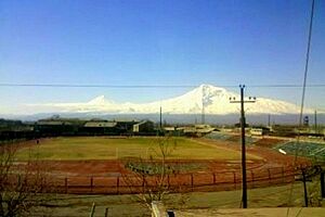
Artashat has a municipal football stadium. It opened in 1960. Many football games and athletics competitions for young teams are held there. FC Dvin Artashat was the town's only football club. It was founded in 1982 as Olympia Artashat. The club stopped playing professionally after 1999 due to money problems.
The Artashat stadium is also where the annual National Athletics Championship of Armenia takes place.
Friends Around the World: Twin Towns
Artashat is twinned with these cities:
 Clamart, France (since 2003)
 Pestszentlőrinc-Pestszentimre (Budapest), Hungary (since 2003)
Famous People from Artashat
- Sergo Karapetyan, a politician and former minister of agriculture
- Varuzhan Yepremyan, a painter
- Gegham Kadimyan, a footballer
- Arayik Gevorgyan, a wrestler
- Anna M. Sargsyan, a chess player
See also
 In Spanish: Artashat para niños
 | Jackie Robinson |
 | Jack Johnson |
 | Althea Gibson |
 | Arthur Ashe |
 | Muhammad Ali |


