
Arthur's Pass facts for kids
Quick facts for kids
Arthur's Pass
|
|
|---|---|
|
Township
|
|

Arthur's Pass township
|
|
| Country | New Zealand |
| Region | Canterbury |
| District | Selwyn |
| Ward | Malvern |
| Community | Malvern |
| Founded | 1906 (originally named Bealey Flat) |
| Electorates |
|
| Area | |
| • Total | 0.27 km2 (0.10 sq mi) |
| Elevation | 739 m (2,425 ft) |
| Population
(June 2023)
|
|
| • Total | 50 |
| • Density | 185/km2 (480/sq mi) |
| Time zone | UTC+12 (NZST) |
| • Summer (DST) | UTC+13 (NZDT) |
| Postcode |
7654
|
| Area code(s) | 03 |
| Local iwi | Ngāi Tahu |
Arthur's Pass is a small town in the Southern Alps of New Zealand's South Island. It's located in the Selwyn area. This town is a great starting point for exploring the amazing Arthur's Pass National Park.
The town of Arthur's Pass is about five kilometres (3.1 mi) south of the mountain pass that shares its name. It sits high up, at 740 metres (2,430 ft) above sea level. The town is surrounded by beautiful beech forests. The Bealey River also flows right through the town. You can reach Arthur's Pass by driving 153 kilometres (95 mi) from Christchurch, which takes about two hours on State Highway 73.
Contents
Discovering Arthur's Pass History
How Arthur's Pass Got Its Name
Both the town and the mountain pass are named after Arthur Dudley Dobson. He was a surveyor who explored the area a long time ago. In 1864, Arthur was asked to find a good path through the mountains. He was looking for a way from the Waimakariri area to the West Coast.
A Māori chief named Tarapuhi told Arthur about a pass that Māori hunting parties sometimes used. Arthur found this pass, but it was very steep on the western side. He didn't name the pass after himself. Instead, he called the spot where the town now stands "Camping Flat."
The Gold Rush and a Better Route
In 1864, a "gold rush" started on the West Coast. Business people offered a prize to anyone who could find an even better pass. This new pass needed to connect Canterbury to the West Coast.
Arthur's brother, George Dobson, was sent to check all the possible passes. After looking at many valleys, he decided that "Arthur's" pass was the best one. It was the most direct way to cross the mountains.
Building the Town and Tunnel
The town was first called Bealey Flats. This name came from Samuel Bealey, an early leader of Canterbury. The town was built to house workers for the Otira Tunnel. Construction on this long tunnel started in 1908.
The railway line from Christchurch reached Arthur's Pass town in 1914. Building the tunnel was very slow, but it finally finished in 1923. Today, the TranzAlpine passenger train travels through Arthur's Pass and the Otira Tunnel. This train journey from Christchurch to Greymouth is famous for its amazing scenery.
A power station was also built near the Devil's Punchbowl Falls. It provided electricity for building the tunnel and for the town itself.
National Park and Earthquakes
In 1929, the Arthur's Pass National Park was created. It was New Zealand's third national park. Later that year, a strong earthquake hit Arthur's Pass. It caused landslides that closed the road to the West Coast for months. The railway lines were also damaged.
Apostrophe Adventures
For a while, the official name of the town was "Arthurs Pass," without an apostrophe. This was because of a rule about place names. But local people were not happy about it. So, the old spelling, "Arthur's Pass," with the apostrophe, was brought back.
Arthur's Pass Weather
Arthur's Pass town is in a valley about 750 meters above sea level. It's about 4 km south of the main Arthur's Pass (which is 920 m high). The climate here is called Oceanic. This means it has mild temperatures and rain throughout the year.
Snow often falls in winter, especially on the mountains around the village. The coldest temperature ever recorded nearby was −18.9 °C (−2 °F) in July 1878.
| Climate data for Arthurs Pass Village (1991–2020 normals, extremes 1978–present) | |||||||||||||
|---|---|---|---|---|---|---|---|---|---|---|---|---|---|
| Month | Jan | Feb | Mar | Apr | May | Jun | Jul | Aug | Sep | Oct | Nov | Dec | Year |
| Record high °C (°F) | 32.1 (89.8) |
29.5 (85.1) |
26.4 (79.5) |
22.5 (72.5) |
17.6 (63.7) |
14.0 (57.2) |
12.8 (55.0) |
14.3 (57.7) |
20.0 (68.0) |
22.5 (72.5) |
26.2 (79.2) |
27.6 (81.7) |
32.1 (89.8) |
| Mean maximum °C (°F) | 25.6 (78.1) |
25.4 (77.7) |
22.4 (72.3) |
17.8 (64.0) |
14.4 (57.9) |
11.1 (52.0) |
9.9 (49.8) |
12.0 (53.6) |
14.9 (58.8) |
18.0 (64.4) |
20.7 (69.3) |
23.4 (74.1) |
27.2 (81.0) |
| Mean daily maximum °C (°F) | 18.3 (64.9) |
18.6 (65.5) |
16.1 (61.0) |
12.7 (54.9) |
9.7 (49.5) |
6.7 (44.1) |
6.0 (42.8) |
7.6 (45.7) |
9.8 (49.6) |
11.7 (53.1) |
13.9 (57.0) |
16.5 (61.7) |
12.3 (54.2) |
| Daily mean °C (°F) | 13.3 (55.9) |
13.4 (56.1) |
11.2 (52.2) |
8.3 (46.9) |
5.8 (42.4) |
3.0 (37.4) |
2.2 (36.0) |
3.5 (38.3) |
5.5 (41.9) |
7.3 (45.1) |
9.3 (48.7) |
11.8 (53.2) |
7.9 (46.2) |
| Mean daily minimum °C (°F) | 8.3 (46.9) |
8.2 (46.8) |
6.3 (43.3) |
4.0 (39.2) |
1.9 (35.4) |
−0.6 (30.9) |
−1.6 (29.1) |
−0.7 (30.7) |
1.3 (34.3) |
3.0 (37.4) |
4.7 (40.5) |
7.2 (45.0) |
3.5 (38.3) |
| Mean minimum °C (°F) | 2.5 (36.5) |
2.3 (36.1) |
−0.4 (31.3) |
−2.2 (28.0) |
−3.9 (25.0) |
−6.7 (19.9) |
−7.5 (18.5) |
−6.2 (20.8) |
−4.5 (23.9) |
−2.7 (27.1) |
−1.4 (29.5) |
1.3 (34.3) |
−8.3 (17.1) |
| Record low °C (°F) | −1.0 (30.2) |
−1.5 (29.3) |
−8.5 (16.7) |
−7.8 (18.0) |
−7.5 (18.5) |
−11.5 (11.3) |
−12.5 (9.5) |
−11.0 (12.2) |
−8.2 (17.2) |
−6.1 (21.0) |
−5.0 (23.0) |
−1.4 (29.5) |
−12.5 (9.5) |
| Average rainfall mm (inches) | 413.5 (16.28) |
272.6 (10.73) |
321.2 (12.65) |
370.3 (14.58) |
395.0 (15.55) |
378.1 (14.89) |
328.4 (12.93) |
353.0 (13.90) |
452.5 (17.81) |
489.4 (19.27) |
438.6 (17.27) |
447.7 (17.63) |
4,660.3 (183.49) |
| Average relative humidity (%) | 77 | 78 | 82 | 86 | 88 | 90 | 88 | 87 | 84 | 81 | 78 | 78 | 83 |
| Source 1: NIWA | |||||||||||||
| Source 2: "Arthur's Pass - Weather Database" | |||||||||||||
Things to Do in Arthur's Pass
Visitor Centre and Information

New Zealand's first national park visitor centre was built in Arthur's Pass in 1959. It was designed to look like the local geology, using stone from the area. This building used to have museum displays about the history of Arthur's Pass. It also had information about the National Park.
In 2019, the building was found to be unsafe in an earthquake. The visitor centre then moved to a temporary building across the road.
Places to Stay and Shop
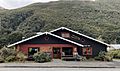
Arthur's Pass offers different places to stay. You can find everything from campsites to hotels. The town also has a general store, a petrol station, and places to eat.
Outdoor Adventures
Arthur's Pass is a popular spot for many outdoor activities. It's a great starting point for hiking trails in the Arthur's Pass National Park.
- Hiking: There are several good walks you can take from the town. These include trails to the Devil's Punchbowl Falls and through the Bealey Valley. You can also hike up Avalanche Peak for amazing views.
- Wildlife: Keep an eye out for the playful kea! This is a special New Zealand mountain parrot. They are known for being very curious.
- Skiing: The Temple Basin ski field is close by. It's a popular place for skiing and snowboarding in winter.
Getting There
You can reach Arthur's Pass by train on The Tranz Alpine Express. This famous train travels along the Midland Line. You can also drive to the town on State Highway 73.
Images for kids
-
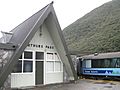
Train station
-
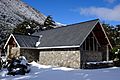
Arthur's Pass Chapel (built 1953)
-
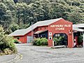
Arthur's Pass Store
-
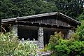
Outdoor Education Centre
-
Wobbly Kea Cafe
-
Aniwaniwa, historic chalet
-
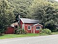
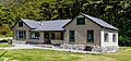
Typical cottage

.jpg)


