Arthur Passage facts for kids
Quick facts for kids Arthur Passage |
|
|---|---|

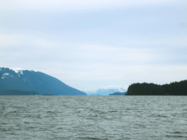
Looking southward down Arthur Passage
|
|
| Coordinates | 54°01′45″N 130°14′21″W / 54.02917°N 130.23917°W |
Arthur Passage is a waterway in British Columbia, Canada. It is part of a larger water route called the Inside Passage. This passage connects Grenville Channel in the southeast to Malacca Passage in the northwest. A notable feature in the middle of its northern end is Hanmer Island.
Contents
How Arthur Passage Got Its Name
Arthur Passage was named in 1867. It was named by Captain Daniel Pender of the Royal Navy. He chose the name to honor Arthur E. Kennedy. Mr. Kennedy was the third governor of Vancouver Island.
Nature and Wildlife
The forests around Arthur Passage are very wet and grow slowly. They are full of tall western redcedar and yellow-cedar trees. These trees are well-suited to the damp climate.
On Hanmer Island, you can find many small creatures living on the forest floor. These include sowbugs, millipedes, centipedes, potworms, and earthworms. They all play an important role in the forest's ecosystem.
Water Flow and Tides
The water in Arthur Passage moves with the tides. When the tide comes in (flood tide), the current flows north. When the tide goes out (ebb tide), the current flows south. Near Hanmer Island, these tidal currents can reach speeds of about 2.5 knots.
A Look Back in History
On January 14, 1942, a ship called the USAT David W. Branch ran aground. This American troopship was carrying 350 passengers when it got stuck on Hanmer Island.
 | Claudette Colvin |
 | Myrlie Evers-Williams |
 | Alberta Odell Jones |


