Attert facts for kids
Quick facts for kids
Attert
Atert (Luxembourgish)
|
|||
|---|---|---|---|

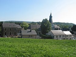
Neighbourhood of St. Stephen's Church
|
|||
|
|||
| Country | Belgium | ||
| Community | French Community | ||
| Region | Wallonia | ||
| Province | Luxembourg | ||
| Arrondissement | Arlon | ||
| Area | |||
| • Total | 70.94 km2 (27.39 sq mi) | ||
| Population
(2018-01-01)Lua error in Module:Wd at line 1575: attempt to index field 'wikibase' (a nil value).
|
|||
| • Total | Lua error in Module:Wd at line 1,575: attempt to index field 'wikibase' (a nil value). | ||
| Postal codes |
6717
|
||
| Area codes | 063 | ||
| Website | www.attert.be | ||
Attert is a lovely municipality, which is like a town or district, located in the Wallonia region of Belgium. You can find it in the province of Luxembourg, which is in the southern part of the country.
As of January 1, 2007, Attert was home to 4,802 people. The municipality covers an area of about 70.94 square kilometers (that's about 27.39 square miles). This means there were about 67.7 people living in each square kilometer.
Contents
Exploring Attert
Attert is made up of several main areas, often called districts. These include Attert itself, along with Nobressart, Nothomb, Thiaumont, and Tontelange. Each of these places has its own unique charm.
Other Villages and Hamlets
Besides the main districts, Attert also includes many smaller villages and hamlets where people live. These include:
- Almeroth
- Grendel
- Heinstert
- Lischert
- Lottert
- Louchert
- Luxeroth
- Metzert
- Parette
- Post
- Rodenhoff
- Schadeck
- Schockville
Speaking Luxembourgish
Attert is part of a special area called the Arelerland. In this region, many people speak Luxembourgish, which is a language similar to German. You might even see street signs written in both French and Luxembourgish! This shows the rich cultural mix of the area.
Friends Around the World
Attert has special friendships with other towns and municipalities around the world. These friendships are called "sister cities" or "twinning" agreements. They help people from different places learn about each other's cultures.
Attert is twinned with:
 Taktaharkány in Hungary. This friendship started in 2003.
 Kruishoutem in Belgium. This partnership began in 2004.
 Bakałarzewo in Poland. They became sister cities in 2005.
 Bandundu, Democratic Republic of the Congo in the Democratic Republic of the Congo.
See also
 In Spanish: Attert para niños
 | James B. Knighten |
 | Azellia White |
 | Willa Brown |


