Avera, Georgia facts for kids
Quick facts for kids
Avera, Georgia
|
|
|---|---|

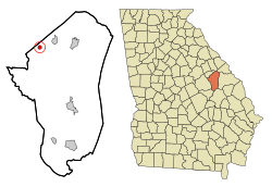
Location in Jefferson County and the state of Georgia
|
|
| Country | United States |
| State | Georgia |
| County | Jefferson |
| Area | |
| • Total | 0.65 sq mi (1.68 km2) |
| • Land | 0.65 sq mi (1.68 km2) |
| • Water | 0.00 sq mi (0.00 km2) |
| Elevation | 446 ft (136 m) |
| Population
(2020)
|
|
| • Total | 223 |
| • Density | 343.08/sq mi (132.47/km2) |
| Time zone | UTC-5 (Eastern (EST)) |
| • Summer (DST) | UTC-4 (EDT) |
| ZIP code |
30803
|
| Area code(s) | 706 |
| FIPS code | 13-04448 |
| GNIS feature ID | 0331069 |
Avera is a small city in Jefferson County, which is in the state of Georgia, United States. It became an official city in the year 1900. In 2020, about 223 people lived there.
Where is Avera?
Avera is located in the eastern part of Georgia. You can find its exact spot using coordinates: 33.194988 degrees North and 82.527503 degrees West. The city covers a total area of about 0.6 square miles (or 1.6 square kilometers). All of this area is land, with no large bodies of water inside the city limits.
How Many People Live in Avera?
The number of people living in a place is called its population. This information is collected during a census, which happens every ten years.
Here's how Avera's population has changed over the years:
| Historical population | |||
|---|---|---|---|
| Census | Pop. | %± | |
| 1910 | 228 | — | |
| 1920 | 258 | 13.2% | |
| 1930 | 258 | 0.0% | |
| 1940 | 298 | 15.5% | |
| 1950 | 230 | −22.8% | |
| 1960 | 197 | −14.3% | |
| 1970 | 217 | 10.2% | |
| 1980 | 248 | 14.3% | |
| 1990 | 215 | −13.3% | |
| 2000 | 217 | 0.9% | |
| 2010 | 246 | 13.4% | |
| 2020 | 223 | −9.3% | |
| U.S. Decennial Census | |||
In the year 2000, there were 217 people living in Avera. These people lived in 99 different homes, and 60 of those homes were families. By 2020, the population was 223 people.
See also
 In Spanish: Avera (Georgia) para niños
 | Madam C. J. Walker |
 | Janet Emerson Bashen |
 | Annie Turnbo Malone |
 | Maggie L. Walker |

