Babylon Governorate facts for kids
Quick facts for kids
Babylon Governorate
محافظة بابل
Babil Province
|
|||
|---|---|---|---|
|
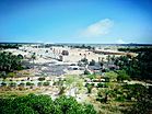
View of the ruins of Babylon from Saddam Hussein's Palace
|
|||
|
|||
 |
|||
| Country | |||
| Capital | Hillah | ||
| Area | |||
| • Total | 5,119 km2 (1,976 sq mi) | ||
| Population
(2018 Estimate)
|
|||
| • Total | 2,065,042 | ||
| HDI (2017) | 0.677 medium |
||
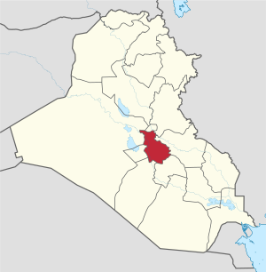
The Babylon Governorate, also known as Babil Province, is a special region in central Iraq. Its name in Arabic is Muḥāfaẓa Bābil. This area covers about 5,119 square kilometers (1,976 sq mi).
In 2023, around 1,820,700 people lived in Babil. The main city and capital of the province is Hillah. Hillah is located right across from the famous ancient city of Babylon. It sits along the Euphrates river.
Contents
Discovering the History of Babylon Province
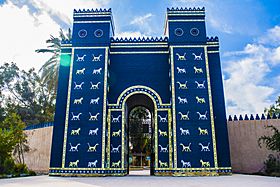
The ancient city of Babylon is found within today's Babylon Province. This city was once the capital of ancient Babylonia. It was built along the Euphrates river, south of Baghdad, Iraq.
People lived in Babylon as early as 3000 BC. It became very important around 2000 BC. This was during the time of the First Dynasty of Babylon. A dynasty is a series of rulers from the same family.
One of the most famous kings from this dynasty was Hammurabi. He ruled from 1792 to 1750 BC. Hammurabi made Babylon the capital of a huge empire. An empire is a large group of states or countries under a single supreme authority. He is best known for his special set of laws, called the Code of Hammurabi.
Babylon reached its greatest power much later. This was under King Nabopolassar (626–605 BC) and his son, Nebuchadnezzar II (605–562 BC). They expanded the Neo-Babylonian Empire across most of Western Asia. Naming this province "Babylon" shows how modern Iraq connects to its ancient past. This includes the history of Mesopotamia before Islam.
Exploring the Geography of Babil
Babylon Province is located in a specific area of the world. It lies between 32° and 33.25° north latitude. It is also between 44° and 45° east longitude.
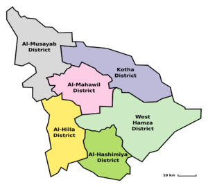
Districts of Babil Province
The Babil Governorate is divided into four main areas. These areas are called districts. Each district has a main town or city:
- Al-Mahawil District (main town: Al-Mahawil)
- Al-Musayab District (main town: Al-Musayab)
- Hashimiya District (main town: Al Hashimiyah)
- Hilla District (main town: Hillah)
Major Cities in Babil
Babil Province is home to several important cities and towns. Some of these include:
- Babylon – the famous ancient capital
- Hillah (about 900,000 people) – the capital of the province
- Al Hashimiyah (about 210,000 people)
- Al-Qasim (about 120,000 people)
- Al Midhatiya (about 160,000 people)
- Al-Iskandariya (about 135,000 people)
- Latifiyah (about 150,000 people)
- Salman Pak (about 350,000 people)
- Yusufiyah (about 17,000 people)
- Musayyib (about 175,000 people)
- Jurf Al Nasr (about 11,000 people)
- Al-Mahawil (about 51,000 people)
People of Babil: Population Changes
Demographics is the study of how populations change over time. This includes how many people live in an area. Here's how the population of Babil Governorate has grown:
| Historical population | ||
|---|---|---|
| Year | Pop. | ±% p.a. |
| 1977 | 592,000 | — |
| 1987 | 1,109,574 | +6.48% |
| 1997 | 1,181,751 | +0.63% |
| 2009 | 1,729,666 | +3.23% |
| 2018 | 2,065,042 | +1.99% |
| Source: Citypopulation | ||
See also
 In Spanish: Gobernación de Babilonia para niños
 | May Edward Chinn |
 | Rebecca Cole |
 | Alexa Canady |
 | Dorothy Lavinia Brown |


