Bache Hill facts for kids
Quick facts for kids Bache Hill |
|
|---|---|
| Bryn Bach | |

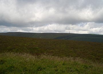
Black Mixen from Bache Hill summit
|
|
| Highest point | |
| Elevation | 610 m (2,000 ft) |
| Prominence | 41 m (135 ft) |
| Parent peak | Rhos Fawr |
| Listing | Hewitt, Nuttall |
| Geography | |
| Location | Powys, Wales |
| Parent range | Cambrian Mountains |
| OS grid | SO182639 |
| Topo map | OS Landranger 148 |
Bache Hill (which means Bryn Bach in Welsh) is a cool mountain peak in the Radnor Forest area of Wales. It's not the tallest mountain around, but it's part of the bigger Rhos Fawr (also known as Great Rhos) mountain range. You can find Bache Hill to the east of another peak called Black Mixen.
When you reach the top of Bache Hill, you'll see a special marker called a trig point. This trig point helps mapmakers figure out heights and distances. What's really interesting is that this marker sits on top of an ancient burial mound! People think this mound might be from the Bronze Age, which was thousands of years ago. Many old burial mounds and stone piles (called cairns) in Wales are found on mountain tops.
About Bache Hill
Bache Hill is located in Powys, a county in Wales. It's part of the Cambrian Mountains, a mountain range that stretches across much of Wales. The hill stands at 610 meters (about 2,001 feet) above sea level. This height makes it a notable peak for hikers and mountain climbers.
The Summit Mystery
There's a bit of a puzzle about Bache Hill's exact height. Since the trig point is built on an old burial mound, some people wonder if the very top of the hill is actually the natural ground or the man-made mound. This makes some hikers question if Bache Hill truly reaches the 2,000-foot mark. However, the latest maps from the Ordnance Survey (OS), which are like official government maps, show a 610-meter line all around the summit. This suggests that the hill's natural height is indeed around 610 meters.
 | John T. Biggers |
 | Thomas Blackshear |
 | Mark Bradford |
 | Beverly Buchanan |

