
Back Bay National Wildlife Refuge facts for kids
Quick facts for kids Back Bay National Wildlife Refuge |
|
|---|---|
|
IUCN Category IV (Habitat/Species Management Area)
|
|

Sunset over the Currituck Sound at Back Bay National Wildlife Refuge
|
|

Back Bay National Wildlife Refuge
Location in Virginia

Back Bay National Wildlife Refuge
Location in the United States
|
|
| Location | Virginia Beach, Virginia, United States |
| Area | 9,062 acres (36.67 km2) |
| Established | 1938 |
| Governing body | U.S. Fish and Wildlife Service |
| Website | Back Bay National Wildlife Refuge |
The Back Bay National Wildlife Refuge is a special natural area in southeastern Virginia. It's located in the city of Virginia Beach. This refuge was created in 1938. It is managed by the U.S. Fish and Wildlife Service. This group helps protect wildlife and their homes.
The refuge covers about 9,062 acres (about 36.7 square kilometers). Most of this area is fresh water. It sits on the Currituck Banks Peninsula. This peninsula has the Atlantic Ocean on one side and the Back Bay of the Currituck Sound on the other.
What Makes the Refuge Special?
This refuge is part of Virginia's Outer Banks. It has many different types of natural areas. You can find huge sand dunes here. There are also forests near the ocean, called maritime forests. The refuge also has fresh water marshes, ponds, and an ocean beach.
A Home for Birds
The Back Bay National Wildlife Refuge is very important for birds. It's a key stop along the Atlantic Flyway. This is a major route that many birds use when they migrate. Birds like snow geese stop here to rest and feed during their long journeys. The refuge has large areas of marshland. These are perfect places for birds to live, especially in winter.
Exploring the Refuge
The refuge is next to False Cape State Park in Virginia. Just south of that is the northern part of North Carolina's Outer Banks.
How to Visit
You can explore the refuge in a few ways. A special tram runs through the refuge. This tram is the only public way to get to False Cape State Park. Otherwise, you can only reach the park by walking, biking, or by boat. There are plans to build a path for bikes and walkers through the refuge. This path would connect the Sandbridge and Lago Mar areas.
Gallery
-
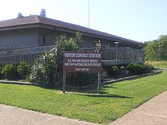
The Visitor Contact Station at Back Bay National Wildlife Refuge. This is where you can learn more about the refuge.
-
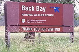
The main office for Back Bay National Wildlife Refuge.
-
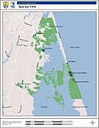
A map showing the Back Bay National Wildlife Refuge.
-
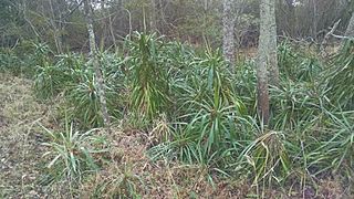
A Yucca aloifolia plant found in the refuge. This might be the most northern group of these plants.


