
Bajura, Vega Alta, Puerto Rico facts for kids
Quick facts for kids
Bajura
|
|
|---|---|
|
Barrio
|
|

Sunset from Bajura
|
|

Location of Bajura within the municipality of Vega Alta shown in red
|
|

Bajura, Vega Alta, Puerto Rico
Location in Caribbean
|
|
| Commonwealth | |
| Municipality | |
| Area | |
| • Total | 3.09 sq mi (8.0 km2) |
| • Land | 3.09 sq mi (8.0 km2) |
| • Water | 0 sq mi (0 km2) |
| Elevation | 46 ft (14 m) |
| Population
(2010)
|
|
| • Total | 3,725 |
| • Density | 1,205.5/sq mi (465.4/km2) |
| Source: 2010 Census | |
| Time zone | UTC−4 (AST) |
Bajura is a special kind of neighborhood or district called a barrio. It is located in the town, or municipality, of Vega Alta, Puerto Rico. In 2010, about 3,725 people lived in Bajura.
Contents
History of Bajura
Becoming Part of the United States
After the Spanish–American War, Spain gave Puerto Rico to the United States. This happened because of a peace agreement called the Treaty of Paris of 1898. Puerto Rico then became an unincorporated territory of the United States. This means it belongs to the U.S. but is not a state.
Early Population Count
In 1899, the United States Department of War (which is now called the Department of Defense) did a special count of all the people in Puerto Rico. This count is known as a census. The census found that 749 people lived in Bajura barrio at that time.
Population Changes Over Time
The number of people living in Bajura has changed a lot over the years. Here is a look at how the population grew and changed from 1900 to 2010:
| Historical population | |||
|---|---|---|---|
| Census | Pop. | %± | |
| 1900 | 749 | — | |
| 1910 | 1,045 | 39.5% | |
| 1920 | 1,100 | 5.3% | |
| 1930 | 1,619 | 47.2% | |
| 1940 | 1,820 | 12.4% | |
| 1950 | 2,197 | 20.7% | |
| 1960 | 2,566 | 16.8% | |
| 1980 | 3,415 | — | |
| 1990 | 4,171 | 22.1% | |
| 2000 | 4,394 | 5.3% | |
| 2010 | 3,725 | −15.2% | |
| U.S. Decennial Census 1899 (shown as 1900) 1910-1930 1930-1950 1960 1980-2000 2010 |
|||
Gallery
-
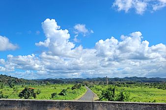
Puerto Rico Highway 676 in Bajura
.jpg)
See also
 In Spanish: Bajura (Vega Alta) para niños
- List of communities in Puerto Rico
