Bald Mountain (Uinta Range) facts for kids
Quick facts for kids Bald Mountain |
|
|---|---|

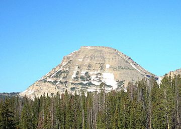
The east face of Bald Mountain, July 2008
|
|
| Highest point | |
| Elevation | 11,948 ft (3,642 m) NAVD 88 |
| Prominence | 1,823 ft (556 m) |
| Geography | |
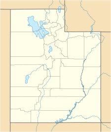
| Location | Duchesne / Summit counties, Utah United States |
| Parent range | Uinta Mountains |
| Topo map | USGS Mirror Lake |
| Climbing | |
| Easiest route | Hike |
Bald Mountain is a tall peak in Utah, standing at about 11,949 feet (3,642 meters) high. It's part of the Uinta Mountain Range and is located in the Uinta-Wasatch-Cache National Forest. This mountain sits right on the border between Summit and Wasatch counties in northeastern Utah, United States.
Contents
Exploring Bald Mountain: A Natural Wonder
Bald Mountain is a very noticeable peak, rising about 1,823 feet (556 meters) above the land around it. This makes it easy to spot!
Wildlife and Plants
The mountain is home to some amazing animals. You might see mountain goats climbing the rocky slopes. Tiny, furry creatures called pikas also live here. They are known for collecting plants to eat later. Many different kinds of beautiful wildflowers also grow on Bald Mountain.
Getting There
A road called Utah State Route 150 (SR-150) passes just east of the mountain. This makes it easier for people to visit and explore the area.
Weather at Bald Mountain
The weather on Bald Mountain can be quite cold, especially in winter.
Temperatures
In January, the average high temperature is around 27 degrees Fahrenheit (negative 3 degrees Celsius). The average low is about 6 degrees Fahrenheit (negative 14 degrees Celsius). July is the warmest month, with average highs around 66 degrees Fahrenheit (19 degrees Celsius). The average low in July is about 40 degrees Fahrenheit (4 degrees Celsius).
Rain and Snow
Bald Mountain gets a good amount of precipitation throughout the year. January usually has the most, with about 4.58 inches (11.63 cm) of rain or snow. July and August are typically drier, but still get some rain.
Hiking the Bald Mountain Trail
You can reach the top of Bald Mountain by hiking the Bald Mountain Trail. This trail is also known as National Forest Trail 3202.
Starting Point and Views
The trail begins at Bald Mountain Pass on SR-150. As you hike, you'll get amazing views of the mountains and valleys around you. It's a great way to see the natural beauty of the area.
Trail Details
The trail climbs about 1,250 feet (381 meters) in elevation. It is about 1.4 miles (2.3 kilometers) long. The starting point of the trail is already very high up, around 10,700 feet (3,261 meters) above sea level. Because of this high elevation, the hike can be a bit challenging. There isn't much shade on the trail, so it's important to be prepared.
Time and Conditions
Most people can hike to the summit and back in about 2 to 3 hours. Even in summer, you might find snow on the trail, so be ready for changing conditions.
 | Jewel Prestage |
 | Ella Baker |
 | Fannie Lou Hamer |


