
Bandarban District facts for kids

Bandarban (which means the dam of monkeys in Bengali) is a district located in the southeastern part of Bangladesh. It's part of the Chittagong Division and the Chittagong Hill Tracts. Bandarban is also known as Arvumi or the Bohmong Circle. There are two other hill districts nearby: Rangamati (the Chakma Circle) and Khagrachari (the Mong Circle).
Contents
A Look Back: British and Pakistani Times
When the area was part of British India, Bandarban was known as the Bohmong Circle and had some freedom to govern itself. During World War II, many soldiers came to this area to fight against the Japanese army, who were in nearby Burma. The local tribes living in these hills have always valued their independence and often resisted outside rule.
When India, Pakistan, and Burma became independent from Britain, the tribes of Bandarban even flew the flag of Burma for a short time. Later, during the Bangladesh War of 1971, which was fought to gain independence from Pakistan, some tribal leaders tried to work with the Pakistani government.
After Bangladesh Became Independent
In the late 1970s, more people from other parts of Bangladesh started moving to the hills. This led to some fighting and a group called Shanti Bahini started a rebellion.
Images for kids
-
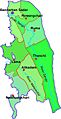
Map of Bandarban District
-
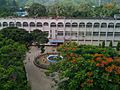
Bandarban DC Office
-
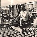
A Chakma woman weaving on balcony of bamboo house in Bandarban
-
Keokradong, a famous peak in Bangladesh
-
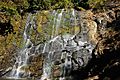
Jadipai waterfall located in Ruma upazila in Bandarban
-
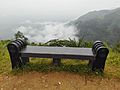
Rain, cloud and a sitting place, Nilgiri hill, Bandarban
-
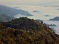
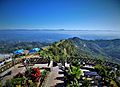
Scenic view of Nilgiri
-
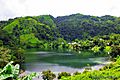
Boga lake, a lake on the hill top
-
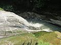
Shoilo Propat, a popular destination for tourists
-

Colorful Handmade Shawls made by the tribal women
-
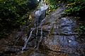
Chingry Jhorna
-
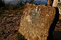
Keokaradong Milestone
-
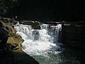
Nafakhum Fall
-
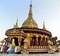
Buddha Dhatu Jadi Temple
-
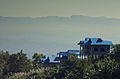
Escape Resort view of Nilachol
-
Nilachol
-
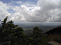
A view of Bandarban from Bandarban-Thanchi road on a cloudy day
-
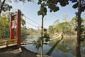
Meghla Hanging Bridge, Bandarban

.jpg)

.jpg)

.jpg)


.jpg)
.jpg)

.jpg)


.jpg)
See also
 In Spanish: Bandarban (zila) para niños
