Baree, Queensland facts for kids
Quick facts for kids BareeQueensland |
|||||||||||||||
|---|---|---|---|---|---|---|---|---|---|---|---|---|---|---|---|

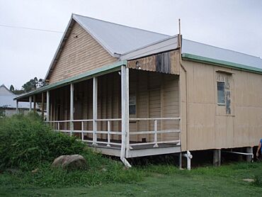
Baree School of Arts, 2009
|
|||||||||||||||
| Population | 201 (2021 census) | ||||||||||||||
| • Density | 144/km2 (370/sq mi) | ||||||||||||||
| Postcode(s) | 4714 | ||||||||||||||
| Area | 1.4 km2 (0.5 sq mi) | ||||||||||||||
| Time zone | AEST (UTC+10:00) | ||||||||||||||
| Location |
|
||||||||||||||
| LGA(s) | Rockhampton Region | ||||||||||||||
| State electorate(s) | Mirani | ||||||||||||||
| Federal Division(s) | Flynn | ||||||||||||||
|
|||||||||||||||
Baree is a small place in Queensland, Australia. It is a rural locality within the Rockhampton Region. In 2021, about 201 people lived in Baree.
Contents
What is Baree Like?
Where is Baree Located?
Baree is found in central Queensland. It is part of the larger Rockhampton Region. The Burnett Highway runs along its south-eastern edge. This highway helps connect Baree to other towns.
How is the Land Used?
Most of the land in Baree is used for homes with large yards. This is called rural residential living. It means people live on bigger blocks of land, often with some space around them. The eastern part of Baree is used for grazing. This is where animals like cattle eat grass. The western part of Baree is mostly undeveloped land.
Baree's Past
How Baree Got Its Name
The name Baree comes from an Aboriginal word. It is believed to mean either crooked (winding) creek or timber. This suggests the area had winding waterways or many trees.
Schools in Baree's History
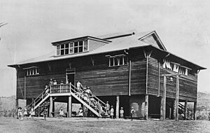
Baree once had its own school. It was called Calliungal North State School. It also went by the names North Culliungal State School and Baree State School. The school first opened in April 1904. It closed for a short time in 1929. Then it reopened in 1933. The school finally closed its doors in 1971.
Baree's Post Office
A Post Office opened in Baree by 1917. Before that, there was a smaller "receiving office" from around 1901. This office helped people send and receive mail. The Baree Post Office closed in 1975.
The Old Railway Line
A railway line used to run through Baree. It was called the Dawson Valley railway line. This line connected Kabra to Mount Morgan. It officially opened on December 2, 1898. Baree had two railway stations:
- Kirkhall railway station
- Baree railway station
The railway line stopped operating on August 1, 1987. Both railway stations are now no longer used.
Important Places
Baree School of Arts
Baree has a special building called the Baree School of Arts. It is located at 18 Creek Street. This building is considered a heritage-listed site. This means it is an important historical place. It is protected to make sure it lasts for a long time.
Education Today
There are no schools located directly in Baree today. Students living in Baree go to schools in nearby towns. The closest government primary school is Mount Morgan State School. The closest government secondary school is Mount Morgan State High School. Both of these schools are in Mount Morgan. Mount Morgan is a town located to the south-east of Baree.
 | Roy Wilkins |
 | John Lewis |
 | Linda Carol Brown |


