Barlings Eau facts for kids
Quick facts for kids Barlings Eau |
|
|---|---|

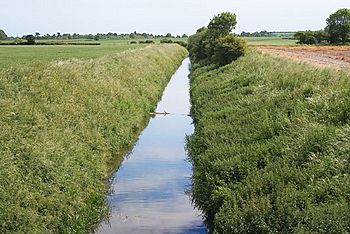
Barlings Eau to the west of Stainton by Langworth
|
|
| Country | England |
| Counties | Lincolnshire |
| Physical characteristics | |
| Main source | Cold Hanworth |
| River mouth | Short Ferry |
The Barlings Eau is a small river in Lincolnshire, England. It flows near the village of Barlings. This river is a branch, or tributary, of the River Witham. It joins the River Witham close to a place called Short Ferry.
The Barlings Eau acts like a main channel for several other small rivers. These smaller rivers help drain the flat, low-lying land on both sides of the Barlings Eau. A special group called the Internal Drainage Board (IDB) manages most of the river. This board is responsible for keeping the land from flooding. They even have a pumping station right on the river's banks.
Another important pumping station is run by the Environment Agency. This station can pump water from the River Witham system to the River Ancholme. This helps keep the Ancholme flowing well and ensures its water quality is good, especially when it's dry.
Contents
Where Does the Barlings Eau Flow?
The Barlings Eau actually starts as three different streams. These streams come together near the old village of Cold Hanworth. One stream begins east of Spridlington and flows southeast. Another starts north of Faldingworth, goes under the A46 road, and then turns south. The third stream begins west of Faldingworth and also flows west and south to meet the others.
One of these streams is known as Faldingworth Beck. It flows down to Snarford Bridge. At Snarford, two more streams join the Barlings Eau from the west. The river then passes under the A46 road at Snarford Bridge.
Joining Other Streams
After Snarford Bridge, more streams join the Barlings Eau. Legsby Beck joins from the left side. It starts in Legsby Wood and flows southwest. Dunholme Beck begins at Old Man's Head Spring. It flows through Welton and Dunholme before joining the Barlings Eau from the right. Scothern Beck also joins from the right. It flows east through the village of Scothern.
When the river reaches Stainton by Langworth, it goes under a small road. It also passes under the railway line that runs from Lincoln to Market Rasen.
Stainton Beck joins the Barlings Eau from the left. It flows past several villages like Legsby and Wickenby. Nettleham Beck joins from the right. It flows through the university area at Riseholme and the villages of Nettleham and Sudbrook.
Past Barlings Abbey
The Barlings Eau then flows under the A158 road. It crosses an area called Newball Common. The river then runs along the eastern side of Barlings Abbey. This Abbey was built in 1156 by a group of monks called the Premonstratensians. Today, only parts of the Abbey remain, but they are very old and important.
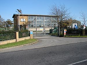
Two more streams, Goltho Beck and Stainfield Beck, join the Barlings Eau near the Abbey. Just before the river goes under Ferry Road at Short Ferry Bridge, you'll find a large pumping station. This one is run by the Environment Agency. There's also a smaller electric pumping station nearby, managed by the Witham Third District Internal Drainage Board.
Finally, the Barlings Eau joins an older path of the River Witham. This old path then connects to the main River Witham. The section of the Barlings Eau up to Short Ferry Bridge used to be used by boats. There was even a marina at Short Ferry. However, the connection to the river has been filled in. The old marina area is now a lake in a caravan park.
Keeping the Land Dry: Land Drainage
Almost the entire Barlings Eau river system is managed by the Witham Third District Internal Drainage Board. This board makes sure the land stays drained. The smaller streams and the upper parts of the Barlings Eau are looked after by this Drainage Board. The main part of the river, below Snarford, is a "main river." This means the Environment Agency is responsible for it.
The Drainage Board was first set up a very long time ago, in 1762. Its job was to drain and protect the low-lying lands, or "fens," around the River Witham. Over the years, different drainage groups joined together. Today, the Board has 31 members. Some are elected by people who pay drainage fees, and others are chosen by local councils. They are responsible for draining an area of about 54 square miles (140 km2).
Pumping Stations for Drainage
The area around Short Ferry is called Stainfield Fen. Landowners first tried to drain this area themselves. Later, it became part of a larger drainage district. A steam engine was used to pump water here before 1881. This was replaced by a more powerful engine in 1896.
Today, the Stainfield pumping station is next to Short Ferry Bridge. It has a large electric pump installed in 1959. This pump can move about 9.7 million gallons of water every day! In 1991, two more smaller pumps were added. Each of these can pump about 1.1 million gallons per day.
Moving Water Around
Just above Short Ferry bridge, there's an Environment Agency pumping station. This station is part of a big plan called the Trent Witham Ancholme Transfer Scheme. Its main goal is to manage water levels in the River Ancholme. This is especially important during dry weather and in summer. It helps make sure there's enough water for drinking and other uses. It also stops salty water from the Humber estuary from getting into the river.
This pumping station sends water through a long pipeline, about 11 miles (18 km) long. The water goes to Toft Newton reservoir, which is at the top of the Ancholme. This reservoir is quite large, covering about 41 acres (16.5 ha). It can hold enough water to keep the Ancholme flowing for up to seven days if the pumps at Short Ferry stop working.
If there isn't enough water in the Barlings Eau or the Witham, extra water can be brought in. This happens at Trent pumping station, near Torksey Lock. This station pumps water into the Foss Dyke. The water then flows about 10.8 miles (17.4 km) along the Foss Dyke to Brayford Pool. From there, it enters the River Witham, adding to the water available for pumping. This whole system started in 1974. The amount of water moved changes a lot depending on how much rain there is.
How Clean is the Water?
The Environment Agency checks the water quality of rivers in England. They give each river an "ecological status." This tells us how healthy the river environment is. There are five levels: high, good, moderate, poor, and bad. To figure this out, they look at things like the types and numbers of tiny animals (invertebrates), plants, and fish living in the river.
They also check the "chemical status." This compares the amount of different chemicals in the water to safe levels. Chemical status is either "good" or "fail." The Barlings Eau and all its streams are called "heavily modified." This means people have changed the river channels a lot.
Here's how the water quality of the Barlings Eau system was in 2015:
| Section | Ecological Status | Chemical Status | Overall Status | Length | Catchment |
|---|---|---|---|---|---|
| Faldingworth Beck | Moderate | Good | Moderate | 5.3 miles (8.5 km) | 9.00 square miles (23.3 km2) |
| Legsby Beck | Moderate | Good | Moderate | 5.0 miles (8.0 km) | 10.90 square miles (28.2 km2) |
| Scothern Beck | Poor | Good | Poor | 4.6 miles (7.4 km) | 5.79 square miles (15.0 km2) |
| Stainton Beck | Moderate | Good | Moderate | 8.6 miles (13.8 km) | 10.82 square miles (28.0 km2) |
| Nettleham Beck | Moderate | Good | Moderate | 7.9 miles (12.7 km) | 9.82 square miles (25.4 km2) |
| Goltho Beck | Moderate | Good | Moderate | 4.6 miles (7.4 km) | 5.39 square miles (14.0 km2) |
| Stainfield Beck | Moderate | Good | Moderate | 6.2 miles (10.0 km) | 7.21 square miles (18.7 km2) |
| Barlings Eau | Moderate | Good | Moderate | 8.6 miles (13.8 km) | 44.46 square miles (115.2 km2) |
Points of Interest Along the River
| Point | Coordinates (Links to map resources) |
OS Grid Ref | Notes |
|---|---|---|---|
| Source | 53°21′05″N 0°28′25″W / 53.3515°N 0.4737°W | TF016849 | |
| Source | 53°21′27″N 0°23′05″W / 53.3574°N 0.3846°W | TF076857 | |
| Source | 53°20′53″N 0°24′31″W / 53.3481°N 0.4086°W | TF060846 | |
| A46 Snarford Bridge | 53°19′13″N 0°25′34″W / 53.3203°N 0.4261°W | TF049815 | |
| Stainton by Langworth railway bridge | 53°16′58″N 0°24′47″W / 53.2828°N 0.4131°W | TF058773 | |
| Barlings Abbey | 53°14′50″N 0°21′59″W / 53.2472°N 0.3663°W | TF091734 | |
| Junction with Old River Witham | 53°13′40″N 0°21′27″W / 53.2277°N 0.3575°W | TF097713 | mouth |
 | Laphonza Butler |
 | Daisy Bates |
 | Elizabeth Piper Ensley |


